MyTopo
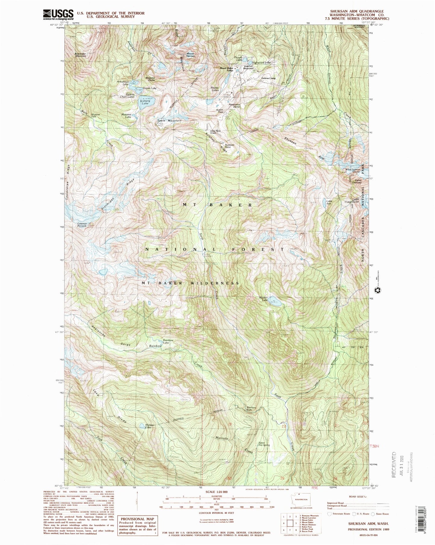
Classic USGS Shuksan Arm Washington 7.5'x7.5' Topo Map
Couldn't load pickup availability
Historical USGS topographic quad map of Shuksan Arm in the state of Washington. Typical map scale is 1:24,000, but may vary for certain years, if available. Print size: 24" x 27"
This quadrangle is in the following counties: Whatcom.
The map contains contour lines, roads, rivers, towns, and lakes. Printed on high-quality waterproof paper with UV fade-resistant inks, and shipped rolled.
Contains the following named places: Lake Ann, Austin Pass, Avalanche Gorge, Bagley Lakes, Baker Hot Spring, Barometer Mountain, Camp Kiser, Coleman Pinnacle, Fisher Chimney, Galena Camp, Galena Chain Lakes, Hayes Lake, Heather Meadows, Mount Hermann, Highwood Lake, Huntoon Point, Iceberg Lake, Kulshan Ridge, Maiden Lake, Marten Lake, Mazama Dome, Mazama Falls, Mazama Lake, Mount Baker Lodge, Panorama Dome, Picture Lake, Ptarmigan Ridge, Rainbow Creek, Rainbow Falls, Rainbow Lake, Shuksan Arm, Shuksan Creek, Slate Mountain, Table Mountain, Arbuthnet Lake, Table Mountain Glacier, Mount Baker Wilderness, Terminal Lake, Sunrise Lake, Mount Baker Ski Resort, Vista Viewpoint, Mount Baker Lodge Lakes, Austin Pass Lake, Mount Baker Post Office (historical)