MyTopo
Classic USGS Shulerville South Carolina 7.5'x7.5' Topo Map
Couldn't load pickup availability
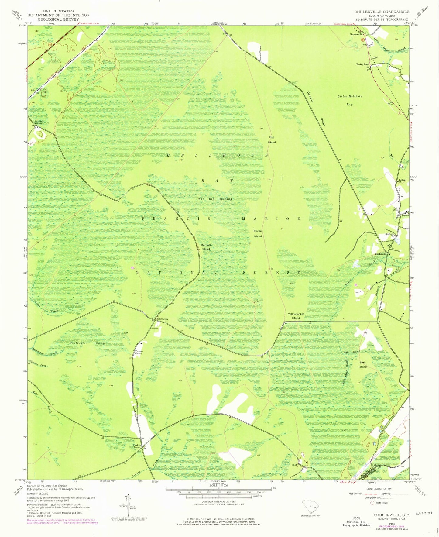
Historical USGS topographic quad map of Shulerville in the state of South Carolina. Typical map scale is 1:24,000, but may vary for certain years, if available. Print size: 24" x 27"
This quadrangle is in the following counties: Berkeley, Charleston.
The map contains contour lines, roads, rivers, towns, and lakes. Printed on high-quality waterproof paper with UV fade-resistant inks, and shipped rolled.
Contains the following named places: Bark Island, Bark Island Slough, Beaman Branch, Big Island, Boggy Head Bay, Dawson Ridge, Gum Branch, Horse Island, Oak Corner, Shulerville, Simmonsville, Thomas Corner, Turkey Pond, Windom Corner, Round Pond Trailhead, Hellhole Bay Wilderness, New Hope Cemetery, New Hope School (historical), Peterstand Island, Barnett Island, Hellhole Bay, Little Hellhole Bay, Bethany Church, Darlington Swamp, Farewell Corner, Newhope Church, The Big Opening, Yellowjacket Island, Shulerville Post Office, Francis Marion National Forest, Cordesville Division, Hell Hole Bay Wilderness