MyTopo
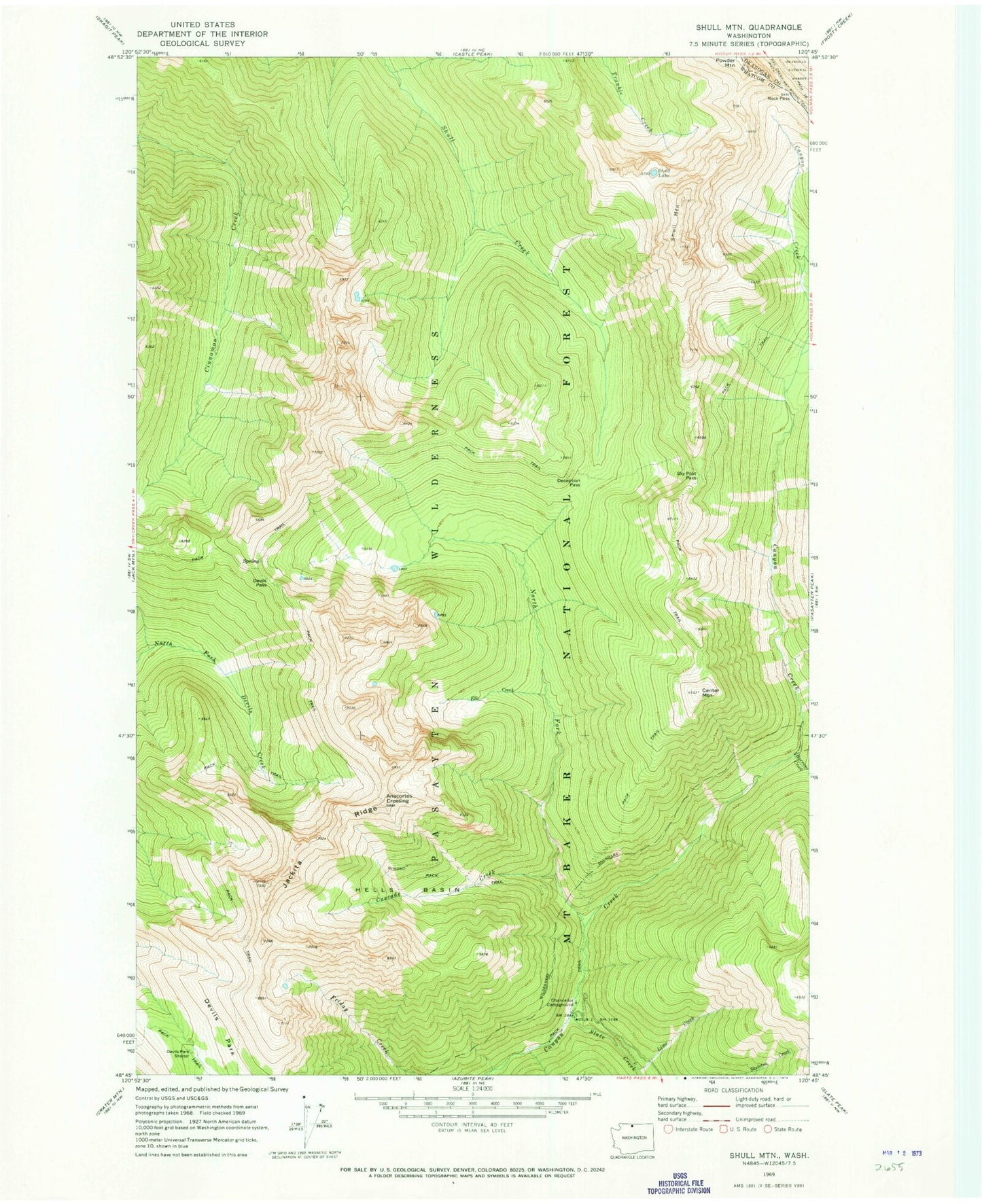
Classic USGS Shull Mountain Washington 7.5'x7.5' Topo Map
Couldn't load pickup availability
Historical USGS topographic quad map of Shull Mountain in the state of Washington. Map scale may vary for some years, but is generally around 1:24,000. Print size is approximately 24" x 27"
This quadrangle is in the following counties: Okanogan, Whatcom.
The map contains contour lines, roads, rivers, towns, and lakes. Printed on high-quality waterproof paper with UV fade-resistant inks, and shipped rolled.
Contains the following named places: Anacortes Crossing, Barron Creek, Cascade Creek, Center Mountain, Chancellor Campground, Deception Pass, Devils Park Shelter, Devils Pass, Elk Creek, Hells Basin, Jackita Ridge, Lime Creek, North Fork Canyon Creek, Rock Pass, Shull Lake, Shull Mountain, Sky Pilot Pass, Slate Creek