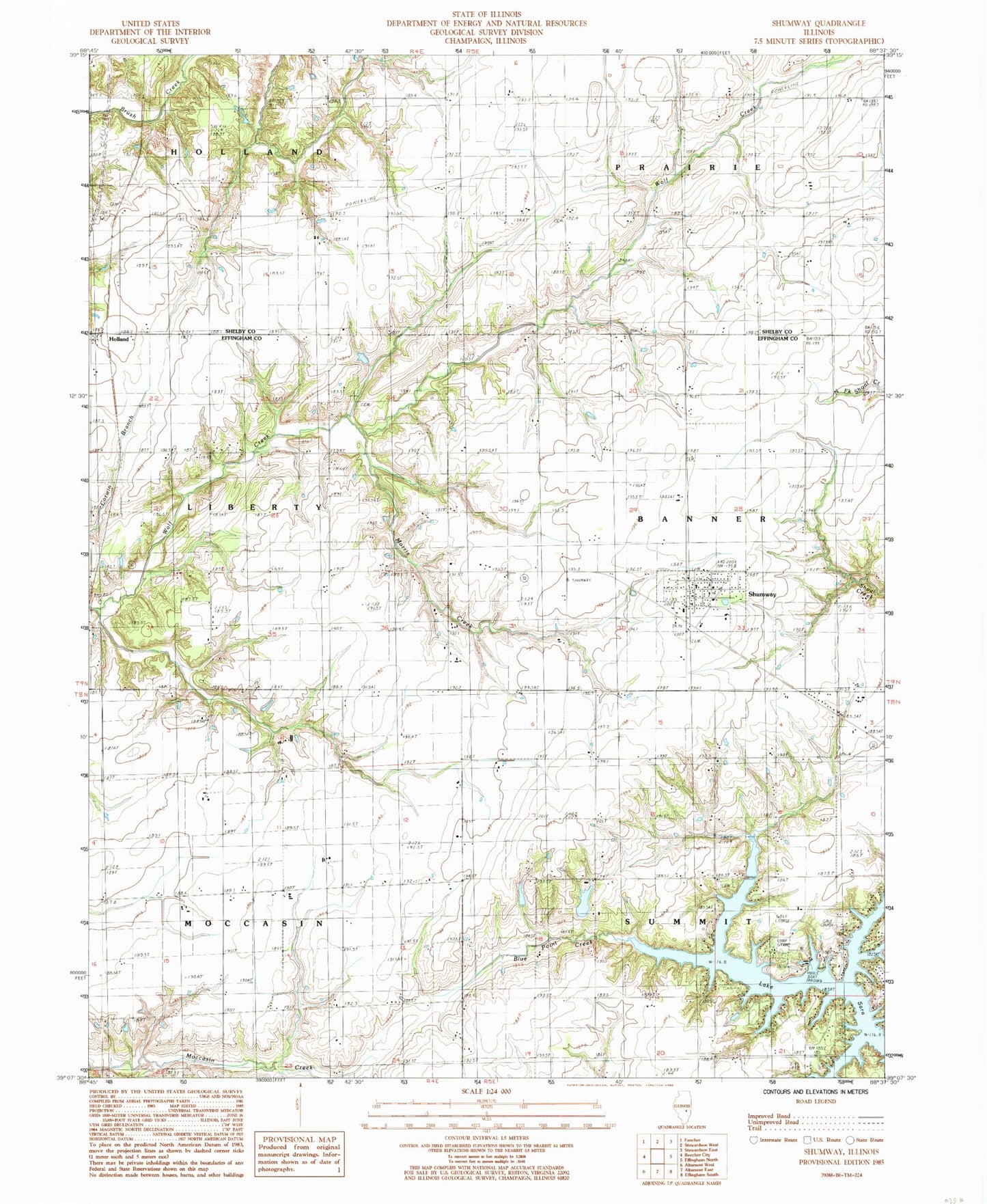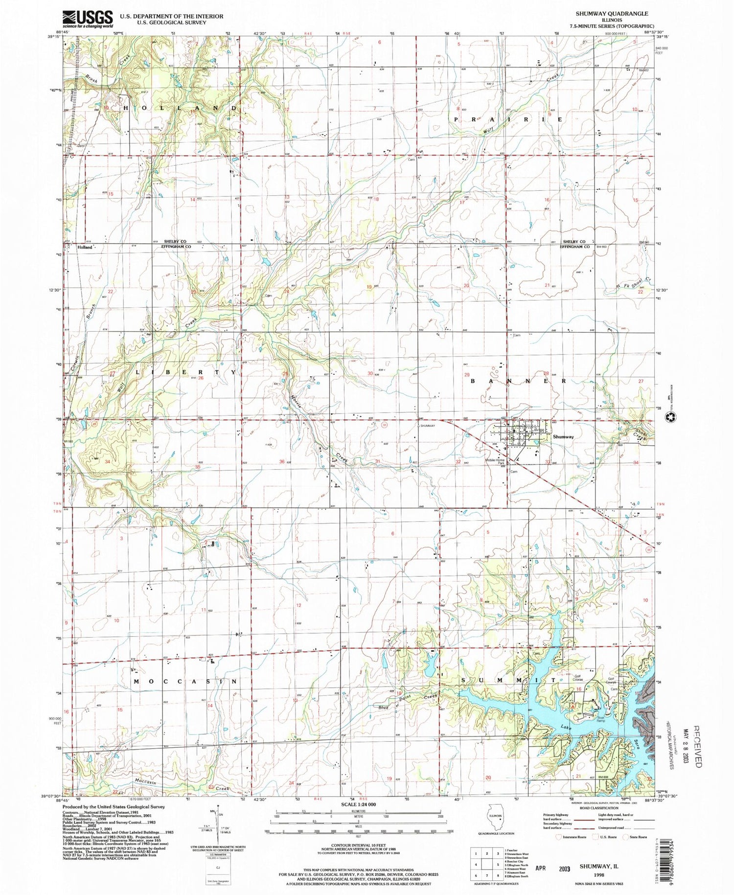

MyTopo
Classic USGS Shumway Illinois 7.5'x7.5' Topo Map
Couldn't load pickup availability
Historical USGS topographic quad map of Shumway in the state of Illinois. Map scale may vary for some years, but is generally around 1:24,000. Print size is approximately 24" x 27"
This quadrangle is in the following counties: Effingham, Shelby.
The map contains contour lines, roads, rivers, towns, and lakes. Printed on high-quality waterproof paper with UV fade-resistant inks, and shipped rolled.
Contains the following named places: Agney Cemetery, Blue Point Baptist Cemetery, Blue Point School, Brown Cemetery, Brush Creek Post Office, Giles Cemetery, Holland, Kyle School, Lake Sara, Laue Farms, Morris Creek, Saint Marys Catholic Cemetery, Shumway, Shumway Cemetery, Shumway Grade School, Shumway International Airport, Shumway Post Office, Township of Banner, Township of Holland, Township of Liberty, Township of Moccasin, Township of Summit, Trinity Lutheran Cemetery, Van Treese Church, Village of Shumway, Wachtel Farms, Wendte Farms, White Chapel, Wolf Creek Cemetery, ZIP Code: 62461