MyTopo
Classic USGS Shushan New York 7.5'x7.5' Topo Map
Couldn't load pickup availability
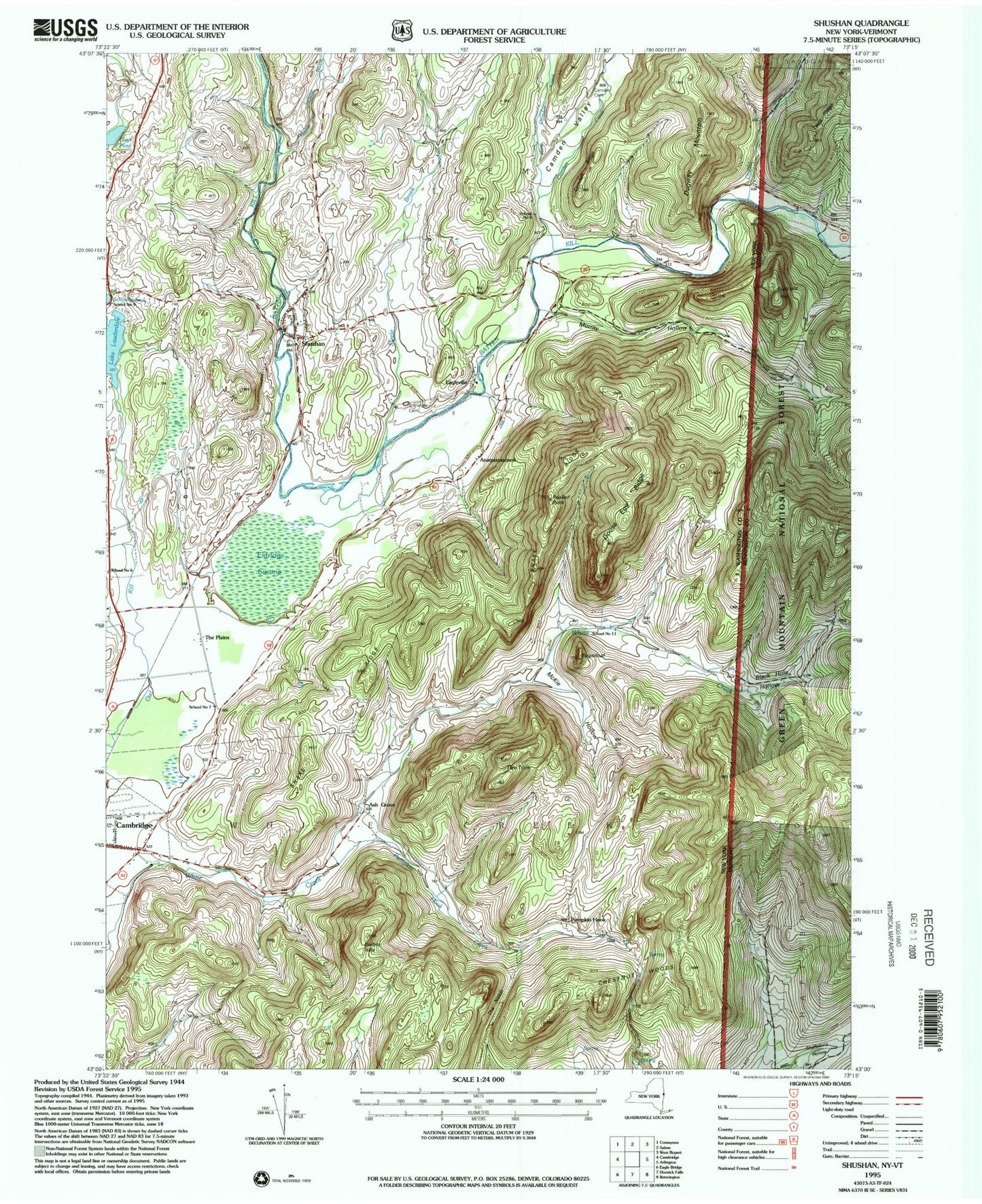
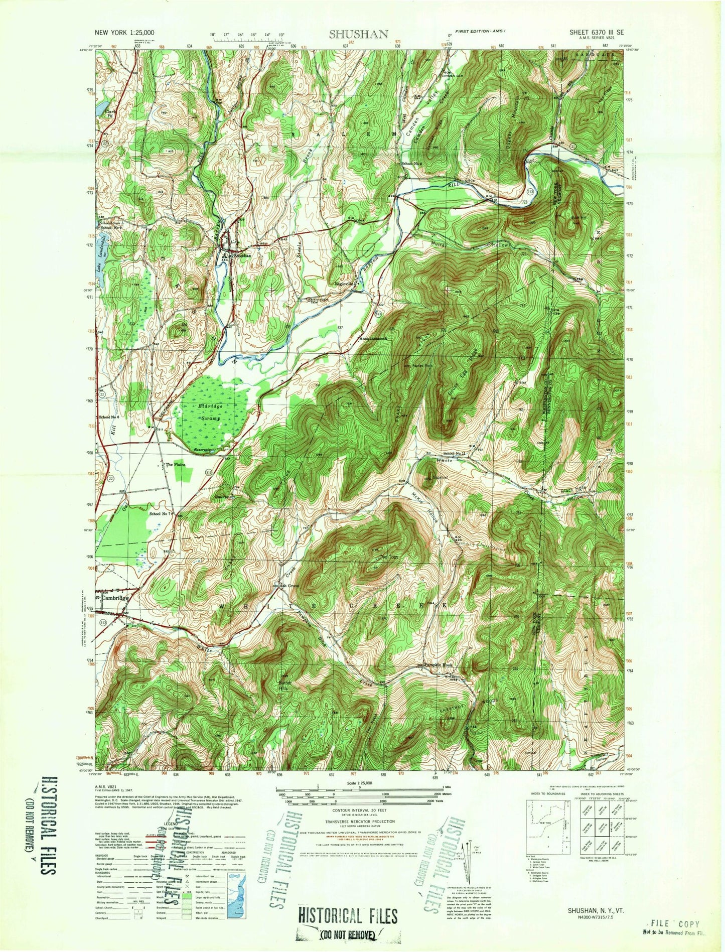
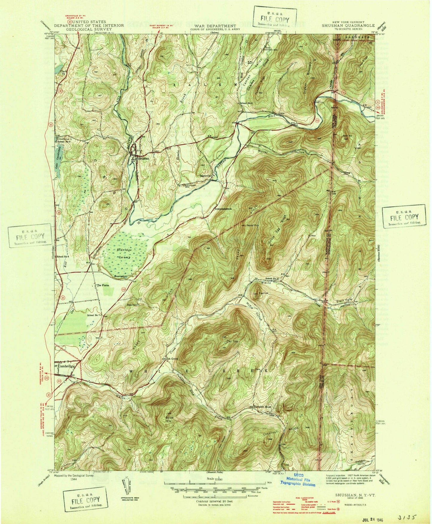
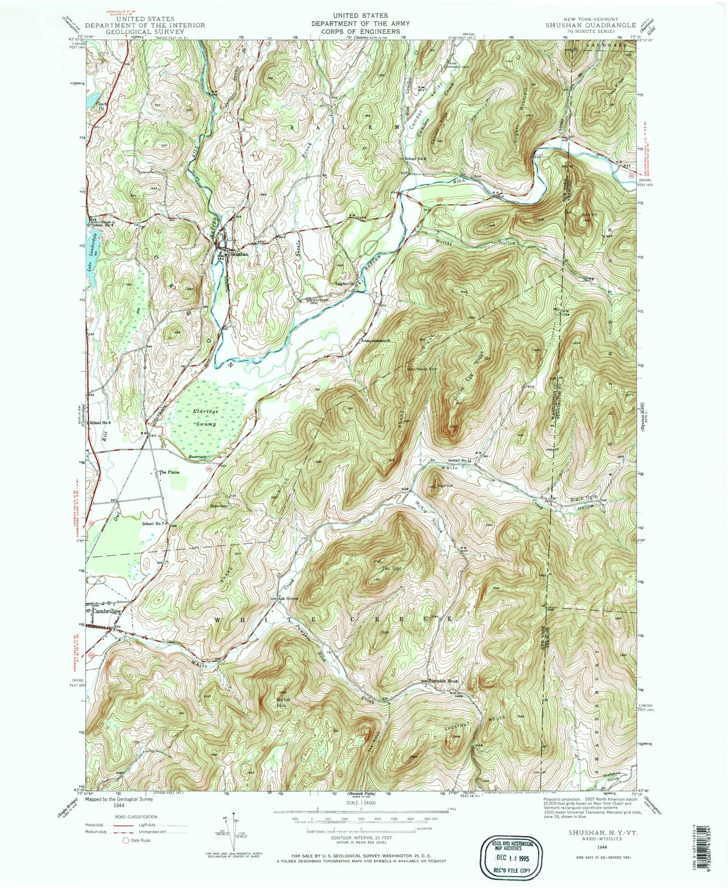
Historical USGS topographic quad map of Shushan in the states of New York, Vermont. Typical map scale is 1:24,000, but may vary for certain years, if available. Print size: 24" x 27"
This quadrangle is in the following counties: Bennington, Washington.
The map contains contour lines, roads, rivers, towns, and lakes. Printed on high-quality waterproof paper with UV fade-resistant inks, and shipped rolled.
Contains the following named places: Anaquassacook, Barber Hills, Old Shushan and Eagleville Cemetery, Black Hole Hollow, Camden Cemetery, Camden Creek, Camden Ridge, Camden Valley, Chestnut Woods, Chunks Brook, Clark Pond, Dugway Mountain, Eagleville, Eldridge Swamp, Goose Egg Ridge, Juniper Swamp Brook, Lake Lauderdale, McKie Hollow, Murray Hollow, Peaked Rock, Pumpkin Hook Creek, Shushan, Snake Ridge, Steele Brook, Sugarloaf, The Notch, The Plains, Two Tops, West Camden Creek, Ash Grove, Pumpkin Hook, School Number 11 (historical), School Number 6 (historical), School Number 6 (historical), School Number 7 (historical), School Number 9 (historical), Chapin Field, Town of White Creek, Eagleville Covered Bridge, Lake Lauderdale County Park, Ravenwood Estates, Flying Pigs Farm, Hemlock Grove Farm, Windy River Farm, Battenkill Riversports and Campground, Lake Lauderdale Campground, Shushan Covered Bridge, Cambridge Valley Rescue Squad, Camden Creek, Black Hole Hollow, Laws Ridge, Murray Hollow, Guber Farm Cemetery, Le Barron - Harrington Farm Cemetery, Rhoda Blowers Cemetery, Buck Hill, Anaquassacook, Barber Hills, Old Shushan and Eagleville Cemetery, Black Hole Hollow, Camden Cemetery, Camden Creek, Camden Ridge, Camden Valley, Chestnut Woods, Chunks Brook, Clark Pond, Dugway Mountain, Eagleville, Eldridge Swamp, Goose Egg Ridge, Juniper Swamp Brook, Lake Lauderdale, McKie Hollow, Murray Hollow, Peaked Rock, Pumpkin Hook Creek, Shushan, Snake Ridge, Steele Brook, Sugarloaf, The Notch, The Plains, Two Tops, West Camden Creek, Ash Grove, Pumpkin Hook, School Number 11 (historical), School Number 6 (historical), School Number 6 (historical), School Number 7 (historical), School Number 9 (historical), Chapin Field, Town of White Creek, Eagleville Covered Bridge, Lake Lauderdale County Park, Ravenwood Estates, Flying Pigs Farm, Hemlock Grove Farm, Windy River Farm, Battenkill Riversports and Campground, Lake Lauderdale Campground, Shushan Covered Bridge, Cambridge Valley Rescue Squad, Camden Creek, Black Hole Hollow, Laws Ridge, Murray Hollow, Guber Farm Cemetery, Le Barron - Harrington Farm Cemetery, Rhoda Blowers Cemetery, Buck Hill, Anaquassacook, Barber Hills, Old Shushan and Eagleville Cemetery, Black Hole Hollow, Camden Cemetery, Camden Creek, Camden Ridge, Camden Valley, Chestnut Woods, Chunks Brook, Clark Pond, Dugway Mountain, Eagleville, Eldridge Swamp, Goose Egg Ridge, Juniper Swamp Brook, Lake Lauderdale, McKie Hollow, Murray Hollow, Peaked Rock, Pumpkin Hook Creek, Shushan, Snake Ridge, Steele Brook, Sugarloaf, The Notch, The Plains, Two Tops, West Camden Creek, Ash Grove, Pumpkin Hook, School Number 11 (historical), School Number 6 (historical), School Number 6 (historical), School Number 7 (historical), School Number 9 (historical), Chapin Field, Town of White Creek, Eagleville Covered Bridge, Lake Lauderdale County Park, Ravenwood Estates, Flying Pigs Farm, Hemlock Grove Farm, Windy River Farm, Battenkill Riversports and Campground, Lake Lauderdale Campground, Shushan Covered Bridge, Cambridge Valley Rescue Squad, Camden Creek, Black Hole Hollow, Laws Ridge, Murray Hollow, Guber Farm Cemetery, Le Barron - Harrington Farm Cemetery, Rhoda Blowers Cemetery, Buck Hill