MyTopo
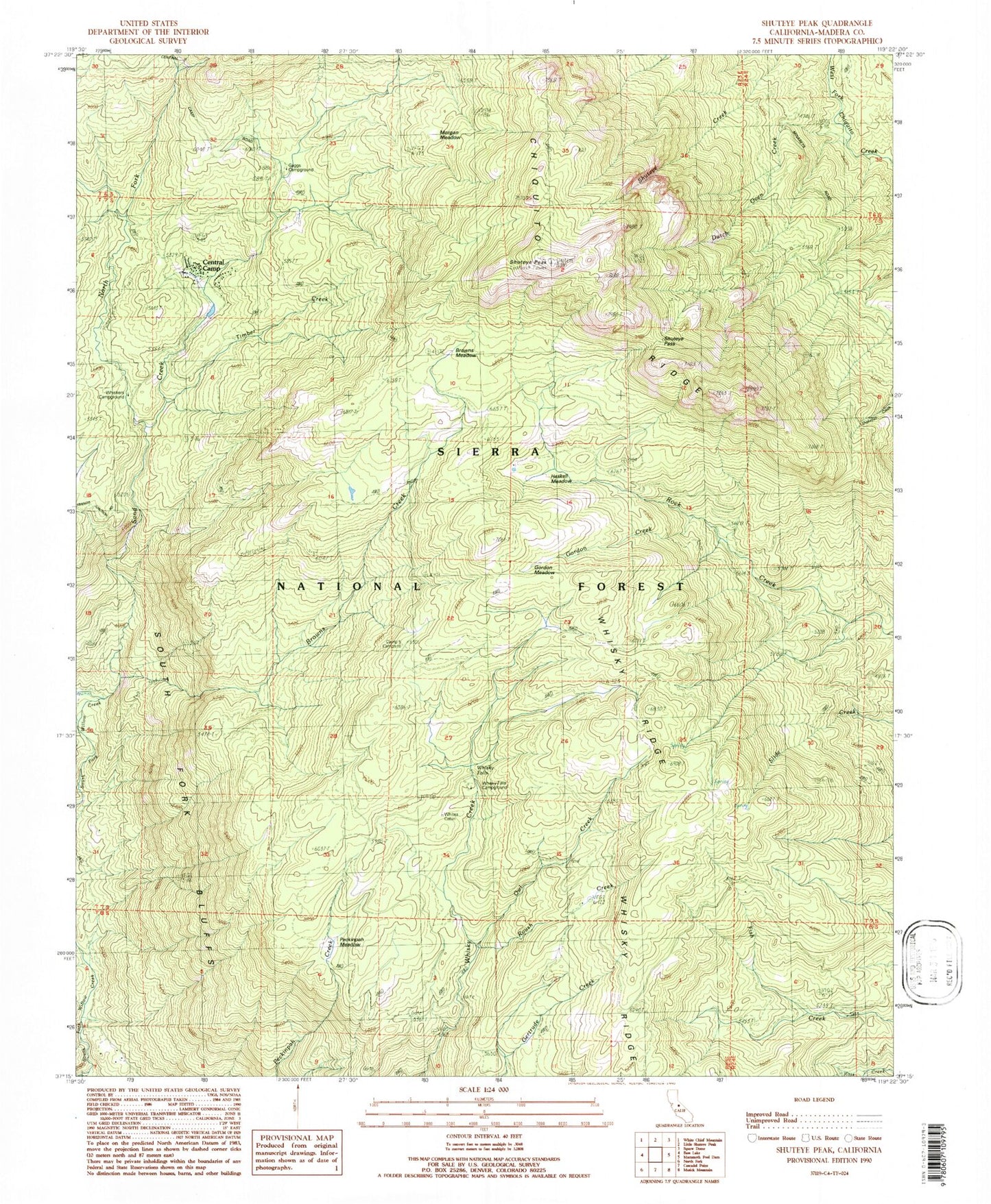
Classic USGS Shuteye Peak California 7.5'x7.5' Topo Map
Couldn't load pickup availability
Historical USGS topographic quad map of Shuteye Peak in the state of California. Typical map scale is 1:24,000, but may vary for certain years, if available. Print size: 24" x 27"
This quadrangle is in the following counties: Madera.
The map contains contour lines, roads, rivers, towns, and lakes. Printed on high-quality waterproof paper with UV fade-resistant inks, and shipped rolled.
Contains the following named places: Cold Spring Meadow, Shuteye Pass, South Fork Bluffs, Dutch Oven Creek, Whisky Falls, Camp Five Campground, Whites Cabin, Browns Creek, Browns Meadow, Chiquito Ridge, Gordon Creek, Gordon Meadow, Haskell Meadow, Morgan Meadow, North Fork Sand Creek, Owl Creek, Peckinpah Meadow, Roush Creek, Sand Creek, Shuteye Peak, Timber Creek, Whiskers Campground, Whisky Ridge, Shuteye Peak Lookout, Cold Springs Meadow, Gaggs Campground, Peckinpah Mountain, Central Camp, Whisky Falls, Whiskey Falls Campground