
MyTopo
Classic USGS Sibbie Georgia 7.5'x7.5' Topo Map
Couldn't load pickup availability
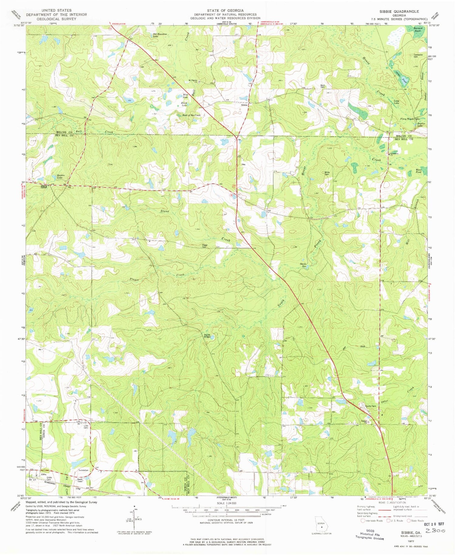
Historical USGS topographic quad map of Sibbie in the state of Georgia. Map scale may vary for some years, but is generally around 1:24,000. Print size is approximately 24" x 27"
This quadrangle is in the following counties: Ben Hill, Irwin, Wilcox.
The map contains contour lines, roads, rivers, towns, and lakes. Printed on high-quality waterproof paper with UV fade-resistant inks, and shipped rolled.
Contains the following named places: Abba, Abba Church, Baptize Lake, Ben Hill County Farm, Ben Hill County Volunteer Fire Department Station 5, Bethlehem Cemetery, Bethlehem Church, Black Lake, Blue Sink, Devils Den, Double Bridges, Gibbs Cemetery, Long Lake, Luke Cemetery, Mims Cemetery, Mount Pilgrim Church, Ocean Pond, Old Rountree Lake, Piney Woods Lake, Player Cemetery, Player Creek, Providence Church, Queensland Division, Reid Cemetery, Reubin Lake, Rinor Cemetery, Sibbie, Sink of the Creek, Snowden Dam One, Snowden Dam Two, Snowden Lake East, Snowden Lake East Dam, Snowden Lake West, Snowden Lake West Dam, Stone Creek, Tomberlin Cemetery, Vaughn Taylor School, Ware Pond


