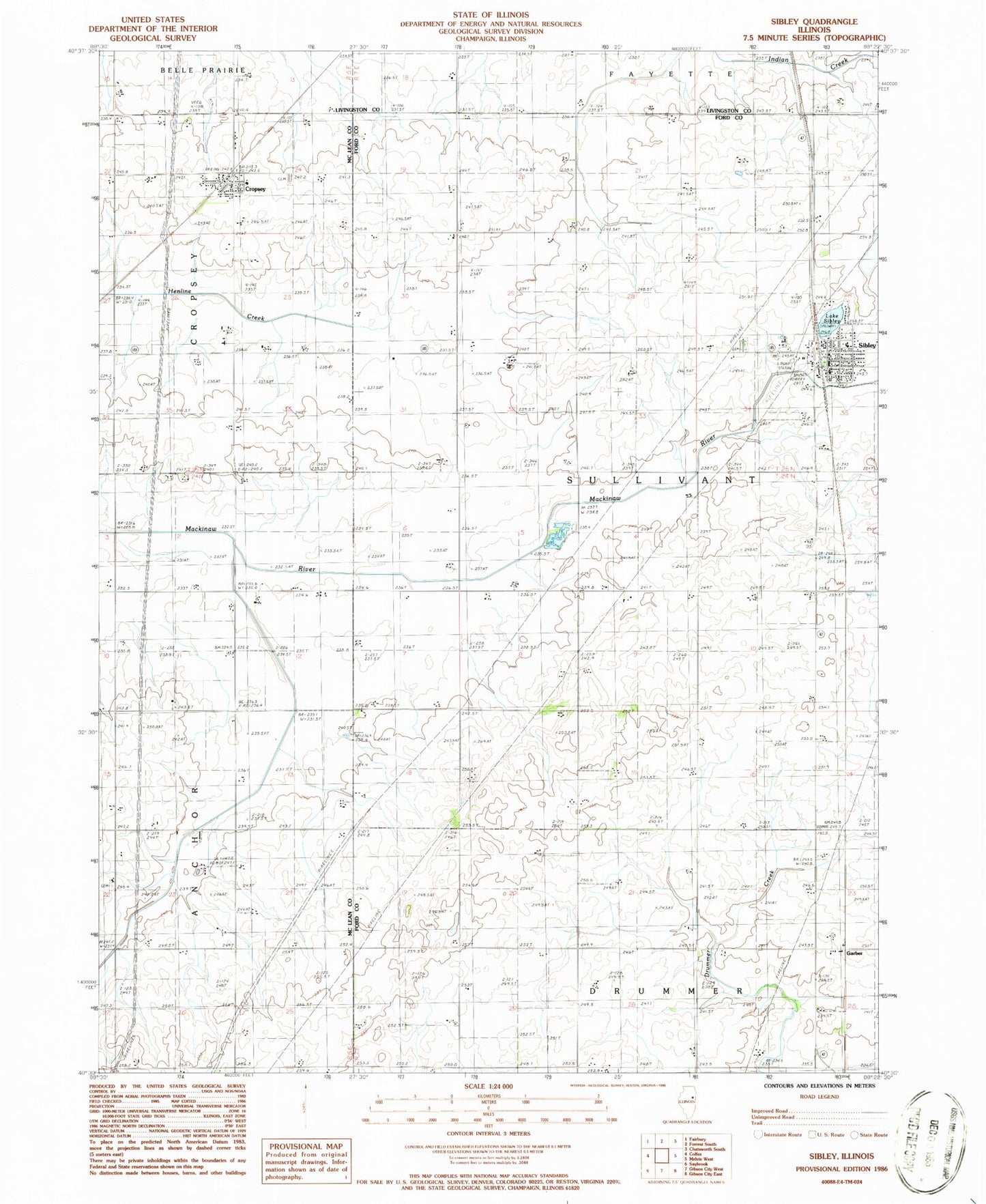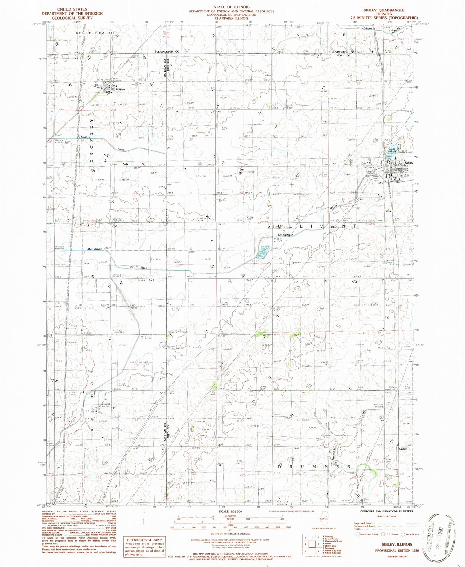
MyTopo
Classic USGS Sibley Illinois 7.5'x7.5' Topo Map
Couldn't load pickup availability
Historical USGS topographic quad map of Sibley in the state of Illinois. Map scale may vary for some years, but is generally around 1:24,000. Print size is approximately 24" x 27"
This quadrangle is in the following counties: Ford, Livingston, McLean.
The map contains contour lines, roads, rivers, towns, and lakes. Printed on high-quality waterproof paper with UV fade-resistant inks, and shipped rolled.
Contains the following named places: Anchor Church, Ashley School, Cropsey, Cropsey Cemetery, Cropsey Fire Department, Cropsey Post Office, Fairview School, Garber, Lake Genevieve, Lake Sibley, Miller School, Mount Hope Cemetery, Mount Zion School, North Union School, Pleasant Ridge School, Saint Johns Church, Saint Johns Lutheran Cemetery, Sibley, Sibley Post Office, Sullivan Township Fire Protection District - Sibley Fire Department, Township of Sullivant, Village of Sibley, ZIP Codes: 61731, 61773