MyTopo
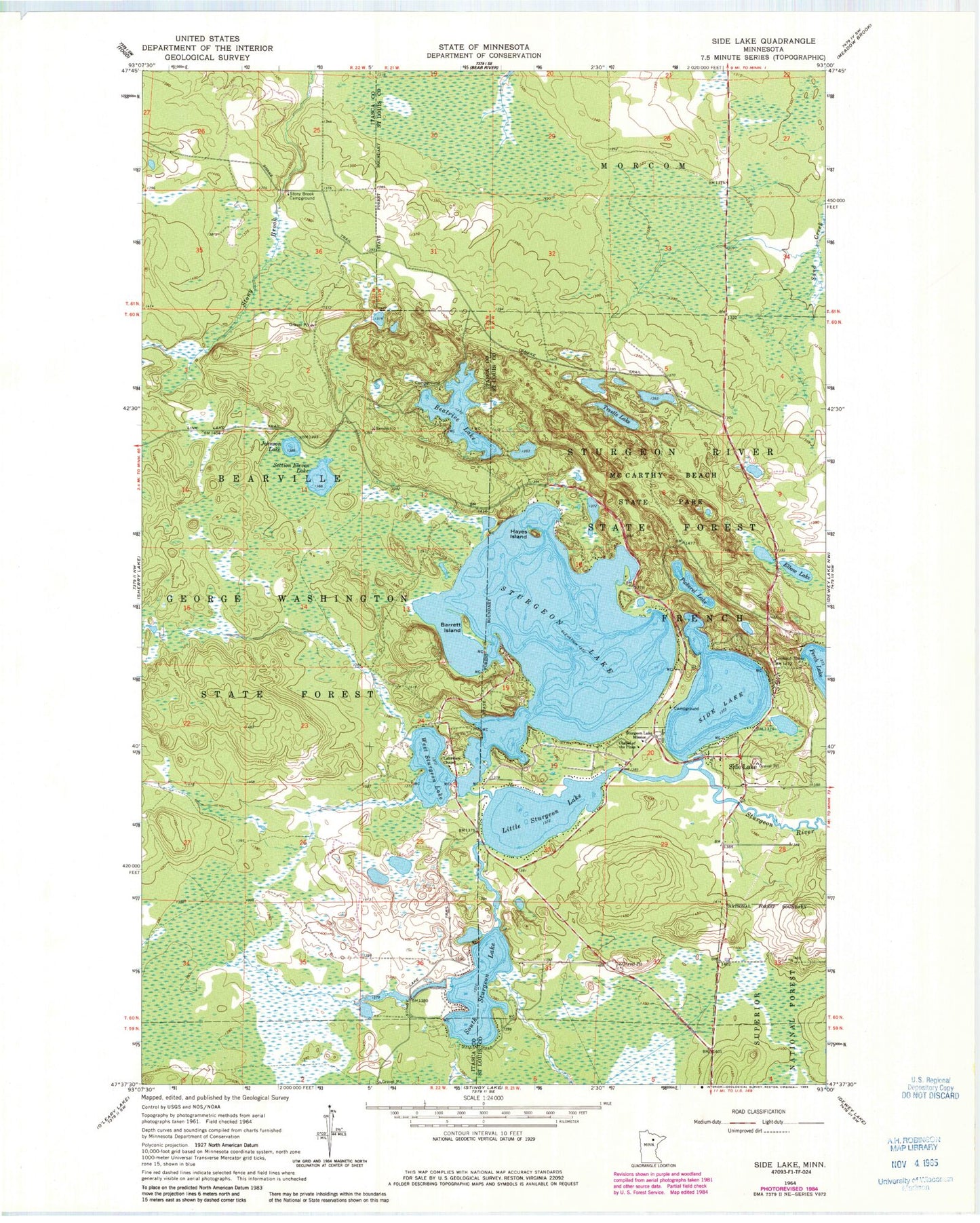
Classic USGS Side Lake Minnesota 7.5'x7.5' Topo Map
Couldn't load pickup availability
Historical USGS topographic quad map of Side Lake in the state of Minnesota. Typical map scale is 1:24,000, but may vary for certain years, if available. Print size: 24" x 27"
This quadrangle is in the following counties: Itasca, St. Louis.
The map contains contour lines, roads, rivers, towns, and lakes. Printed on high-quality waterproof paper with UV fade-resistant inks, and shipped rolled.
Contains the following named places: Barrett Island, Beatrice Lake, Johnson Lake, Lakeview Chapel, Link Lake Trail, Section Eleven Lake, Stingy Lake Trail, Stony Brook Campground, West Sturgeon Lake, Sixberrys Landing Seaplane Base, Christenson Point Seaplane Base, Chapel of the Pines, Elbow Lake, Hayes Island, Little Sturgeon Lake, McCarthy Beach State Park, Pickerel Lake, Side Lake, Side Lake, Snake Trail, South Sturgeon Lake, Sturgeon Lake, Sturgeon Lake Mission, Trestle Lake, Sturgeon Lake Dam, Sturgeon Lake, Pine Beach Resort and Campground, Side Lake Post Office, Origin of McCarthy Beach Geological Marker, French Fire Department and Emergency Medical Services