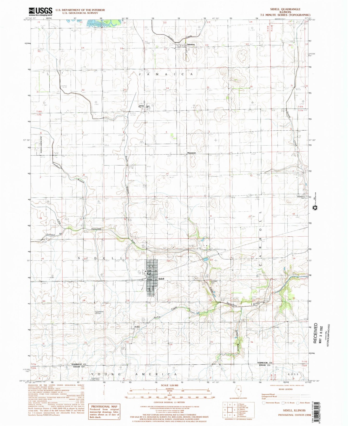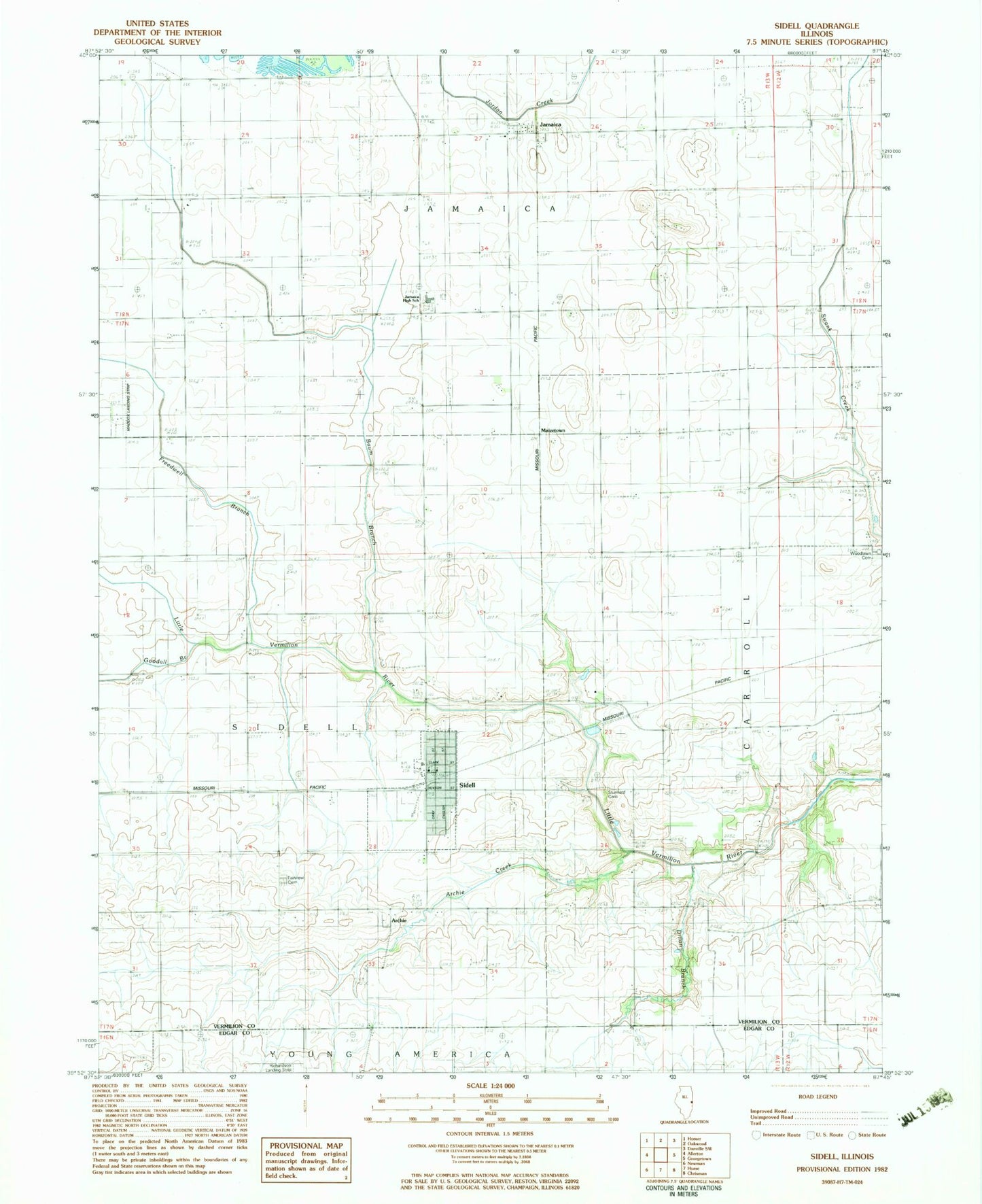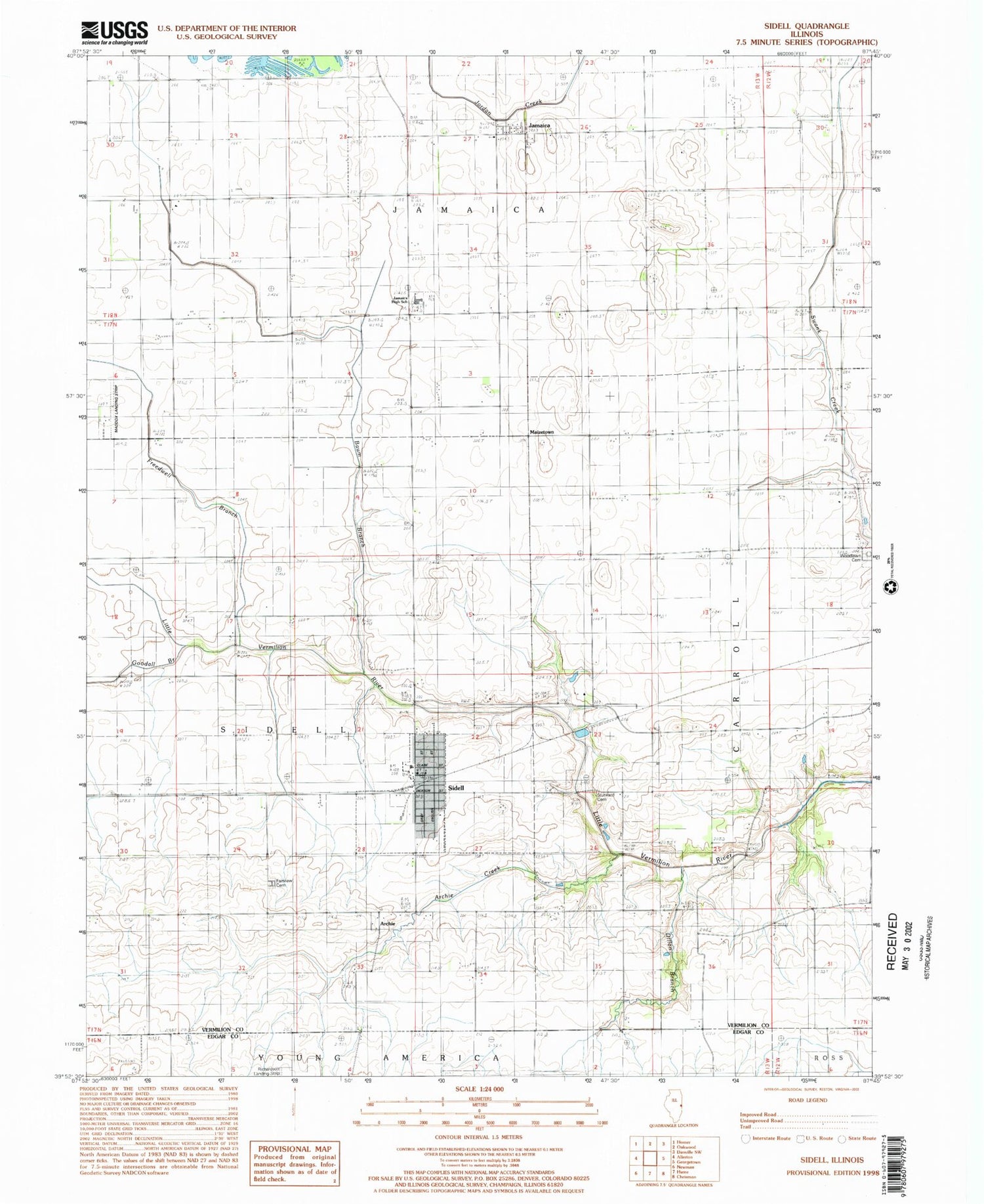
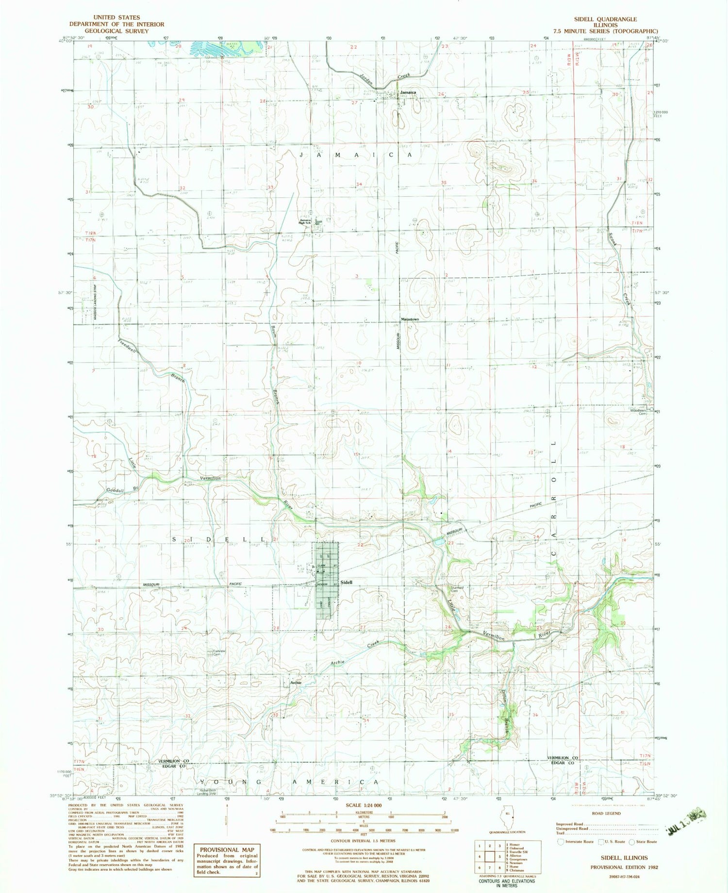
MyTopo
Classic USGS Sidell Illinois 7.5'x7.5' Topo Map
Couldn't load pickup availability
Historical USGS topographic quad map of Sidell in the state of Illinois. Map scale may vary for some years, but is generally around 1:24,000. Print size is approximately 24" x 27"
This quadrangle is in the following counties: Edgar, Vermilion.
The map contains contour lines, roads, rivers, towns, and lakes. Printed on high-quality waterproof paper with UV fade-resistant inks, and shipped rolled.
Contains the following named places: Archie, Archie Creek, Baum Branch, Dillon Branch, Fairview Cemetery, Freedwell Branch, Goodall Branch, Jamaica, Jamaica High School, Maddox Airport, Maizetown, Miller School, Sidell, Sidell Fire and Rescue, Sidell Post Office, Stunkard Cemetery, Township of Jamaica, Village of Sidell, ZIP Code: 61876