MyTopo
Classic USGS Sidney SE Montana 7.5'x7.5' Topo Map
Couldn't load pickup availability
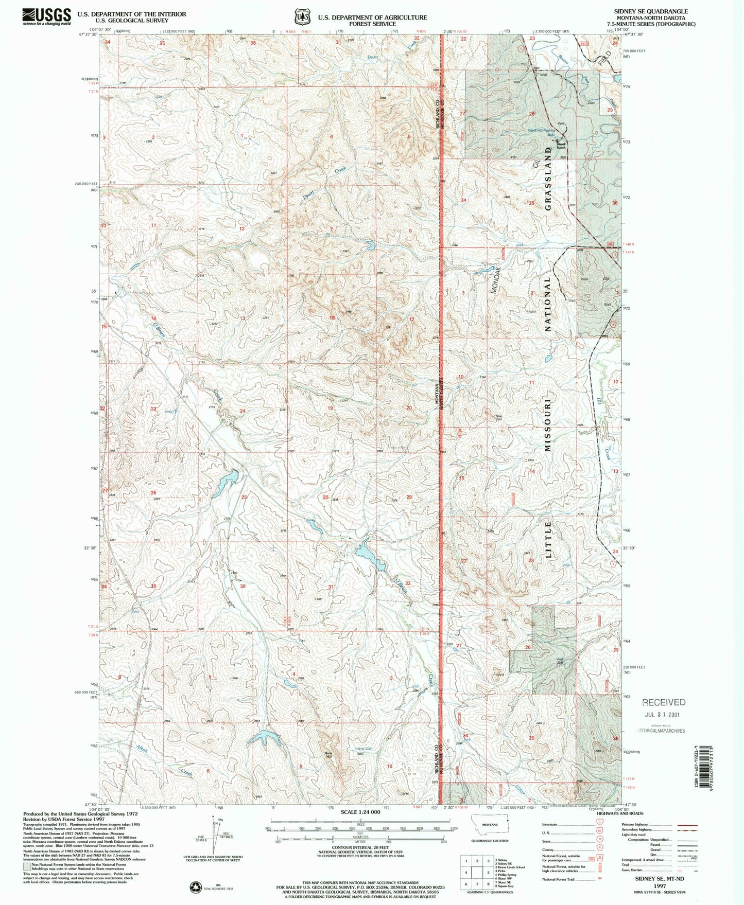
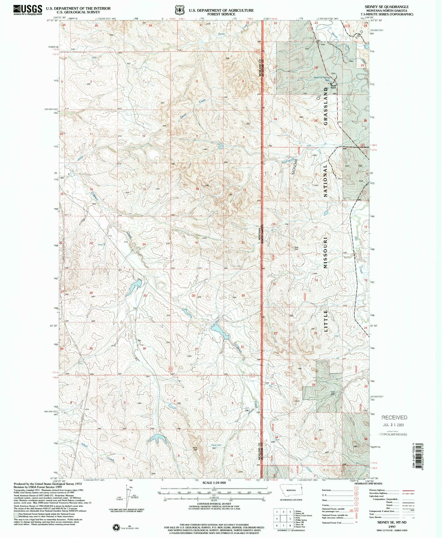
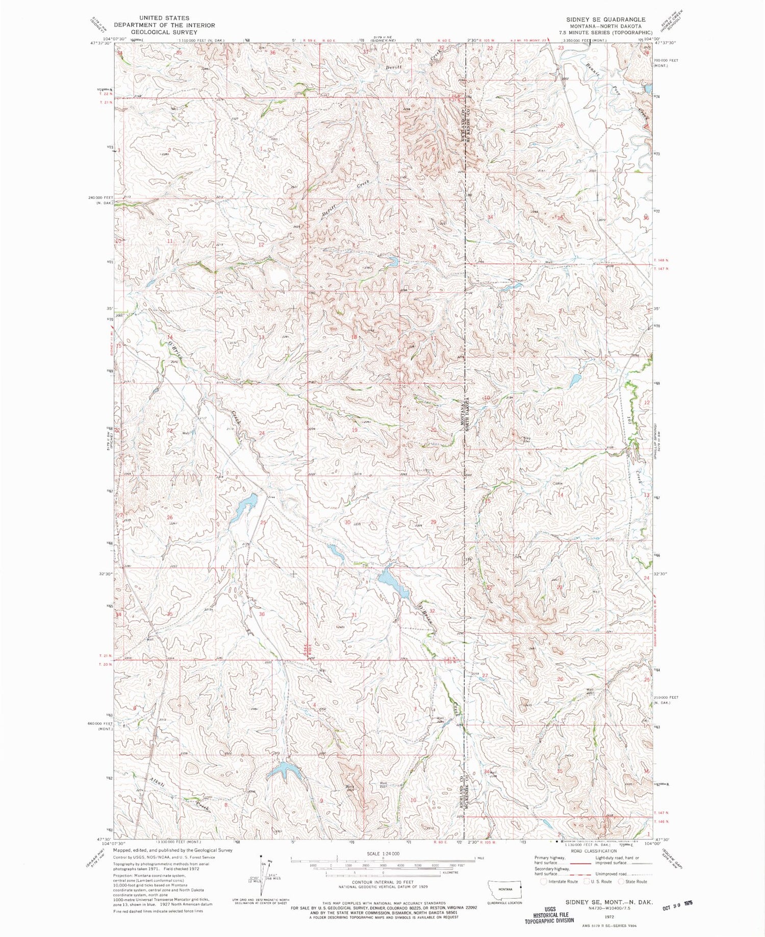
Historical USGS topographic quad map of Sidney SE in the states of Montana, North Dakota. Map scale may vary for some years, but is generally around 1:24,000. Print size is approximately 24" x 27"
This quadrangle is in the following counties: McKenzie, Richland.
The map contains contour lines, roads, rivers, towns, and lakes. Printed on high-quality waterproof paper with UV fade-resistant inks, and shipped rolled.
Contains the following named places: 20N60E04BAAD01 Well, 20N60E10BDBC01 Well, 21N59E13CDC_01 Well, 21N59E14BCA_01 Well, 21N59E23DBAA01 Well, 21N59E35CCAA01 Well, 21N60E05BADC01 Well, 21N60E18DCBC01 Well, 21N60E29BABA01 Well, 59270, Buxbaum Number 2 Dam, Folkoord Dam, Klandi Ranch, Klandl Headquarters Flowing Water Well, Olson Dam