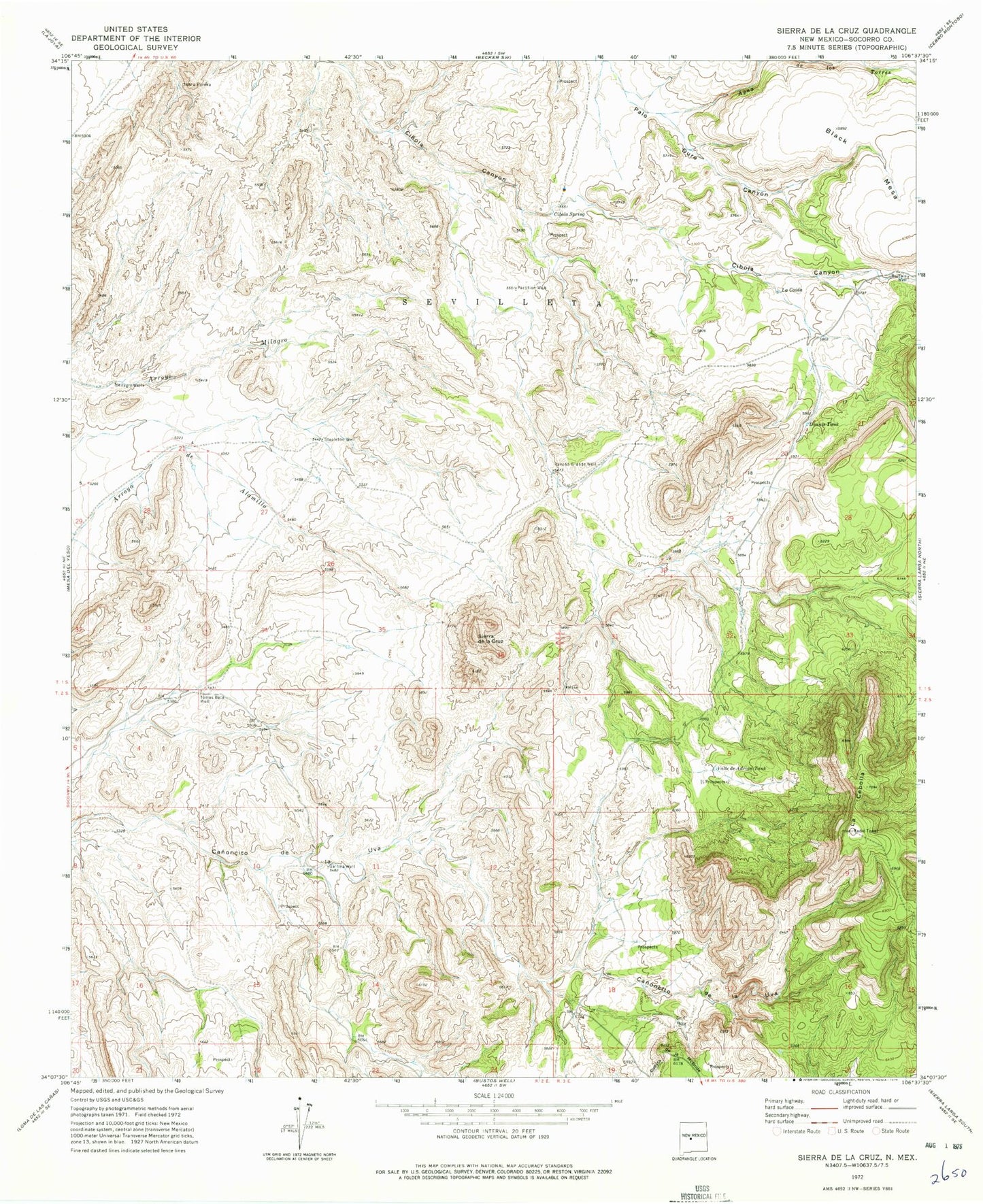
MyTopo
Classic USGS Sierra De La Cruz New Mexico 7.5'x7.5' Topo Map
Regular price
$16.95
Regular price
Sale price
$16.95
Unit price
per
Couldn't load pickup availability
Historical USGS topographic quad map of Sierra De La Cruz in the state of New Mexico. Map scale may vary for some years, but is generally around 1:24,000. Print size is approximately 24" x 27"
This quadrangle is in the following counties: Socorro.
The map contains contour lines, roads, rivers, towns, and lakes. Printed on high-quality waterproof paper with UV fade-resistant inks, and shipped rolled.
Contains the following named places: Agua de los Torres, Buffalo Water Well, Buffalo Well, Cibola Spring, Cuesta de la McBride, Donnis Tank, Gallina Well, La Caida, La Cebolla, Milagro Well, Partition Well, Rancho Grande Well, Sierra de la Cruz, Stapleton Well, Tomas Baca Well, Valle de Adrian Tank