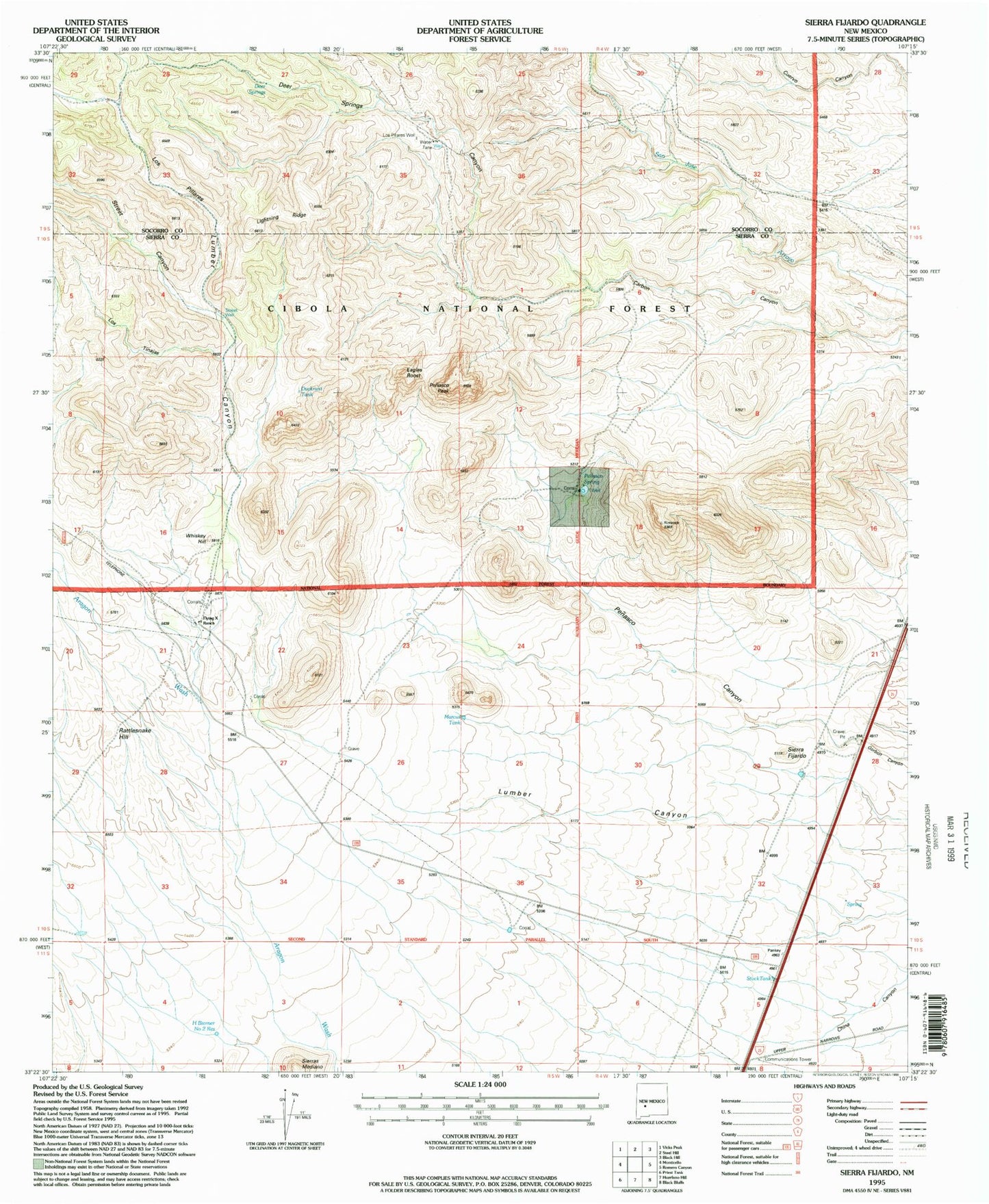
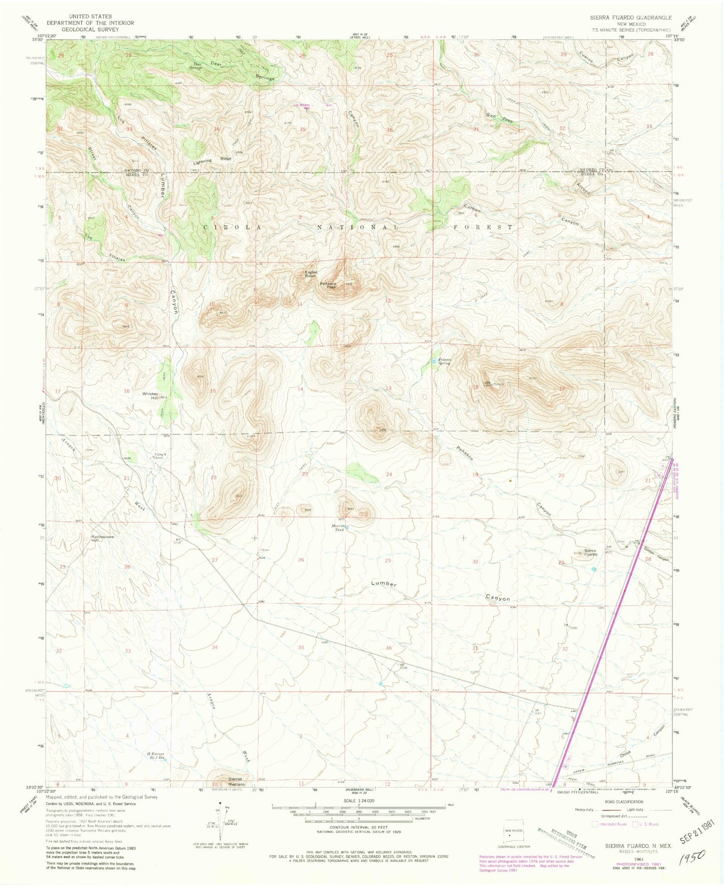
MyTopo
Classic USGS Sierra Fijardo New Mexico 7.5'x7.5' Topo Map
Couldn't load pickup availability
Historical USGS topographic quad map of Sierra Fijardo in the state of New Mexico. Map scale may vary for some years, but is generally around 1:24,000. Print size is approximately 24" x 27"
This quadrangle is in the following counties: Sierra, Socorro.
The map contains contour lines, roads, rivers, towns, and lakes. Printed on high-quality waterproof paper with UV fade-resistant inks, and shipped rolled.
Contains the following named places: Deer Springs, Deer Springs Canyon, Ducknest Tank, Eagles Roost, Flying X 2 Water Well, Flying X Ranch, Flying X Water Well, H Bierner Number 2 Reservoir, Lighting Ridge, Los Pillares, Los Pillares Well, Los Tinajas, Marcus Tank, Penasco Canyon, Penasco Peak, Penasco Spring, Rattlesnake Hill, Sierra Fijardo, Sierras Mediano, Street Canyon, Street Well, Whiskey Hill