MyTopo
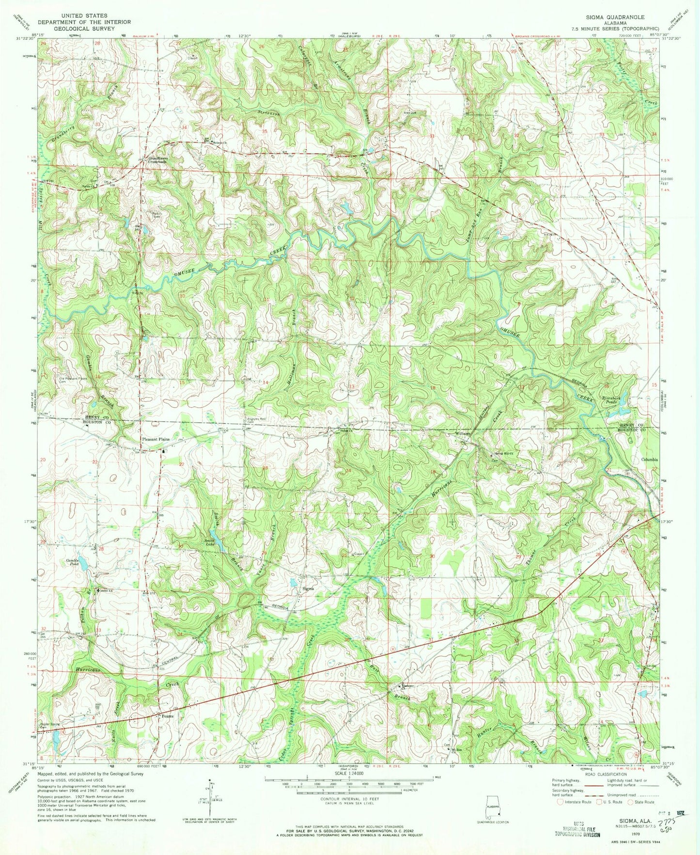
Classic USGS Sigma Alabama 7.5'x7.5' Topo Map
Couldn't load pickup availability
Historical USGS topographic quad map of Sigma in the state of Alabama. Map scale may vary for some years, but is generally around 1:24,000. Print size is approximately 24" x 27"
This quadrangle is in the following counties: Henry, Houston.
The map contains contour lines, roads, rivers, towns, and lakes. Printed on high-quality waterproof paper with UV fade-resistant inks, and shipped rolled.
Contains the following named places: Armstrong Branch, Bruner School, Buie Branch, Camp Abel Methodist Church Camp, Cedar Springs Creek, Center Baptist Church, Columbia Church Camp, Culpepper Branch, Ebenezer Church, Faith Church, Gamble Branch, Gamble Pond, Grandberry Branch, Grandberry Crossroads, Haleburg Fire Rescue Department Station 3, Hebron, Hebron Baptist Church, Hebron Cemetery, Holliman Branch, Hunter Branch, Hurricane Creek, Jump and Run Branch, Lansdale, Mount Zion Methodist Church, Mount Zion School, Nalls Creek, New Poplar Springs Church, Old Pleasant Plains Cemetery, Old Poplar Springs Church, Pearce, Pelham Branch, Pilgrims Rest Cemetery, Pleasant Plain School, Pleasant Plains, Pleasant Plains Church, Poplar Spring Cemetery, Poplar Springs Baptist Church, Rivenbark Ponds, Sardis Baptist Church, Sardis Missionary Baptist Cemetery, Shiloh Baptist Church, Shiloh Cemetery, Sigma, Smith Branch, Smith Lake, Spivey Mill Creek, Spring Hill Church, Stevenson Creek, Thomas Creek, Williams, Yance Branch, ZIP Code: 36319