MyTopo
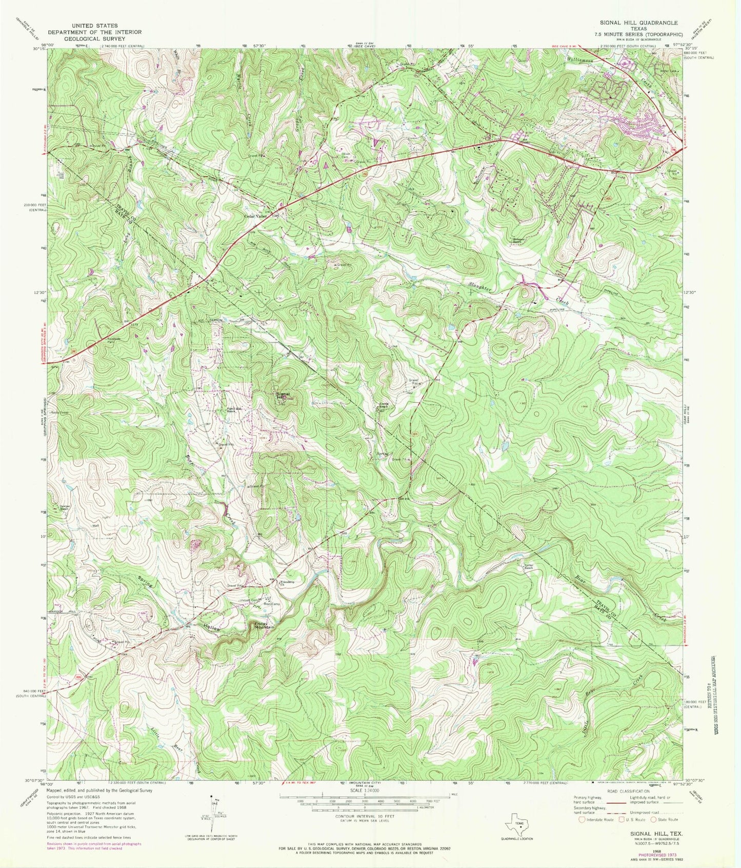
Classic USGS Signal Hill Texas 7.5'x7.5' Topo Map
Couldn't load pickup availability
Historical USGS topographic quad map of Signal Hill in the state of Texas. Typical map scale is 1:24,000, but may vary for certain years, if available. Print size: 24" x 27"
This quadrangle is in the following counties: Hays, Travis.
The map contains contour lines, roads, rivers, towns, and lakes. Printed on high-quality waterproof paper with UV fade-resistant inks, and shipped rolled.
Contains the following named places: Friday Mountain, Friendship Church, Heissner Ranch, Johnson Cemetery, Koenig Ranch, Oliver Cemetery, Rim Rock Trail, Sawyer Ranch, Signal Hill, Signal Hill Ranch, Spillar Ranch, Spring Hollow, Cedar Valley, Johnny Voudouris Heliport, Bear Creek, Joe Dan Mills Elementary School, Kiker Elementary School, Fellowship of the Hills Church, Scenic Hills Baptist Church, Hill Country Baptist Church of Oakhill, Oak Hill Assembly of God Church, Fitzhugh Baptist Church, Circle C Slaughter Creek Trail, Hill Country Baptist Church of Oakhill, Majestic Mountain Ministries, First Baptist Church of Oak Hill, Mills Elementary School, Mount Olive Lutheran Church Preschool, Gorzycki Middle School, Village of Bear Creek, Driftwood Volunteer Fire Department, Travis County ESD 3 Oak Hill Fire Department Station 1, Austin Fire Department Station 43, Manchaca Volunteer Fire Department Station 6, Austin / Travis County Emergency Medical Service - Medic 31, Seton Southwest Hospital, Belterra Census Designated Place, Belterra


