MyTopo
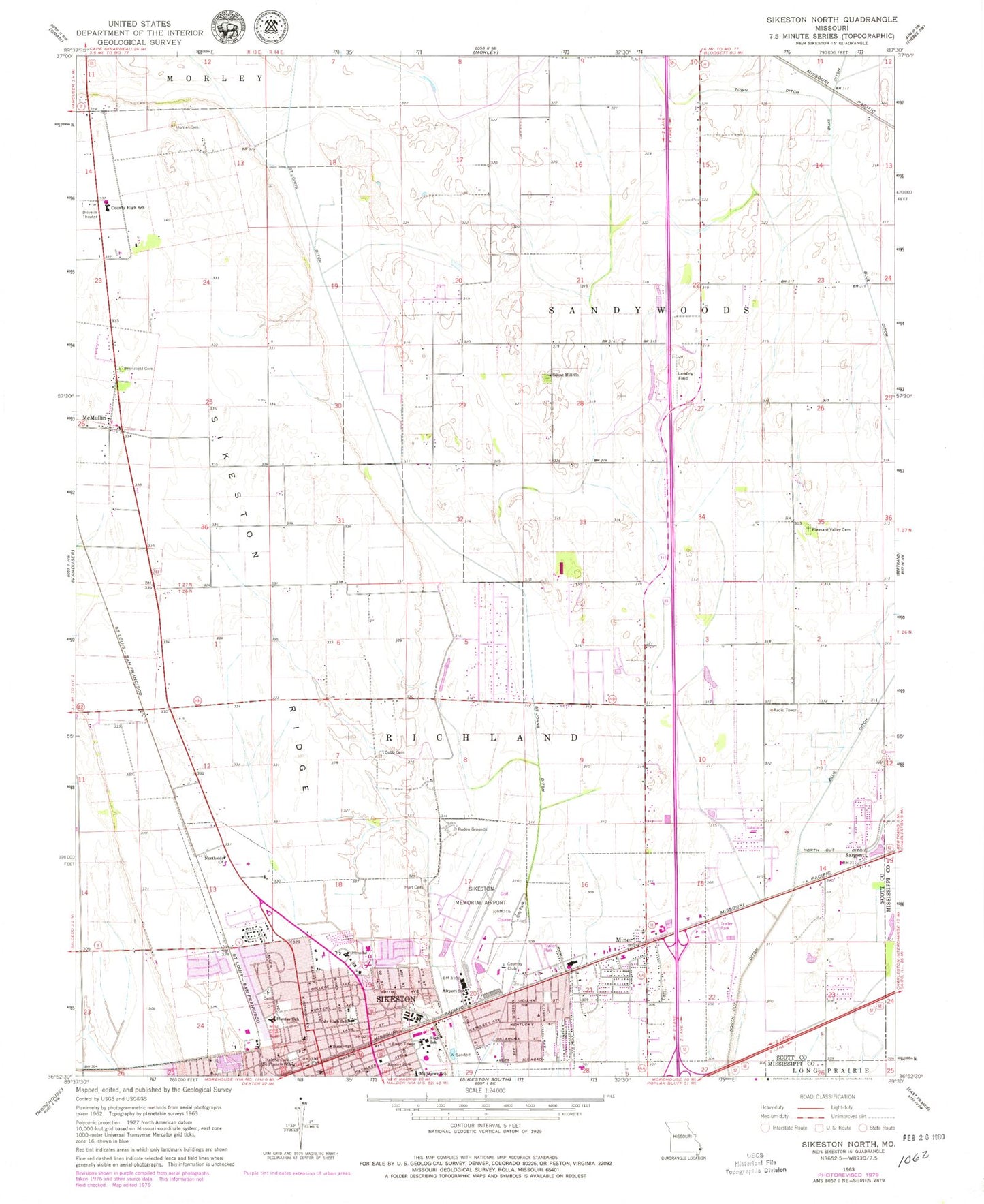
Classic USGS Sikeston North Missouri 7.5'x7.5' Topo Map
Couldn't load pickup availability
Historical USGS topographic quad map of Sikeston North in the state of Missouri. Map scale may vary for some years, but is generally around 1:24,000. Print size is approximately 24" x 27"
This quadrangle is in the following counties: Mississippi, Scott.
The map contains contour lines, roads, rivers, towns, and lakes. Printed on high-quality waterproof paper with UV fade-resistant inks, and shipped rolled.
Contains the following named places: Airport School, Bennifield Cemetery, Blodgett School, Boardman School, Bright Prospect Church, Chaney School, City of Miner, City of Sikeston, Cobb Cemetery, Dunver School, Hart Cemetery, Hunter Cemetery, Hunter School, Lennox School, Malone Park, Matthews School, McMullin, Melon, Miner, Miner Fire Station, Miner Police Department, Miner School, Missouri Delta Heliport, Missouri Delta Medical Center, Northside Church, Pleasant Valley Cemetery, Pleasant Valley Church, Saint Francis School, Saint Francis Xavier Church, Sand Prairie School, Sargent, Shady Grove School, Sikeston, Sikeston Department of Public Safety Fire Division Station 2, Sikeston Department of Public Safety Fire Division Station 3, Sikeston Memorial Municipal Airport, Sikeston Police Department, Sikeston Post Office, Sikeston Public Safety Fire Division Station 1, Sikeston Ridge, Silent Hill Church, Town Ditch, Township of Richland, Township of Sandywoods, ZIP Code: 63801