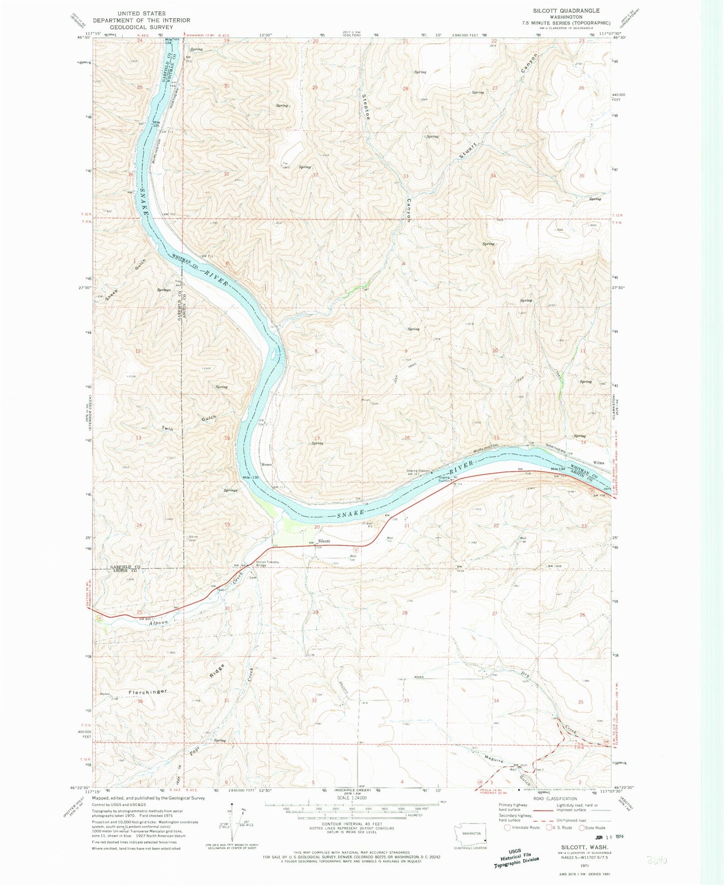
MyTopo
Classic USGS Silcott Island Washington 7.5'x7.5' Topo Map
Regular price
$16.95
Regular price
Sale price
$16.95
Unit price
per
Couldn't load pickup availability
Historical USGS topographic quad map of Silcott Island in the state of Washington. Map scale may vary for some years, but is generally around 1:24,000. Print size is approximately 24" x 27"
This quadrangle is in the following counties: Asotin, Garfield, Whitman.
The map contains contour lines, roads, rivers, towns, and lakes. Printed on high-quality waterproof paper with UV fade-resistant inks, and shipped rolled.
Contains the following named places: Alpowa, Alpowa Creek, Chief Timothy State Park, Indian Timothy Bridge, Moses, Nisqually John Landing, Page Creek, Sheep Gulch, Silcott, Silcott Island, Steptoe Canyon, Steptoe Creek, Steptoe Lower Range, Stuart Canyon, ZIP Code: 99179