MyTopo
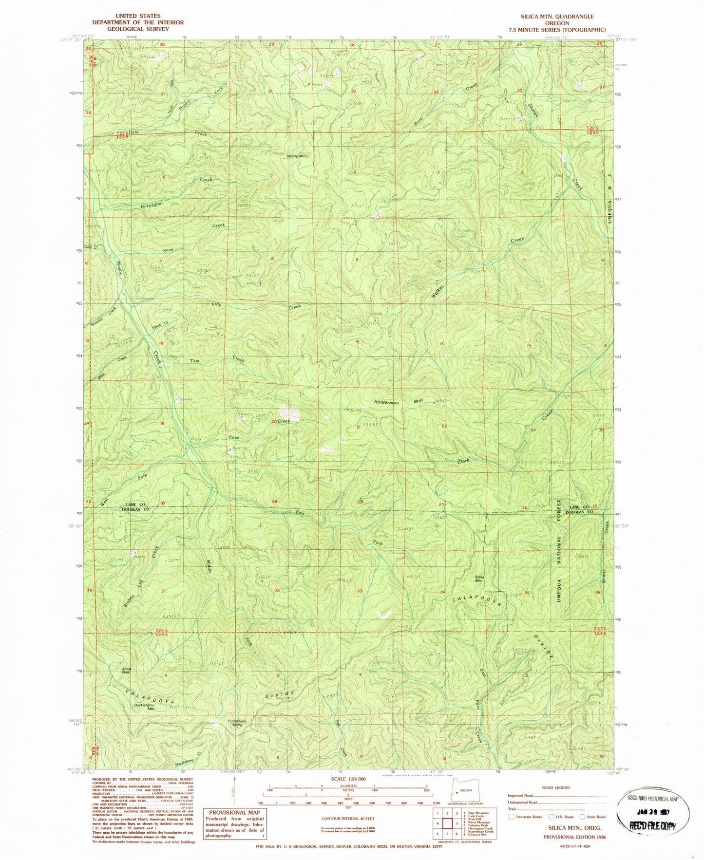
Classic USGS Silica Mountain Oregon 7.5'x7.5' Topo Map
Couldn't load pickup availability
Historical USGS topographic quad map of Silica Mountain in the state of Oregon. Map scale may vary for some years, but is generally around 1:24,000. Print size is approximately 24" x 27"
This quadrangle is in the following counties: Douglas, Lane.
The map contains contour lines, roads, rivers, towns, and lakes. Printed on high-quality waterproof paper with UV fade-resistant inks, and shipped rolled.
Contains the following named places: Broken Leg Creek, Brownie Creek, Buck Creek, Cove Creek, East Fork Mosby Creek, Gray Creek, Holderman Mountain, Huckleberry Mountain, Huckleberry Spring, Lick Creek, Lilly Creek, Middle Fork Dahl Creek, Middle Fork Mosby Creek, Miles Creek, North Fork Dahl Creek, Norwegian Creek, Pass Creek Trail, Shea Creek, Silica Camp, Silica Mountain, Silica Trail, Snow Peak, Tom Creek, Tones Creek, Walker Creek, West Fork Mosby Creek, White Creek, Windy Mountain