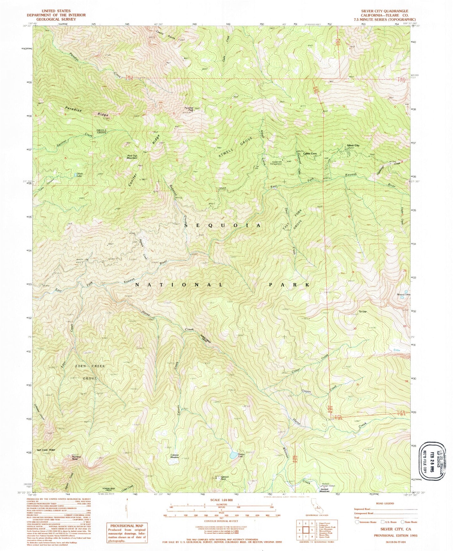
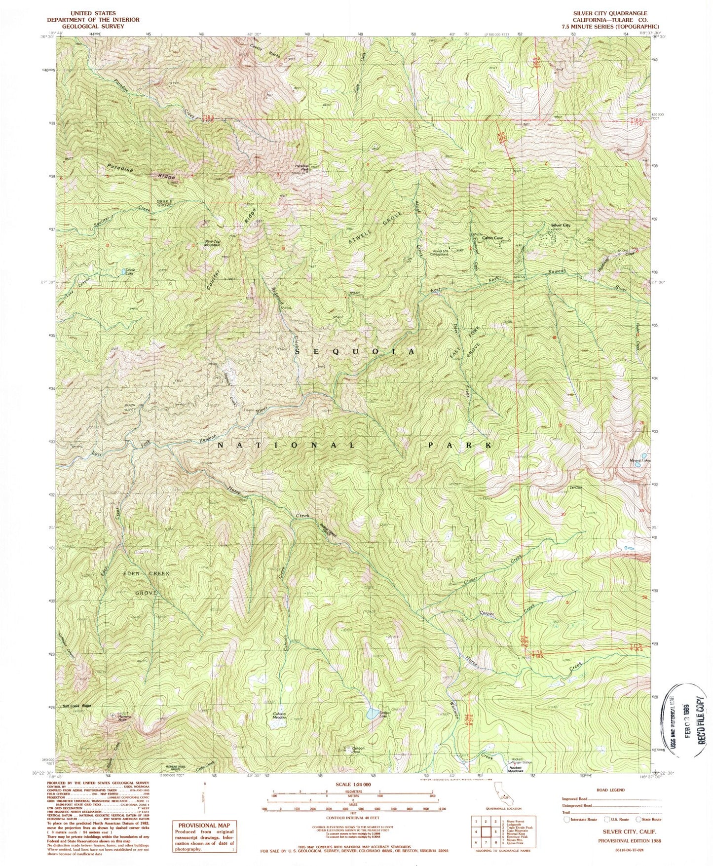
MyTopo
Classic USGS Silver City California 7.5'x7.5' Topo Map
Couldn't load pickup availability
Historical USGS topographic quad map of Silver City in the state of California. Typical map scale is 1:24,000, but may vary for certain years, if available. Print size: 24" x 27"
This quadrangle is in the following counties: Tulare.
The map contains contour lines, roads, rivers, towns, and lakes. Printed on high-quality waterproof paper with UV fade-resistant inks, and shipped rolled.
Contains the following named places: Atwell Creek, Atwell Hockett Trail, Atwell Mill Ranger Station, Cahoon Rock Lookout, Camp Conifer, Clover Creek, East Fork Grove, Eden Creek Grove, Evelyn Lake, Hockett Meadow Trail, Hockett Ranger Station, Homers Nose, Horse Creek, Horse Creek Grove, Oriole Grove, Pine Top Mountain, Redwood Creek, Silver City, Slapjack Creek, Highbridge Creek, Fowler Creek, Deadwood Creek, Corner Creek, Cahoon Rock, Hockett Meadows, Deer Creek, Eden Creek, Paradise Peak, Paradise Ridge, Tar Gap, Atwell Grove, Cahoon Creek, Cahoon Meadow, Castle Rocks, Conifer Ridge, Oriole Lake, Whitman Creek, Salt Creek Ridge, Atwell Mill Ranger Station, Camp Conifer, Cabin Cove, Atwell Mill Campground, Silver City Census Designated Place, John Krebs Wilderness