
MyTopo
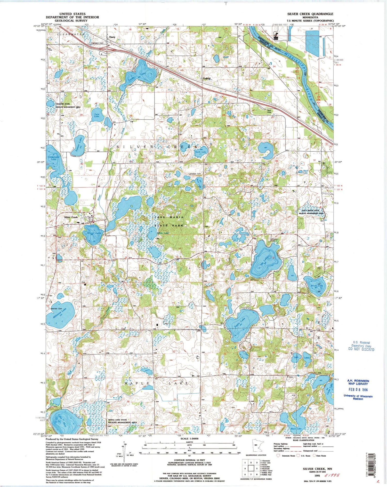
Classic USGS Silver Creek Minnesota 7.5'x7.5' Topo Map
Couldn't load pickup availability
Historical USGS topographic quad map of Silver Creek in the state of Minnesota. Map scale may vary for some years, but is generally around 1:24,000. Print size is approximately 24" x 27"
This quadrangle is in the following counties: Sherburne, Wright.
The map contains contour lines, roads, rivers, towns, and lakes. Printed on high-quality waterproof paper with UV fade-resistant inks, and shipped rolled.
Contains the following named places: Birch Lake, Black Lake, Carter School, Eagle Lake, Ember Lake, Enfield, Enfield East Bound Rest Area, Enfield Post Office, Front Line Plus Fire and Rescue, Hasty, Hasty Post Office, Highland Cemetery, Ida Lake, Immanuel Lutheran Church of Silver Creek, Kelly Meyer State Wildlife Management Area, Lake Maria State Park, Lake Mary, Lakeside Cemetery, Lakeview Cemetery, Limestone Lake, Little Eagle Lake, Locke Lake, Maple Lake State Wildlife Management Area, Maria Lake, Millstone Lake, Minnesotas Highways Historical Marker, North Lake, Olsons Campground, Silver Creek, Silver Creek Census Designated Place, Silver Creek Church, Silver Creek Post Office, Silver Lake, Township of Silver Creek, Twin Lake, Twin Lakes, West Lake, ZIP Code: 55358


