MyTopo
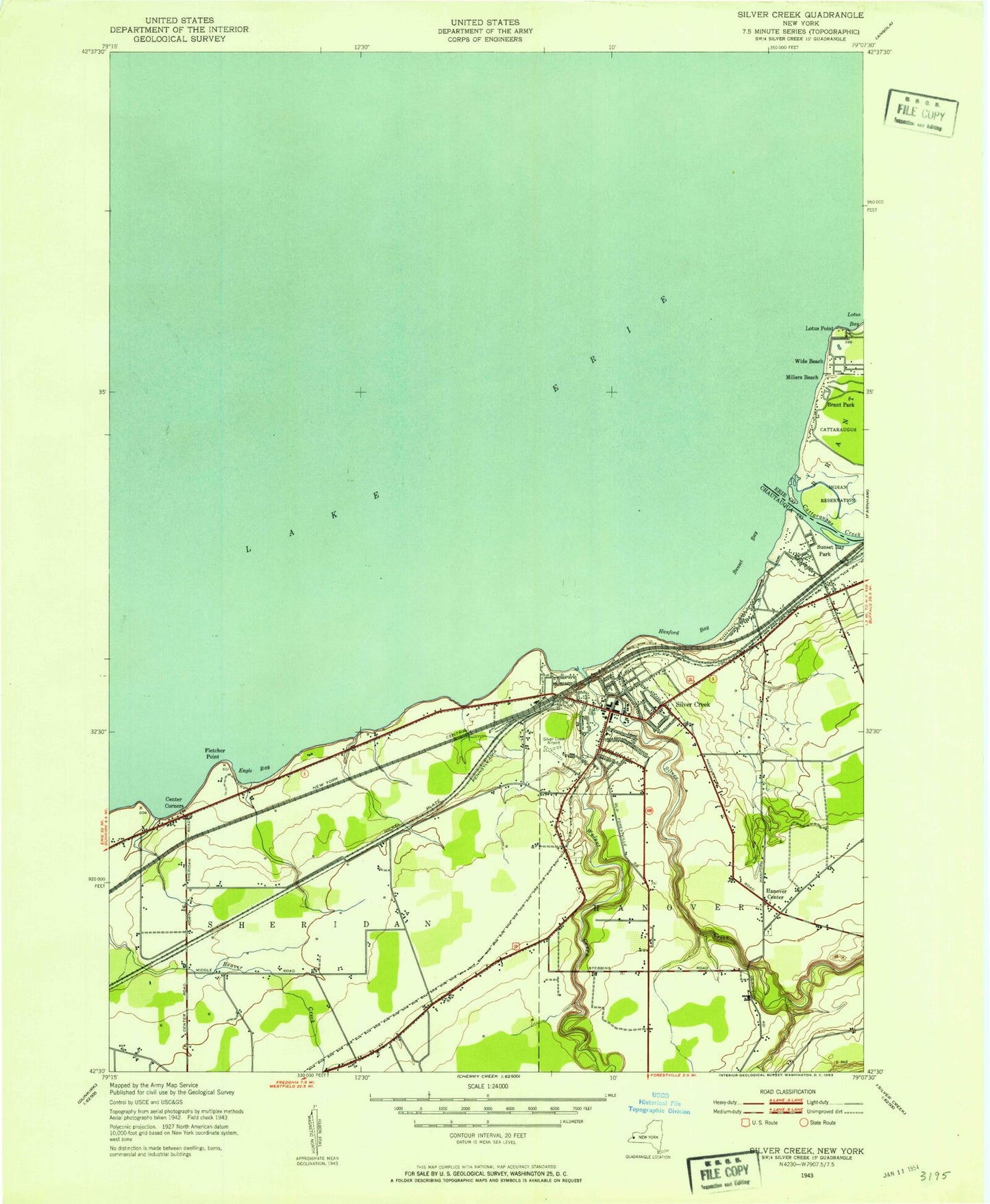
Classic USGS Silver Creek New York 7.5'x7.5' Topo Map
Couldn't load pickup availability
Historical USGS topographic quad map of Silver Creek in the state of New York. Map scale may vary for some years, but is generally around 1:24,000. Print size is approximately 24" x 27"
This quadrangle is in the following counties: Chautauqua, Erie.
The map contains contour lines, roads, rivers, towns, and lakes. Printed on high-quality waterproof paper with UV fade-resistant inks, and shipped rolled.
Contains the following named places: Anderson-Lee Library, Cattaraugus Creek, Center Corners, Central High School, Christ Chapel Wesleyan Church, Concord Nurseries Farm, Eagle Bay, Evergreen Lawn Cemetery, First Baptist Church, First United Church, Fletcher Point, Glenwood Cemetery, Hanford Bay, Hanover Center, Hanover Center Fire Department, Hanover Town Hall, Hidden Harbor Marina, Keene marina, Keene Marina, Lake Shore Health Care Center, Lotus Point, Millers Beach, Mount Carmel Cemetery, Our Lady of Mount Carmel Church, Saint Alban's Episcopal Church, Saint Columban's on the Lake, Saint Columban's on the Lake Assisted Living Facility, Saint Columbans Seminary, Silver Creek, Silver Creek Airport, Silver Creek Assembly of God Church, Silver Creek Post Office, Silver Creek Volunteer Fire Department, Snow Marine Basin, Sunset Bay, Sunset Bay Census Designated Place, Sunset Bay Volunteer Fire Department, Trinity Lutheran Church, Village of Silver Creek, Walnut Creek, Wide Beach, Willow Creek Winery, Zion Lutheran Church, ZIP Code: 14136