MyTopo
Classic USGS Silver Dollar Flat Oregon 7.5'x7.5' Topo Map
Regular price
$16.95
Regular price
Sale price
$16.95
Unit price
per
Couldn't load pickup availability
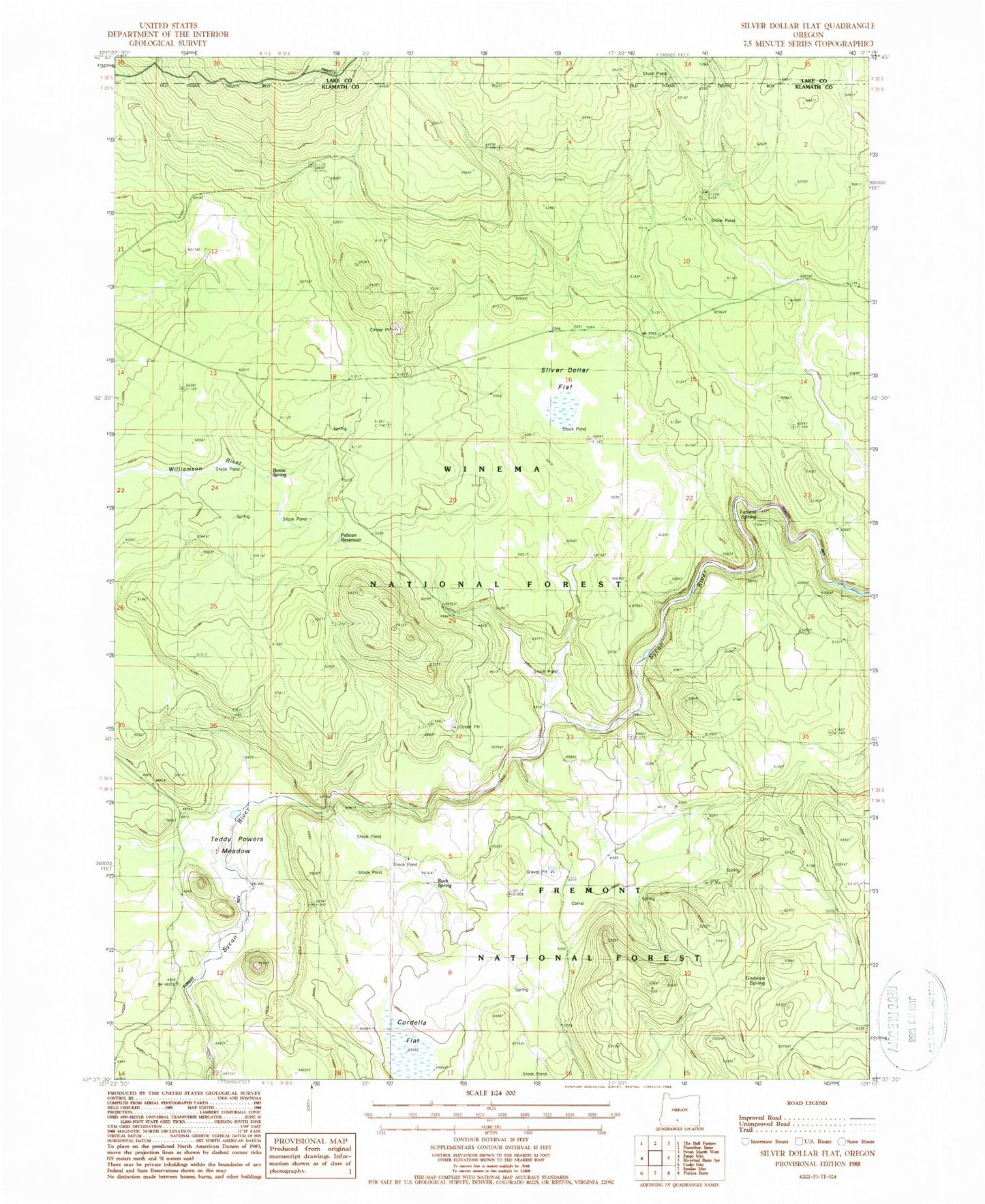
Historical USGS topographic quad map of Silver Dollar Flat in the state of Oregon. Map scale may vary for some years, but is generally around 1:24,000. Print size is approximately 24" x 27"
This quadrangle is in the following counties: Klamath, Lake.
The map contains contour lines, roads, rivers, towns, and lakes. Printed on high-quality waterproof paper with UV fade-resistant inks, and shipped rolled.
Contains the following named places: Bottle Spring, Cordelia Flat, Godowa Spring, Moondance Ranch Airport, Pelican Bay Camp, Pelican Reservoir, Rock Spring, Silver Dollar Cinder Pit, Silver Dollar Flat, Sycan Ford, Teddy Powers Meadow, Torrent Spring