MyTopo
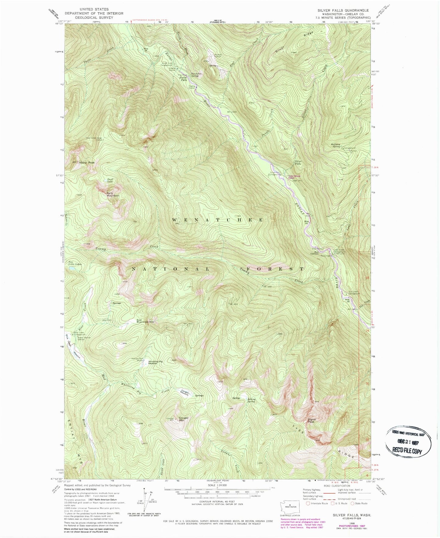
Classic USGS Silver Falls Washington 7.5'x7.5' Topo Map
Couldn't load pickup availability
Historical USGS topographic quad map of Silver Falls in the state of Washington. Typical map scale is 1:24,000, but may vary for certain years, if available. Print size: 24" x 27"
This quadrangle is in the following counties: Chelan.
The map contains contour lines, roads, rivers, towns, and lakes. Printed on high-quality waterproof paper with UV fade-resistant inks, and shipped rolled.
Contains the following named places: Blue Creek, Blue Creek Campground, Blue Creek Meadow, Box Canyon, Cougar Meadow, Cougar Mountain, Devil Lake, East Blue Creek Meadow, Entiat Falls, Fox Creek, Fox Creek Campground, Halfway Spring, Hunters Trail, Hunters Trail Shelter, Jungle Creek, Kelly Mountain, Klone Peak, Lake Creek, Lake Creek Campground, North Fork Campground, North Fork Entiat River, Pope Creek, Signal Peak, Silver Creek, Silver Falls, Silver Falls Campground, Snowshoe Spring, Three Creek, Three Creek Ridge Camp, Tommy Creek, Tyee Ridge, Whistling Pig Creek, Whistling Pig Meadow, Halfway Spring Campground, Blue Creek Forest Service Station, Cougar Mountain Lookout, Silver Falls Forest Service Station