MyTopo
Classic USGS Silver Lake Indiana 7.5'x7.5' Topo Map
Couldn't load pickup availability
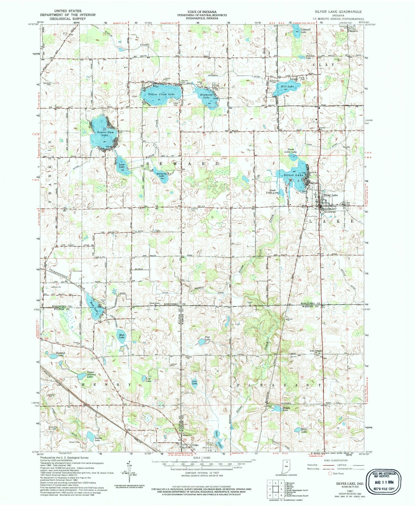
Historical USGS topographic quad map of Silver Lake in the state of Indiana. Map scale may vary for some years, but is generally around 1:24,000. Print size is approximately 24" x 27"
This quadrangle is in the following counties: Fulton, Kosciusko, Wabash.
The map contains contour lines, roads, rivers, towns, and lakes. Printed on high-quality waterproof paper with UV fade-resistant inks, and shipped rolled.
Contains the following named places: Arthur Ditch, Bear Lake, Beaver Dam Lake, Brown Lake, Caldwell Lake, Center Church, Diamond Lake, Disko, Eaton Ditch, Fairview Cemetery, Flat Lake, Franklin Cemetery, Funk Ditch, Germantown Cemetery, Graceland Cemetery, Hamman Cemetery, Harsh Ditch, Hill Lake, Jamison Lake, Kroft Ditch, Lakeview Cemetery, Landis Ditch, Landis Lake, Lautzenhizer Ditch, Loon Lake, Lordan Farms, Lost Lake, Lotz Lake, McClures Lake, Michaels Ditch, Morrett Ditch, Mud Lake, Multiple Township Emergency Medical Services, North Little Lake, Rock Lake, Silver Creek Church, Silver Lake, Silver Lake Elementary School, Silver Lake Fire Department, Silver Lake Post Office, Silver Lake Town Marshal's Office, Silveus Ditch, South Little Lake, South Pleasant Church, Summit Lake, Town of Silver Lake, Township of Seward, Twin Lakes, Upper Summit Lake, Yellow Creek Lake, ZIP Code: 46982