
MyTopo
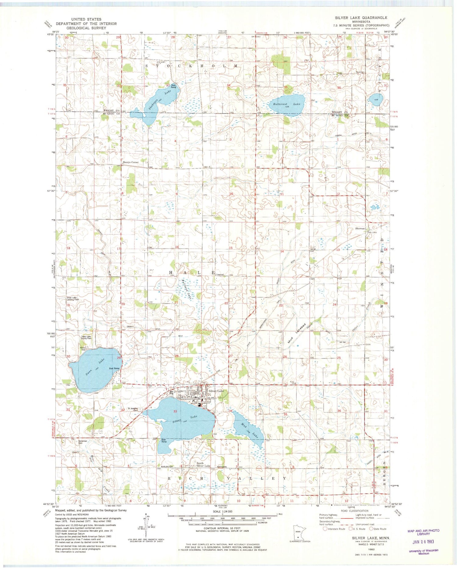
Classic USGS Silver Lake Minnesota 7.5'x7.5' Topo Map
Couldn't load pickup availability
Historical USGS topographic quad map of Silver Lake in the state of Minnesota. Map scale may vary for some years, but is generally around 1:24,000. Print size is approximately 24" x 27"
This quadrangle is in the following counties: McLeod, Wright.
The map contains contour lines, roads, rivers, towns, and lakes. Printed on high-quality waterproof paper with UV fade-resistant inks, and shipped rolled.
Contains the following named places: Bohemian Cemetery, Bullhead Lake, Butternut Lake, Carlson's Orchard, Church of the Holy Family, City of Silver Lake, County Ditch Number Eight, County Ditch Number Forty, County Ditch Number Thirtyfive, County Ditch Number Thirtysix, County Ditch Number Thirtytwo, Dahl School, Faith Church, First Congregational Church, Henrys Corner, Judicial Ditch Number Eleven, Lakeside Elementary School, Mud Lake, Mud Lakebed, Presbyterian Church, Saint Adelbert's Catholic Cemetery, Saint Joseph Cemetery, School Number 1014, School Number 987, Shakopee Lake, Sherman, Silver Lake, Silver Lake Catholic School, Silver Lake City Hall, Silver Lake Fire Department, Silver Lake Police Department, Silver Lake Post Office, South Silver Lake, Swan Lake, Swan Lake County Park, Timmers Landing Field, Township of Hale, ZIP Code: 55381


