MyTopo
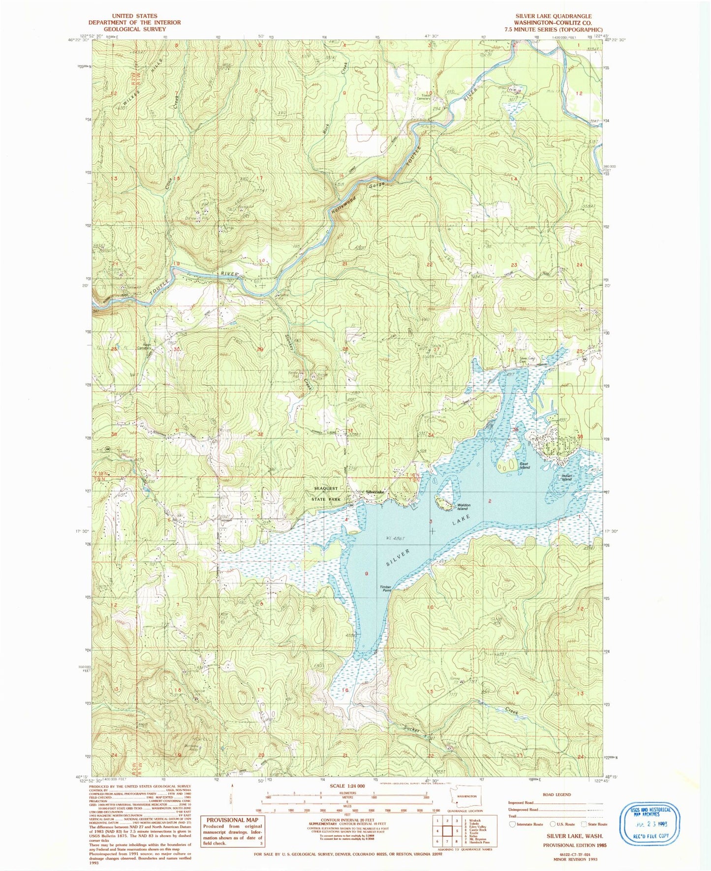
Classic USGS Silver Lake Washington 7.5'x7.5' Topo Map
Couldn't load pickup availability
Historical USGS topographic quad map of Silver Lake in the state of Washington. Typical map scale is 1:24,000, but may vary for certain years, if available. Print size: 24" x 27"
This quadrangle is in the following counties: Cowlitz.
The map contains contour lines, roads, rivers, towns, and lakes. Printed on high-quality waterproof paper with UV fade-resistant inks, and shipped rolled.
Contains the following named places: Camp Cowlitz, Cline Creek, Goat Island, Hollywood Gorge, Pete Moore Island, Rock Creek, Rosin Cemetery, Seaquest State Park, Silver Lake, Silver Lake Cemetery, Silver Lake, Stankey Creek, Sucker Creek, Tower Township Cemetery, Indian Island, Timber Point, Waldon Island, Seven Wonders Museum, Cowlitz County Fire District 3 Castle Rock Substation