
MyTopo
Classic USGS Silver Zone Pass Nevada 7.5'x7.5' Topo Map
Couldn't load pickup availability
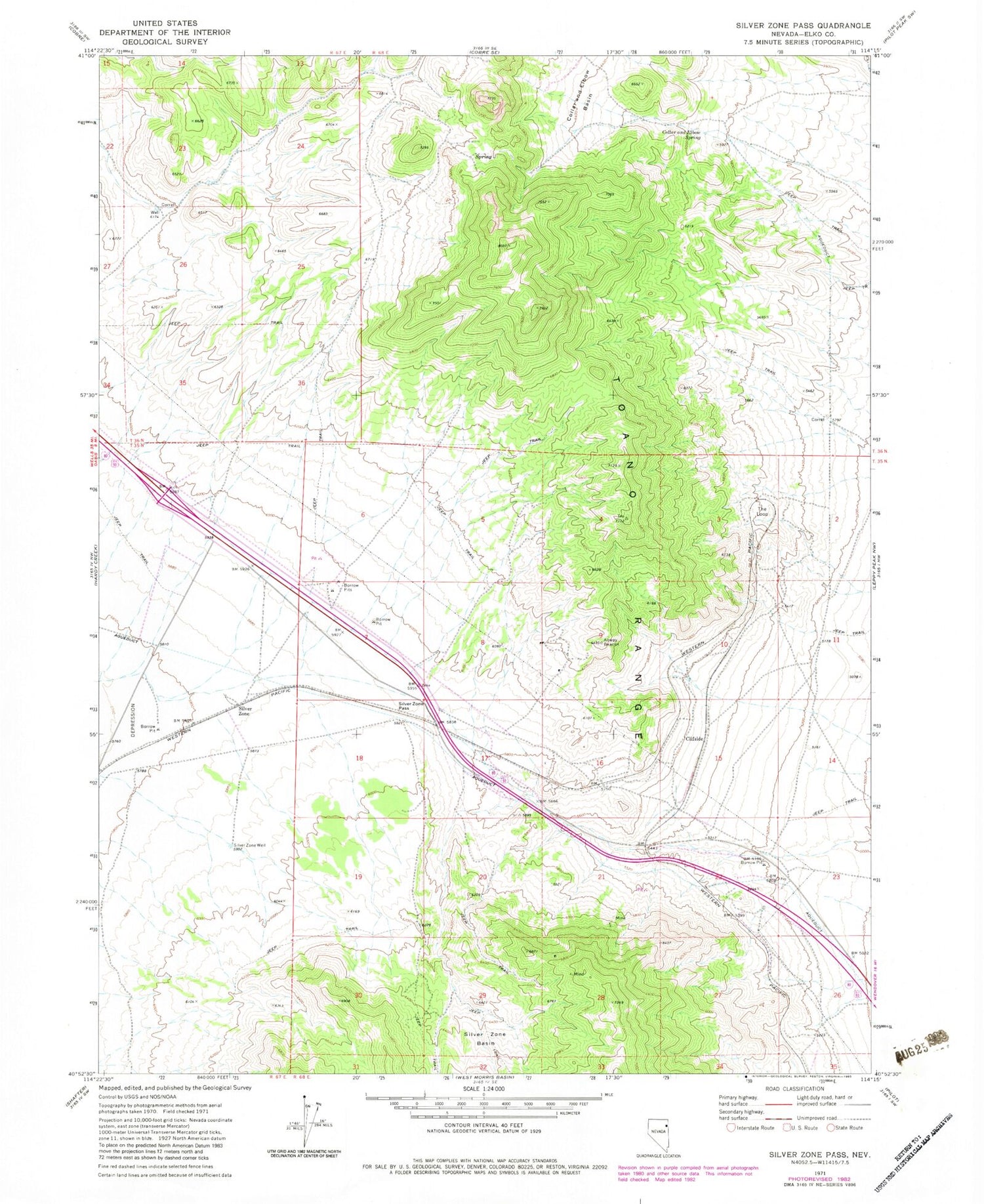
Historical USGS topographic quad map of Silver Zone Pass in the state of Nevada. Map scale may vary for some years, but is generally around 1:24,000. Print size is approximately 24" x 27"
This quadrangle is in the following counties: Elko.
The map contains contour lines, roads, rivers, towns, and lakes. Printed on high-quality waterproof paper with UV fade-resistant inks, and shipped rolled.
Contains the following named places: Arnold, Clifside, Collar and Elbow Basin, Collar and Elbow Dam, Collar and Elbow Spring, Gath, Iron J Mine, Nick Del Duke Mine, Proctor, Proctor Mining District, Silver Hoard Mine, Silver Zone, Silver Zone Basin, Silver Zone Pass, Silver Zone Post Office, Silver Zone Well, The Loop, Toano Number Thirteen Spring


