MyTopo
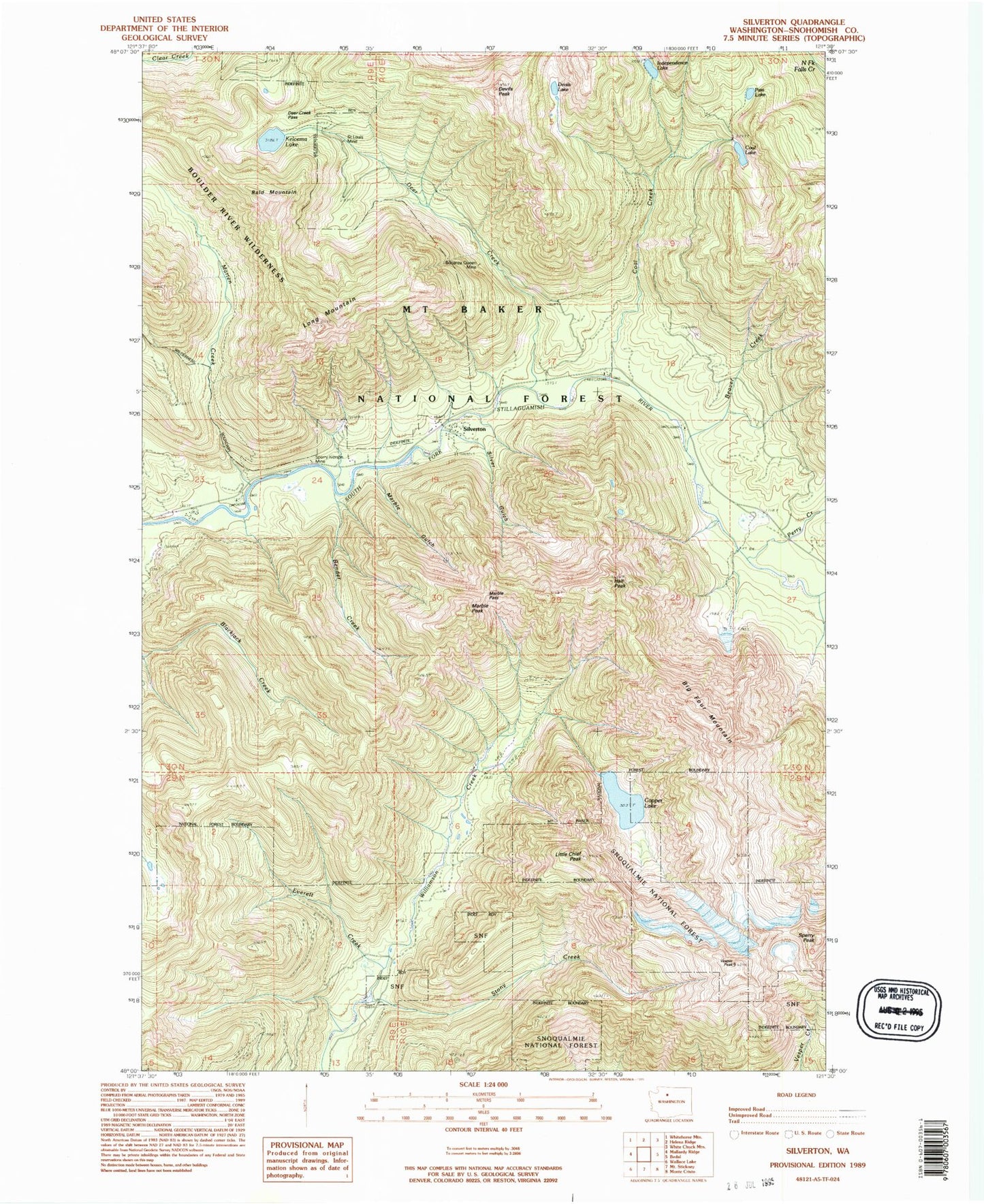
Classic USGS Silverton Washington 7.5'x7.5' Topo Map
Couldn't load pickup availability
Historical USGS topographic quad map of Silverton in the state of Washington. Typical map scale is 1:24,000, but may vary for certain years, if available. Print size: 24" x 27"
This quadrangle is in the following counties: Snohomish.
The map contains contour lines, roads, rivers, towns, and lakes. Printed on high-quality waterproof paper with UV fade-resistant inks, and shipped rolled.
Contains the following named places: Bald Mountain, Beaver Creek, Beaver Creek Camp, Bender Creek, Big Four Camp, Big Four Mountain, Bonanza Queen Mine, Camp Silverton-Wadheim, Coal Creek, Coal Creek Camp, Coal Lake, Copper Lake, Deer Creek, Deer Creek Campground (historical), Deer Creek Pass, Devils Peak, Everett Creek, Hall Peak, Independence Lake, Kelcema Lake, Little Chief Peak, Long Mountain, Marble Gulch, Marble Pass, Marble Peak, Marten Creek, Pass Lake, Perry Creek, Saint Louis Mine, Silver Gulch, Silverton, Sperry Peak, Stony Creek, Vesper Peak, Marien Creek Campground, Coal Lake Viewpoint, Dick Sperry Campground, Perry Creek Campground, Blackjack Lookout, Big Four, Big Four Post Office (historical), Silverton Post Office (historical)