MyTopo
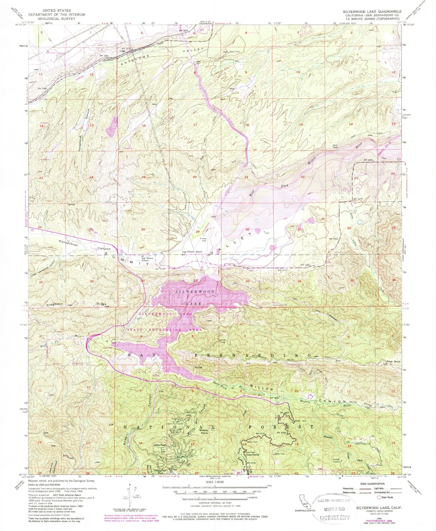
Classic USGS Silverwood Lake California 7.5'x7.5' Topo Map
Couldn't load pickup availability
Historical USGS topographic quad map of Silverwood Lake in the state of California. Typical map scale is 1:24,000, but may vary for certain years, if available. Print size: 24" x 27"
This quadrangle is in the following counties: San Bernardino.
The map contains contour lines, roads, rivers, towns, and lakes. Printed on high-quality waterproof paper with UV fade-resistant inks, and shipped rolled.
Contains the following named places: Breezy Point, Burnt Mill Canyon, Camp Seeley, Dart Creek, Grass Valley Creek, Horsethief Canyon, Houston Creek, Las Flores Ranch, Las Flores School, Little Horsethief Canyon, Miller Canyon, Miller Canyon Trail, Pillars of God, Pilot Rock, Pilot Rock Truck Trail, Sawpit Canyon, Seeley Creek, Seeley Flat, Silverwood Lake, Telephone Canyon, Lugo, East Fork West Fork Mojave River, San Bernardino County Regional Park Campground, Cedar Spring Dam, Cottonwood Forest Station, Lugo Substation Heliport, Cedarpines Park, Jobs Peak, Silverwood Lake State Recreation Area, Cedar Springs (historical), Black Oak Picnic Area, Burnt Mill Creek, Chamise Picnic Area, Cleghorn Day Use Area, Jamajab Point, Live Oak Landing Picnic Area, Lynx Point, Mesa Campground, Pilot Rock Conservation Camp, Rio Baranca Valle Campground, Serrano Beach Picnic Area, Silverwood Lake State Recreation Area Visitors Center, Sycamore Landing Picnic Area, Lake Arrowhead Division, Breezy Point, Burnt Mill Canyon, Camp Seeley, Dart Creek, Grass Valley Creek, Horsethief Canyon, Houston Creek, Las Flores Ranch, Las Flores School, Little Horsethief Canyon, Miller Canyon, Miller Canyon Trail, Pillars of God, Pilot Rock, Pilot Rock Truck Trail, Sawpit Canyon, Seeley Creek, Seeley Flat, Silverwood Lake, Telephone Canyon, Lugo, East Fork West Fork Mojave River, San Bernardino County Regional Park Campground, Cedar Spring Dam, Cottonwood Forest Station, Lugo Substation Heliport, Cedarpines Park, Jobs Peak, Silverwood Lake State Recreation Area, Cedar Springs (historical), Black Oak Picnic Area, Burnt Mill Creek, Chamise Picnic Area, Cleghorn Day Use Area, Jamajab Point, Live Oak Landing Picnic Area, Lynx Point, Mesa Campground, Pilot Rock Conservation Camp, Rio Baranca Valle Campground, Serrano Beach Picnic Area, Silverwood Lake State Recreation Area Visitors Center, Sycamore Landing Picnic Area, Lake Arrowhead Division