MyTopo
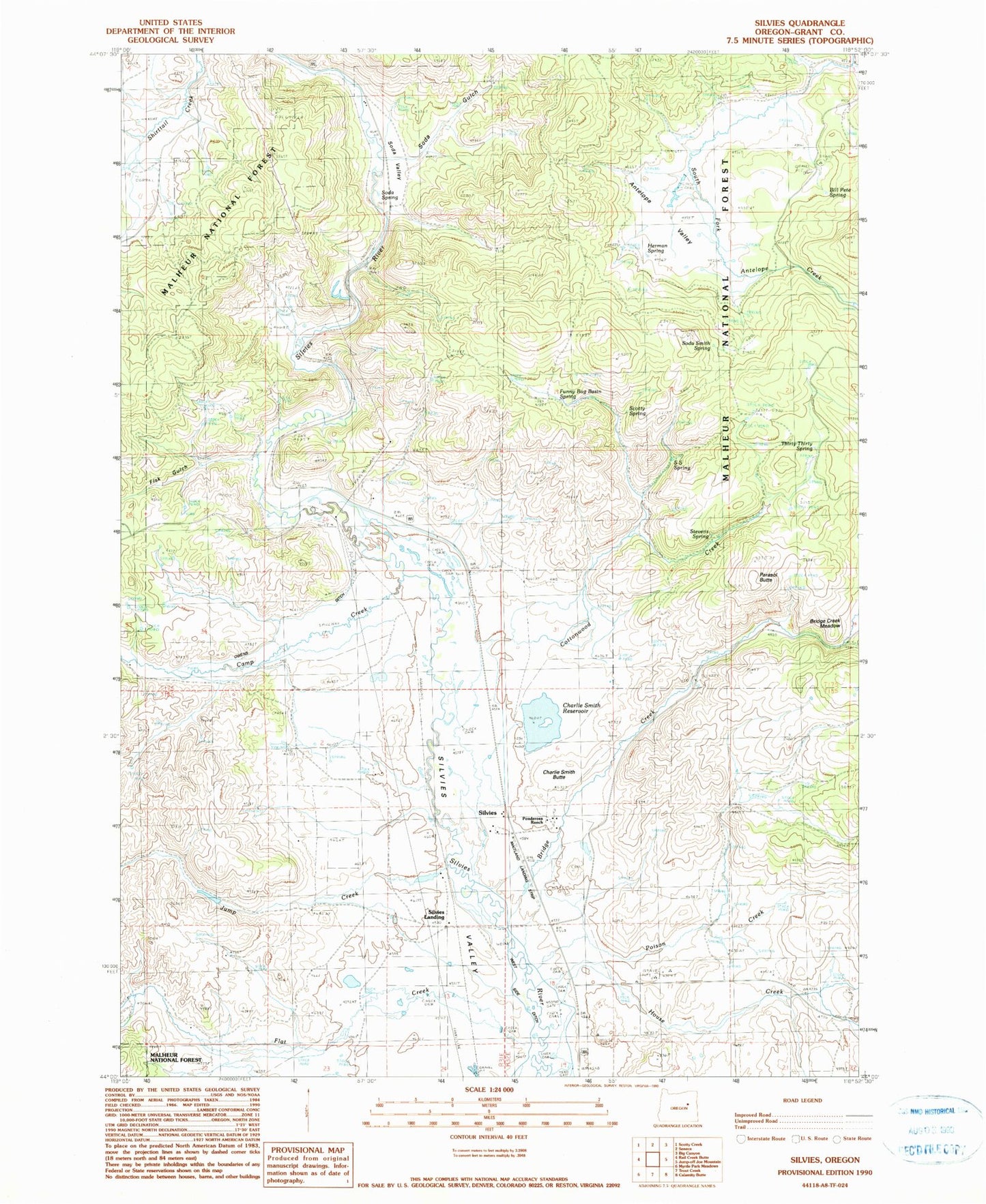
Classic USGS Silvies Oregon 7.5'x7.5' Topo Map
Couldn't load pickup availability
Historical USGS topographic quad map of Silvies in the state of Oregon. Map scale may vary for some years, but is generally around 1:24,000. Print size is approximately 24" x 27"
This quadrangle is in the following counties: Grant.
The map contains contour lines, roads, rivers, towns, and lakes. Printed on high-quality waterproof paper with UV fade-resistant inks, and shipped rolled.
Contains the following named places: Antelope Valley, Bennett Dam, Bill Pete Spring, Bridge Creek, Camp Creek, Charlie Smith Butte, Cottonwood Creek, Fisk Gulch, Flat Creek, Funny Bug Basin Spring, Hankins Cemetery, Hankins Ranch, Herman Spring, House Creek, Jack Andy Creek, Jump Creek, Lake Pons Dam, Owens Ditch, Parasol Butte, Poison Creek, Pronghorn Reservoir, Rann Post Office, S S Spring, Scotty Spring, Silvies, Silvies Cemetery, Silvies Landing, Silvies Post Office, Silvies Valley Ranch, Silvies Valley Ranch Airport, Soda Gulch, Soda Smith Spring, Soda Spring, Soda Valley, Stevens Spring, Thirty-Thirty Spring