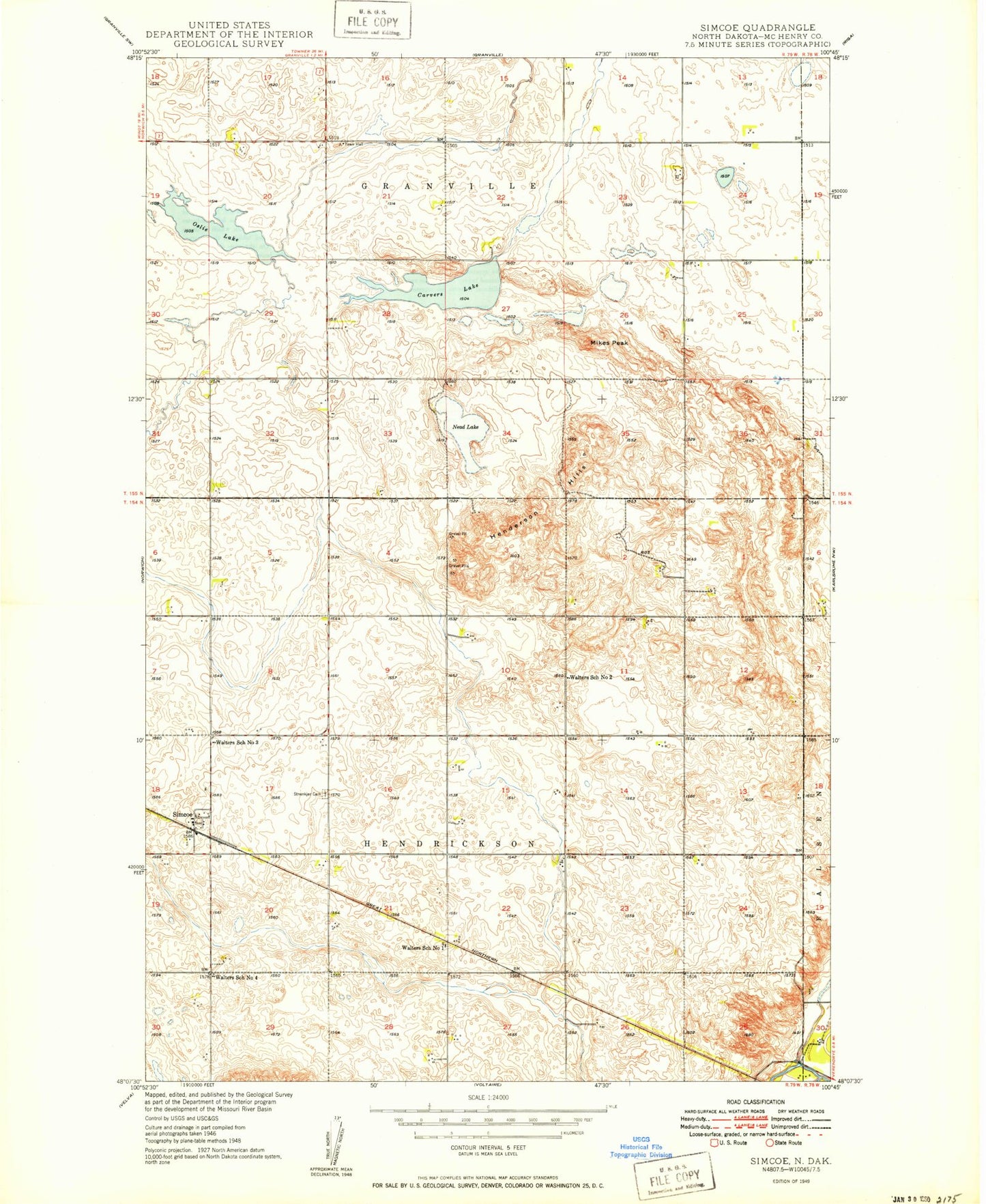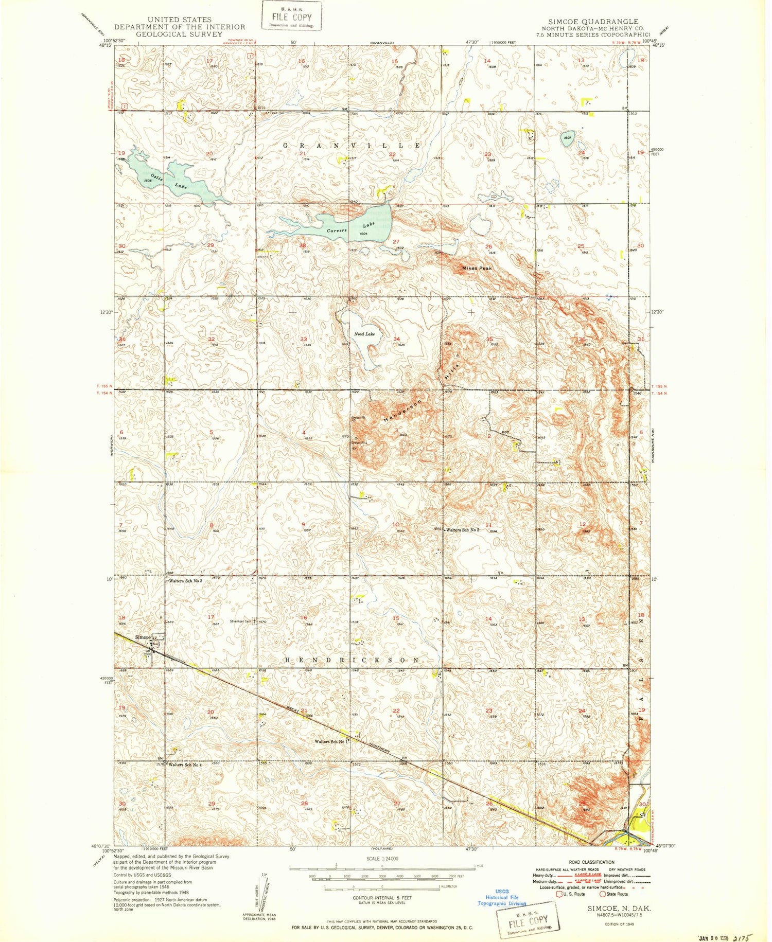
MyTopo
Classic USGS Simcoe North Dakota 7.5'x7.5' Topo Map
Couldn't load pickup availability
Historical USGS topographic quad map of Simcoe in the state of North Dakota. Map scale may vary for some years, but is generally around 1:24,000. Print size is approximately 24" x 27"
This quadrangle is in the following counties: McHenry.
The map contains contour lines, roads, rivers, towns, and lakes. Printed on high-quality waterproof paper with UV fade-resistant inks, and shipped rolled.
Contains the following named places: Carvers Lake, Henderson Hills, McHenry County Waterfowl Production Area, Mikes Peak, Nead Lake, Oslie Lake, Simcoe, Stenkjaer Lutheran Cemetery, Township of Granville, Township of Hendrickson, Walters School Number 1, Walters School Number 2, Walters School Number 3, Walters School Number 4