MyTopo
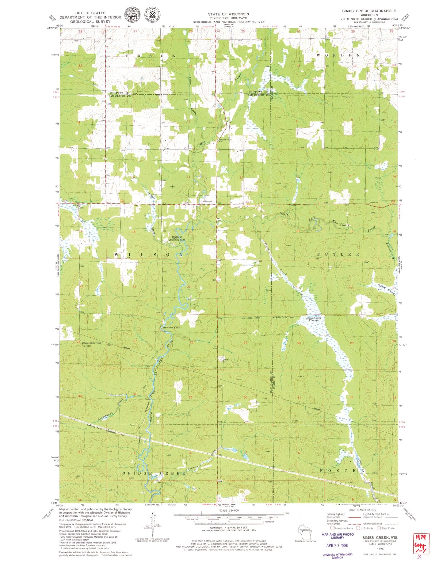
Classic USGS Simes Creek Wisconsin 7.5'x7.5' Topo Map
Couldn't load pickup availability
Historical USGS topographic quad map of Simes Creek in the state of Wisconsin. Map scale may vary for some years, but is generally around 1:24,000. Print size is approximately 24" x 27"
This quadrangle is in the following counties: Chippewa, Clark, Eau Claire.
The map contains contour lines, roads, rivers, towns, and lakes. Printed on high-quality waterproof paper with UV fade-resistant inks, and shipped rolled.
Contains the following named places: Beeman Creek, Hamilton Falls, Hamilton Falls Snowmobile Trail, Loper Creek, Pleasant Valley Church, Pleasant Valley School, Robinson Creek, Shambaugh Creek, Simes Creek, Simes Creek Flowage, South Worden School, Swim Creek, Township Memorial Park, Wilson Lookout Tower, Wolf River