MyTopo
Classic USGS Sims Mountain California 7.5'x7.5' Topo Map
Couldn't load pickup availability
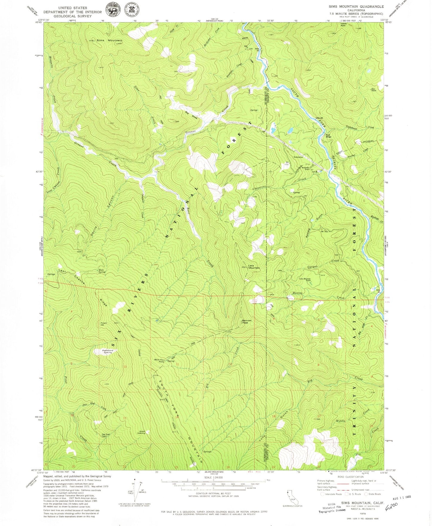
Historical USGS topographic quad map of Sims Mountain in the state of California. Map scale may vary for some years, but is generally around 1:24,000. Print size is approximately 24" x 27"
This quadrangle is in the following counties: Humboldt, Trinity.
The map contains contour lines, roads, rivers, towns, and lakes. Printed on high-quality waterproof paper with UV fade-resistant inks, and shipped rolled.
Contains the following named places: Bear Creek, Bennett Peak, Big Creek, Big Slide, Big Slide Creek, Black Fox Rock, Breckeen Creek, Buckeye Creek, Canyon Creek, Castle Rock, Dan East Cabin, Dan East Creek, Dan East Trail, Devils Canyon, Grapevine Creek, Grouse Creek, Hog Ranch, Lake Mountain, Lake Mountain Ranch, Last Chance Creek, Last Chance Ridge, Last Chance Trail, Lucy Gulch, Manzanita Ranch, Monroe Creek, Mosquito Creek, Mule Bridge, Mule Spring, Panther Creek, Potato Hill, Saddle Gulch, Sims Creek, Sims Mountain, Slide Creek Campground, Smith Opening, Trappers Creek, Twin Lakes Creek, Underwood Creek, Waterbarrel Opening, Wise Station