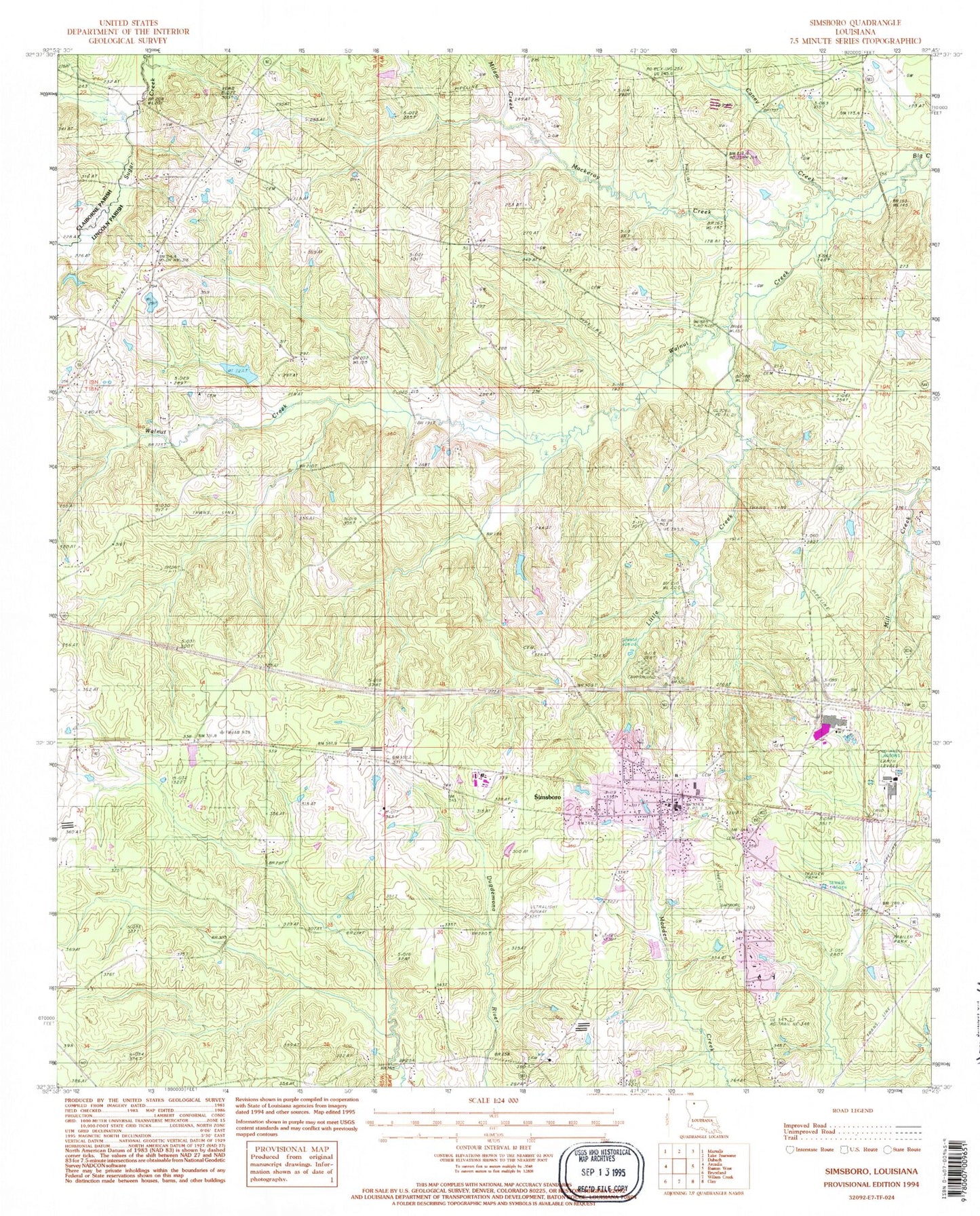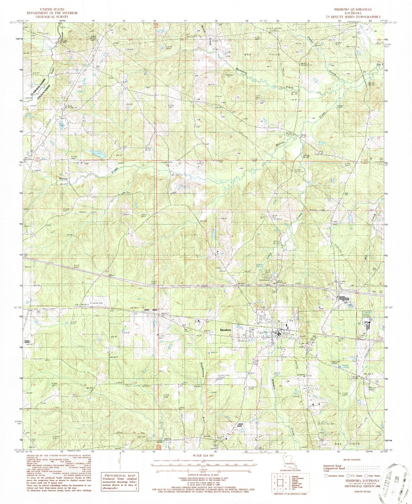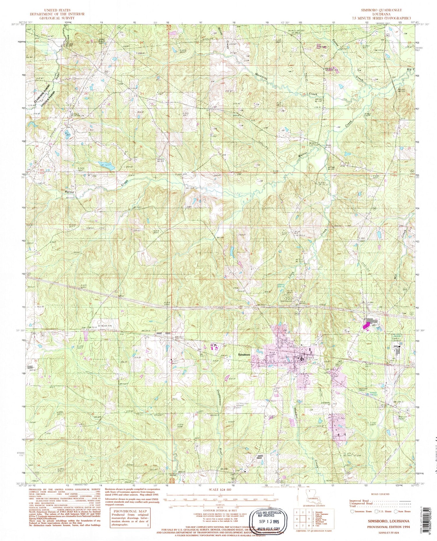

MyTopo
Classic USGS Simsboro Louisiana 7.5'x7.5' Topo Map
Couldn't load pickup availability
Historical USGS topographic quad map of Simsboro in the state of Louisiana. Map scale may vary for some years, but is generally around 1:24,000. Print size is approximately 24" x 27"
This quadrangle is in the following counties: Claiborne, Lincoln.
The map contains contour lines, roads, rivers, towns, and lakes. Printed on high-quality waterproof paper with UV fade-resistant inks, and shipped rolled.
Contains the following named places: Antioch Cemetery, Calcote - Powell Cemetery, Caney Creek, Centre Point Church, Dye Creek, Fellowship Baptist Church, Little Creek, Mackeroy Creek, Midway Church, Milam Creek, Parish Governing Authority District 3, Simsboro, Simsboro Baptist Church, Simsboro Post Office, Simsboro School, Simsboro United Methodist Church, Sunshine School, Sutton Creek, Terryville School, Village of Simsboro, Walnut Creek, Walnut Creek Church, Ward Three, West Simsboro Gas Field, Williams School, ZIP Code: 71275