MyTopo
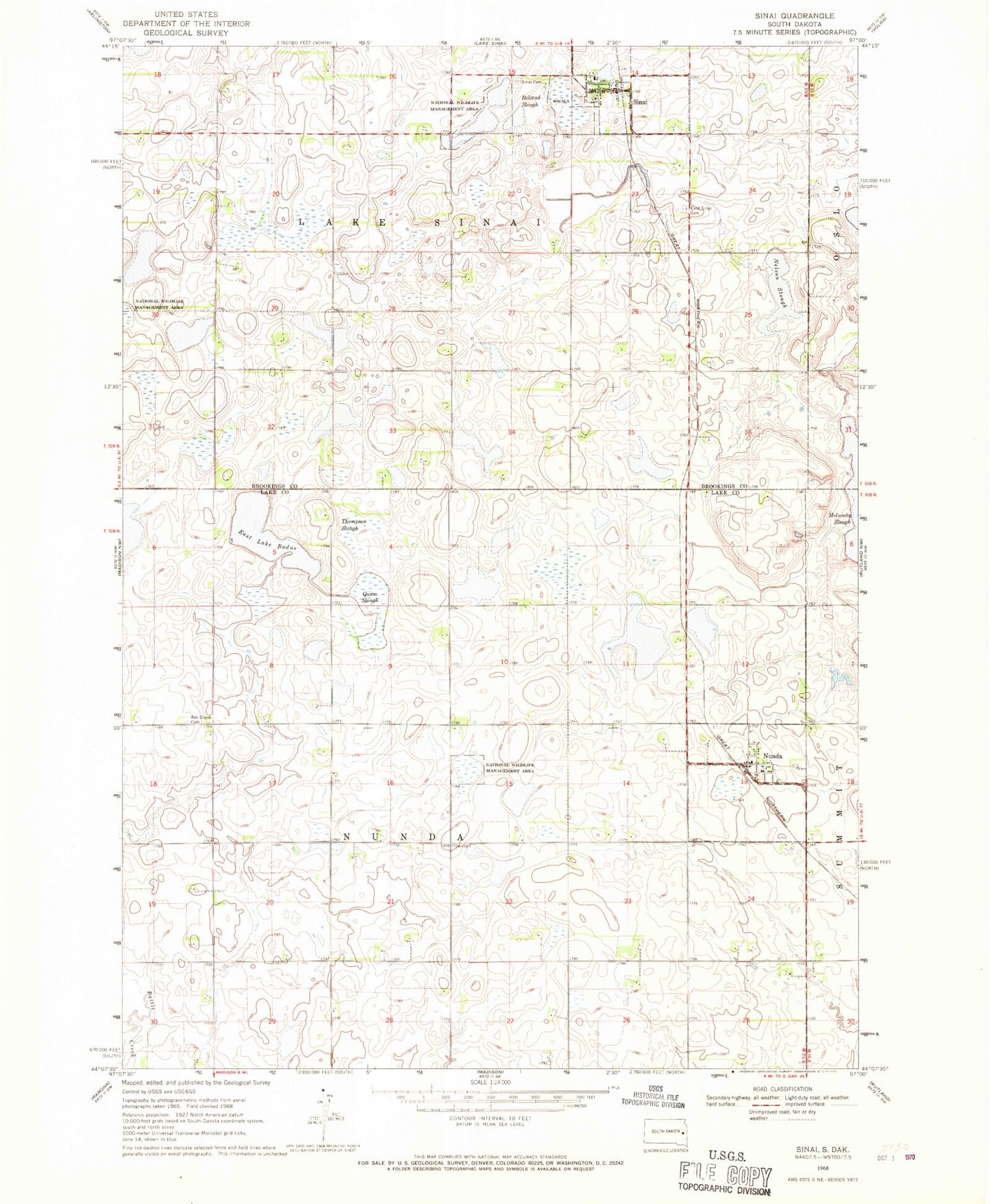
Classic USGS Sinai South Dakota 7.5'x7.5' Topo Map
Couldn't load pickup availability
Historical USGS topographic quad map of Sinai in the state of South Dakota. Map scale may vary for some years, but is generally around 1:24,000. Print size is approximately 24" x 27"
This quadrangle is in the following counties: Brookings, Lake.
The map contains contour lines, roads, rivers, towns, and lakes. Printed on high-quality waterproof paper with UV fade-resistant inks, and shipped rolled.
Contains the following named places: Ash Grove Cemetery, Ash Grove Church, Bolstad Slough, East Lake Badus, East Sinai Cemetery, Nelson Slough, Nunda, Nunda Fire Department, Nunda Post Office, Nunda Township Hall, Prairie Queen, Quam Slough, Sinai, Sinai Cemetery, Sinai Fire Department, Sinai Post Office, Thompson Slough, Town of Nunda, Town of Sinai, Township of Hyland, Township of Lake Sinai, Township of Nunda, ZIP Codes: 57050, 57061