MyTopo
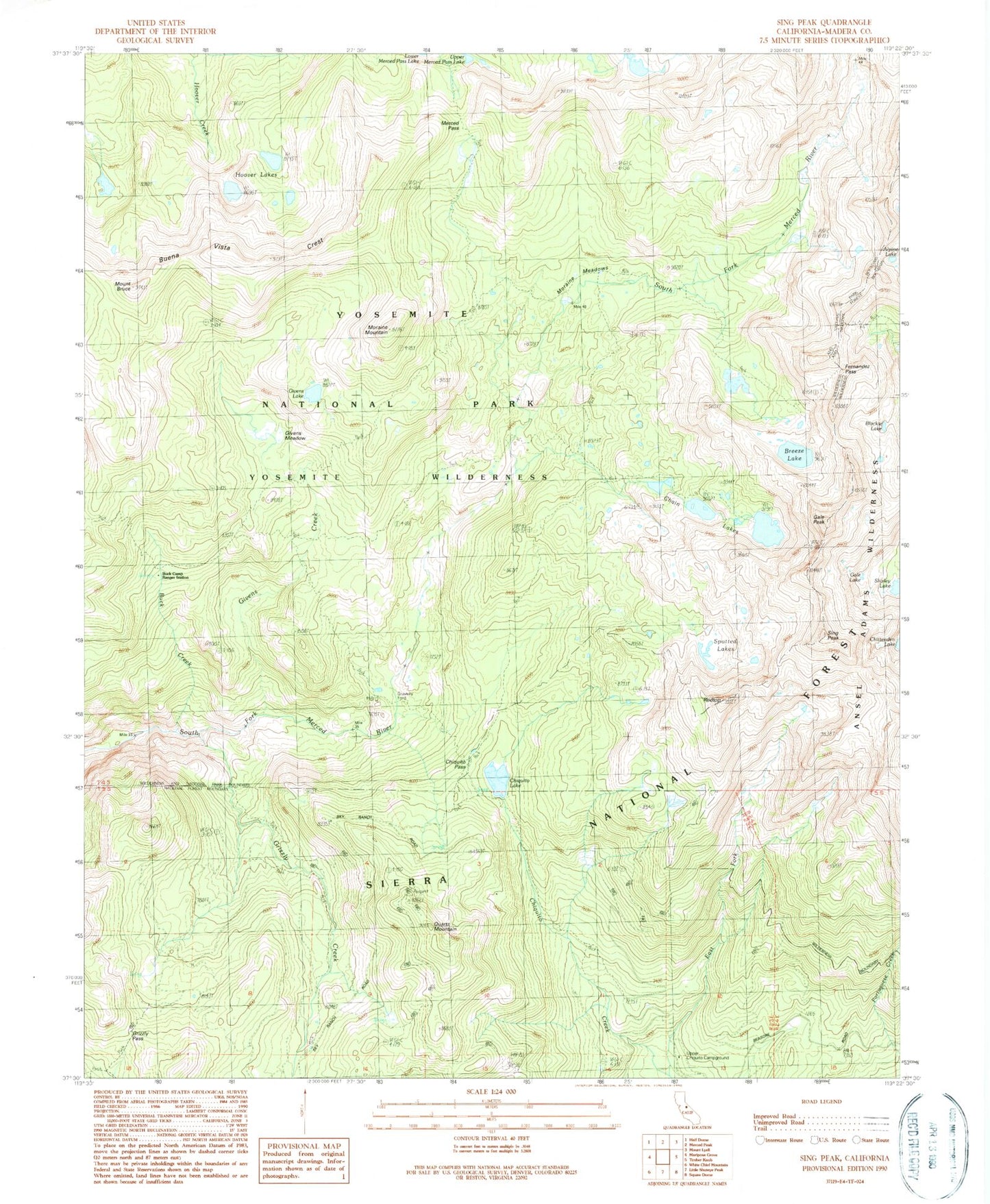
Classic USGS Sing Peak California 7.5'x7.5' Topo Map
Couldn't load pickup availability
Historical USGS topographic quad map of Sing Peak in the state of California. Typical map scale is 1:24,000, but may vary for certain years, if available. Print size: 24" x 27"
This quadrangle is in the following counties: Madera.
The map contains contour lines, roads, rivers, towns, and lakes. Printed on high-quality waterproof paper with UV fade-resistant inks, and shipped rolled.
Contains the following named places: Blackie Lake, Gale Peak, Givens Meadow, Gravelly Ford, Merced Pass, Quartz Mountain, Fernandez Pass, Swamp Lake, Upper Merced Pass Lake, Givens Lake, Grizzly Pass, Mount Bruce, Buck Camp Ranger Station, Alpine Lake, Chiquito Lake, Chittenden Lake, Cold Springs Meadow, East Fork Chiquito Creek, Gale Lake, Givens Creek, Grizzly Creek, Hoover Lakes, Shirley Lake, Upper Chiquito Campground, Sing Peak, Spotted Lakes, Breeze Lake, Buck Creek, Buena Vista Crest, Chain Lakes, Chiquito Pass, Moraine Meadows, Moraine Mountain, Redtop, Mud Lakes, Klette Meadow, Brophy Meadow, Walker Mine, Blackie Lake, Gale Peak, Givens Meadow, Gravelly Ford, Merced Pass, Quartz Mountain, Fernandez Pass, Swamp Lake, Upper Merced Pass Lake, Givens Lake, Grizzly Pass, Mount Bruce, Buck Camp Ranger Station, Alpine Lake, Chiquito Lake, Chittenden Lake, Cold Springs Meadow, East Fork Chiquito Creek, Gale Lake, Givens Creek, Grizzly Creek, Hoover Lakes, Shirley Lake, Upper Chiquito Campground, Sing Peak, Spotted Lakes, Breeze Lake, Buck Creek, Buena Vista Crest, Chain Lakes, Chiquito Pass, Moraine Meadows, Moraine Mountain, Redtop, Mud Lakes, Klette Meadow, Brophy Meadow, Walker Mine