MyTopo
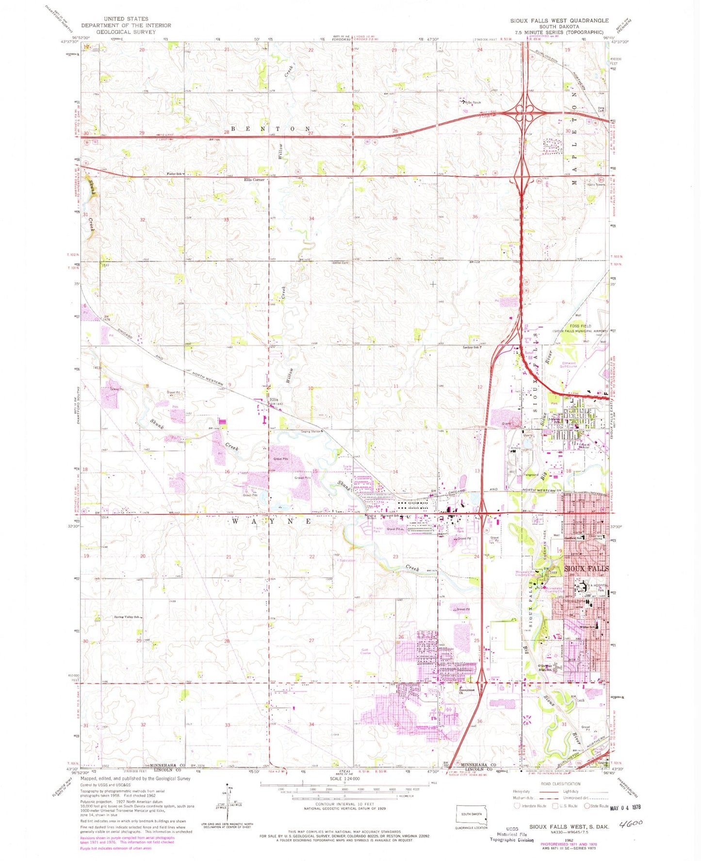
Classic USGS Sioux Falls West South Dakota 7.5'x7.5' Topo Map
Couldn't load pickup availability
Historical USGS topographic quad map of Sioux Falls West in the state of South Dakota. Map scale may vary for some years, but is generally around 1:24,000. Print size is approximately 24" x 27"
This quadrangle is in the following counties: Lincoln, Minnehaha.
The map contains contour lines, roads, rivers, towns, and lakes. Printed on high-quality waterproof paper with UV fade-resistant inks, and shipped rolled.
Contains the following named places: Addams School, All City Elementary School, Andera Hall, Berg Cemetery, Bethel Cemetery, Bethel Lutheran School, Caille Branch Library, Challenge Center School, Christian Center Elementary School, Discovery Elementary School, Ed Wood Trade and Industry Center, El Rancho Acres, Ellis, Ellis Corner, Elmwood Golf Course, Forest Home Cemetery, Foster School, Garfield Elementary School, George S Mickelson Center, Glawe's Airport, Great Plains Zoo, Hayward Addition, Hayward Elementary School, Howard Wood Field, John F Kennedy Elementary School, KKRC-FM (Sioux Falls), KRSS-AM (Sioux Falls), KYKC-AM (Sioux Falls), Lackey School, Laura Wilder Elementary School, LifeScape Hospital and School, Martindale Addition, McCrossan Boys Ranch Elementary School, McCrossan Boys Ranch High School, McCrossan Boys Ranch Middle School, McEneaney Field, Meadows Postal Store Post Office, Memorial Middle School, Minnehaha Country Club, New Technology High, New Technology High School, Nicolay Hall, O'Gorman High School, O'Gorman Junior High School, Oscar Howe Elementary School, R F Pettigrew Elementary School, Reppert Addition, Roosevelt High School, Rural / Metro Ambulance, Saint Katharine Drexel Elementary School, Saint Michael Elementary School, Sherman Park, Sherman Park Mounds, Silver Valley Addition, Sioux Falls Convention Center, Sioux Falls Fire Rescue Station 10, Sioux Falls Fire Rescue Station 6, Sioux Falls Fire Rescue Station 8, Sioux Falls Veterans Affairs Medical Center, Skunk Creek, Skyline Heights, South Dakota Highway Patrol - District 2 Headquarters, Southeast Technical Institute, Southeast Technology Center, Spring Valley School, Sullivan Health/Science Center, Sunnycrest Church, Swanson's Tracts, Township of Wayne, W H Lyon Fairgrounds and Exposition Center, Webster Grove Addition, West Acres Development, Westward Ho Country Club, Willow Creek, ZIP Codes: 57106, 57107, 57117