MyTopo
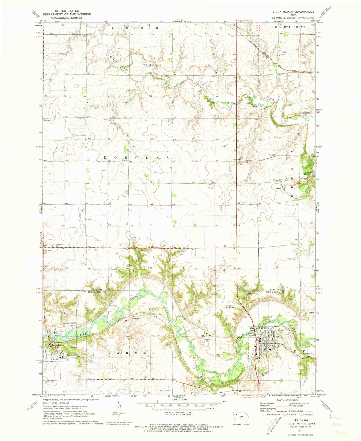
Classic USGS Sioux Rapids Iowa 7.5'x7.5' Topo Map
Couldn't load pickup availability
Historical USGS topographic quad map of Sioux Rapids in the state of Iowa. Map scale may vary for some years, but is generally around 1:24,000. Print size is approximately 24" x 27"
This quadrangle is in the following counties: Buena Vista, Clay.
The map contains contour lines, roads, rivers, towns, and lakes. Printed on high-quality waterproof paper with UV fade-resistant inks, and shipped rolled.
Contains the following named places: Barnes Township Cemetery, Bluebird Access, Bluebird Creek, Buena Vista County Ambulance Sioux Rapids, City of Linn Grove, City of Sioux Rapids, Cornell, Cornell Post Office, Douglas Centre Post Office, Douglas Townhall, Faith Lutheran Church, Fanny Fern Cemetery, First Co-op Elevator, First Lutheran Church, First United Church, Fox and Boyd Dental Center, Gabrielson Park, Gilbert James Wildlife Area, Gustafson Lake, KTFG-FM (Sioux Rapids), Liberty Cemetery, Linn Grove, Linn Grove Dam Park, Linn Grove Post Office, Linn Grove Public Library, Linngrove, Little Sioux Country Club, Lone Tree Cemetery, Presbyterian Church, Saint Joseph Cemetery, Saint Joseph's Catholic Church, Sioux Care Center, Sioux Rapids, Sioux Rapids Area Historical Association Museum, Sioux Rapids Baptist Church, Sioux Rapids City Hall, Sioux Rapids City Park, Sioux Rapids Fire Department, Sioux Rapids Memorial Library, Sioux Rapids Post Office, Soldier Creek, Township of Douglas, Trinity Lutheran Church, Welsh Pioneer Cemetery, Zion Methodist Cemetery, ZIP Code: 50585