MyTopo
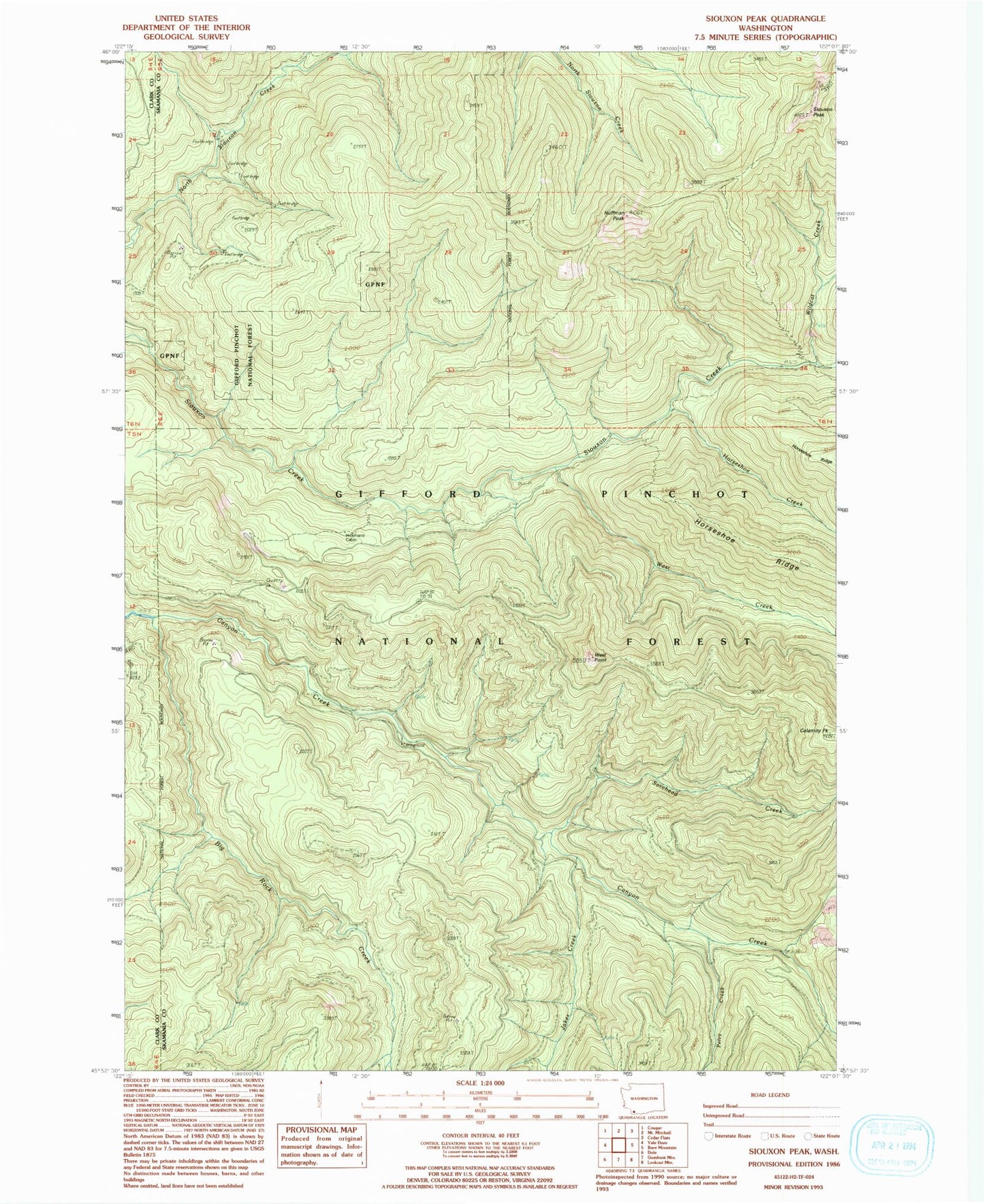
Classic USGS Siouxon Peak Washington 7.5'x7.5' Topo Map
Couldn't load pickup availability
Historical USGS topographic quad map of Siouxon Peak in the state of Washington. Typical map scale is 1:24,000, but may vary for certain years, if available. Print size: 24" x 27"
This quadrangle is in the following counties: Clark, Skamania.
The map contains contour lines, roads, rivers, towns, and lakes. Printed on high-quality waterproof paper with UV fade-resistant inks, and shipped rolled.
Contains the following named places: Big Rock Creek, Calamity Peak, Canyon Creek Trail, Hackamore Creek, Horseshoe Creek, Horseshoe Ridge Trail, Huffman Peak, Jakes Creek, Pelvy Creek, Siouxon Peak, Siouxon Trail, Sorehead Creek, West Creek, West Point, Wildcat Creek, Canyon Creek Campground, Huffman Peak Lookout, Siouxon Peak Lookout, West Point Lookout, Hickmans Cabin