MyTopo
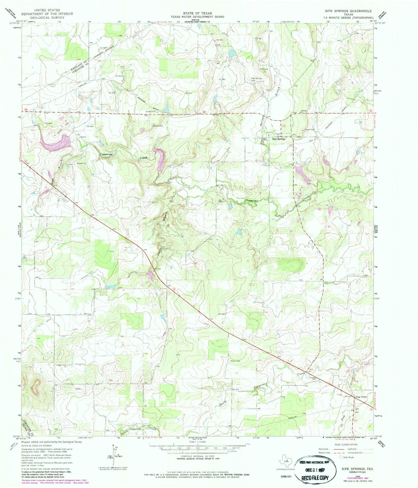
Classic USGS Sipe Springs Texas 7.5'x7.5' Topo Map
Couldn't load pickup availability
Historical USGS topographic quad map of Sipe Springs in the state of Texas. Map scale may vary for some years, but is generally around 1:24,000. Print size is approximately 24" x 27"
This quadrangle is in the following counties: Brown, Comanche, Eastland.
The map contains contour lines, roads, rivers, towns, and lakes. Printed on high-quality waterproof paper with UV fade-resistant inks, and shipped rolled.
Contains the following named places: Highway Lake, Highway Lake Dam, Keys Branch, Nanny Branch, North Gibson Dam, North Gibson Lake, Parker Cemetery, Railroad Lake, Railroad Lake Dam, Shults Lake, Shults Lake Dam, Sipe Springs, Sipe Springs Cemetery, Sipe Springs Creek, Sipe Springs Volunteer Fire Department, Soil Conservation Service Site 1 Dam, Soil Conservation Service Site 1 Reservoir, Soil Conservation Service Site 2 Dam, Soil Conservation Service Site 2 Reservoir, South Gibson Dam, South Gibson Lake, Stag Creek, Walnut Creek