MyTopo
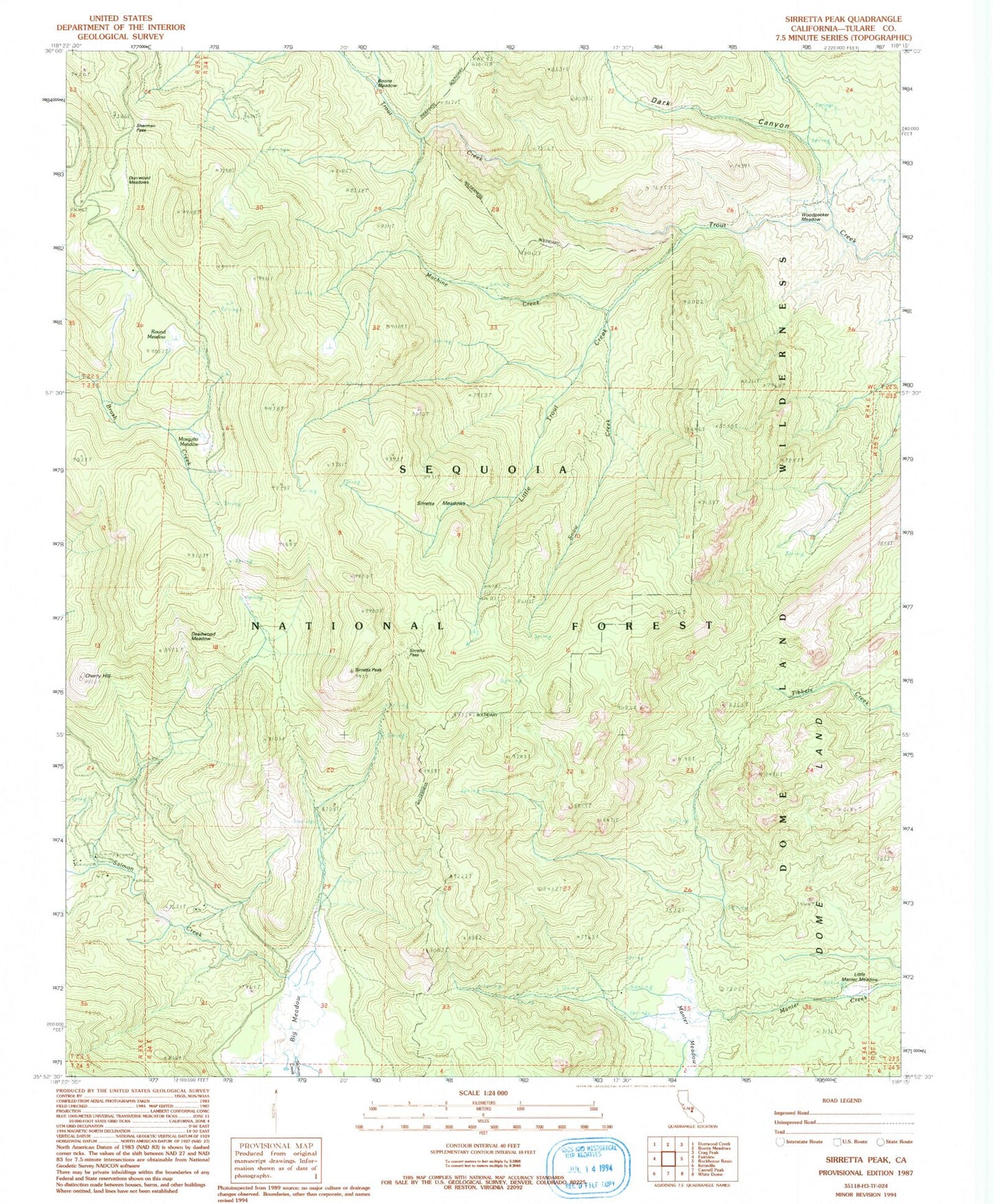
Classic USGS Sirretta Peak California 7.5'x7.5' Topo Map
Couldn't load pickup availability
Historical USGS topographic quad map of Sirretta Peak in the state of California. Typical map scale is 1:24,000, but may vary for certain years, if available. Print size: 24" x 27"
This quadrangle is in the following counties: Tulare.
The map contains contour lines, roads, rivers, towns, and lakes. Printed on high-quality waterproof paper with UV fade-resistant inks, and shipped rolled.
Contains the following named places: Big Meadow, Boone Meadow, Cherry Hill, Dark Canyon, Deadwood Meadow, Dome Land, Durrwood Meadows, Little Trout Creek, Machine Creek, Manter Meadow, Sirretta Meadows, Sirretta Peak, Snow Creek, Woodpecker Meadow, Mosquito Meadow, Horse Meadow Campground, Round Meadow, Little Manter Meadow, Sherman Pass, Sirretta Pass