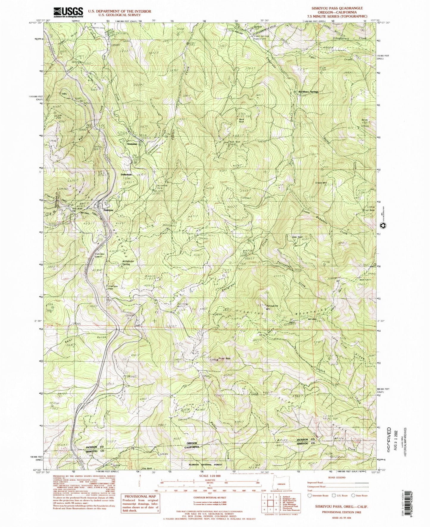
MyTopo
Classic USGS Siskiyou Pass Oregon 7.5'x7.5' Topo Map
Couldn't load pickup availability
Historical USGS topographic quad map of Siskiyou Pass in the state of Oregon. Map scale may vary for some years, but is generally around 1:24,000. Print size is approximately 24" x 27"
This quadrangle is in the following counties: Jackson, Siskiyou.
The map contains contour lines, roads, rivers, towns, and lakes. Printed on high-quality waterproof paper with UV fade-resistant inks, and shipped rolled.
Contains the following named places: Baldy, Baldy Creek, Barrats Reservoir, Bean Cabin, Bear Gulch, Buck Rock, Buck Rock Tunnel, Buckhorn Springs, Callahans Mountain Lodge Wastewater Treatment Facility, Cougar Gulch, Dollarhide, Dollarhide Curve, Dollarhide Spring, Foliage, Green Mountain, Green Mountain Creek, Green Springs Powerplant, Joes Rock, Little Pilot Rock, McAllister Spring, North Fork Barron Creek, Pilot Rock, Porcupine Creek, Porcupine Mountain, Porcupine Reservoir, Powder Springs, Resort Post Office, Schoolhouse Creek, Shady Spring, Siskiyou, Siskiyou Pass, Siskiyou Post Office, Slide Creek, Slide Ridge, Soda Spring, Soda Springs Post Office, South Fork Barron Creek, Spring Creek, Steinman, Steinman Creek, Steinman Post Office, Timothy Flats, Toll Road Gap, Tyler Creek, Viaduct, Viaduct Creek, Wall Creek, West Branch Carter Creek