MyTopo
Classic USGS Sister Lakes Michigan 7.5'x7.5' Topo Map
Couldn't load pickup availability
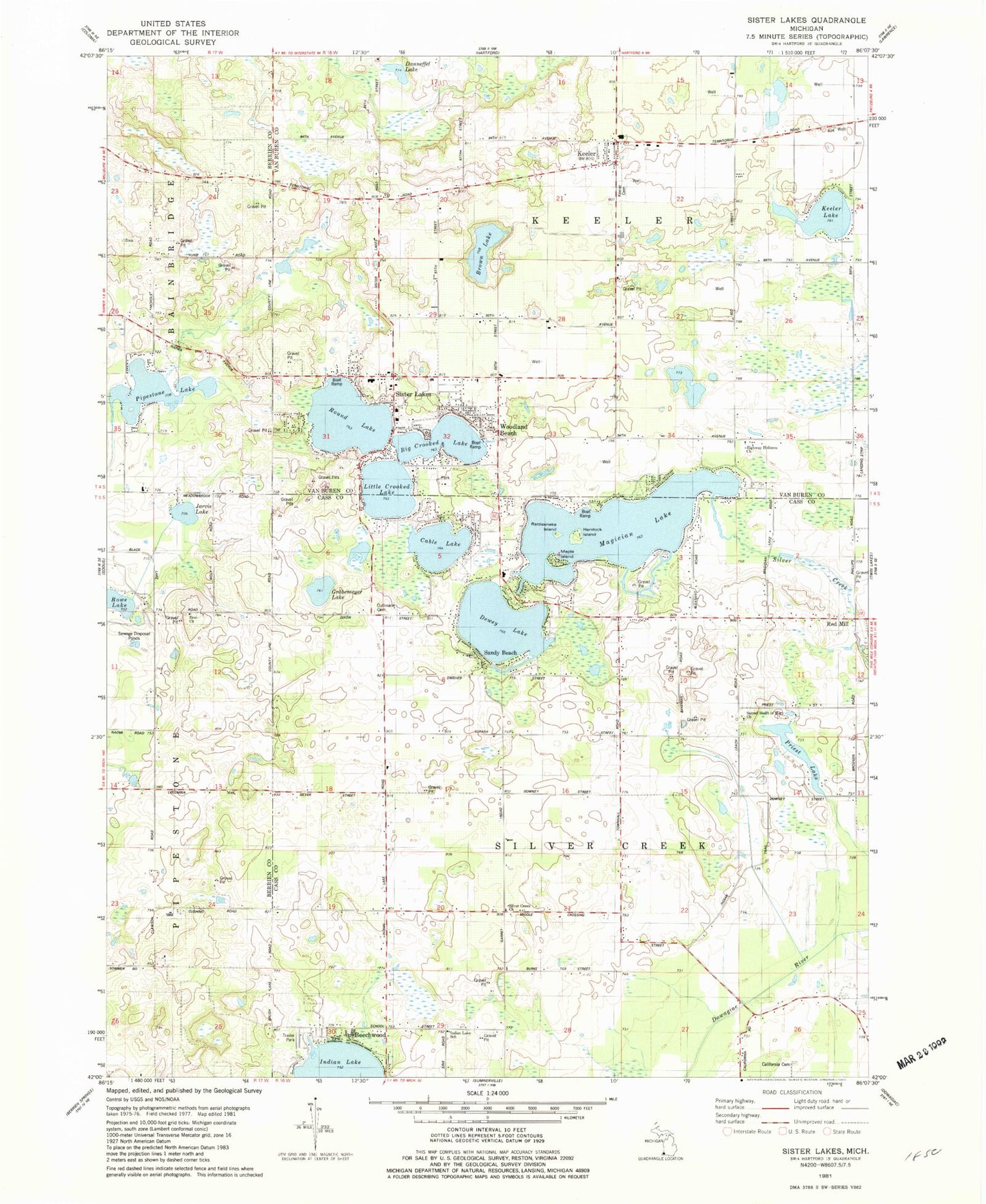
Historical USGS topographic quad map of Sister Lakes in the state of Michigan. Map scale may vary for some years, but is generally around 1:24,000. Print size is approximately 24" x 27"
This quadrangle is in the following counties: Berrien, Cass, Van Buren.
The map contains contour lines, roads, rivers, towns, and lakes. Printed on high-quality waterproof paper with UV fade-resistant inks, and shipped rolled.
Contains the following named places: Baker School, Beechwood, Brown Lake, Byers School, Cable Lake, California Cemetery, Crooked Lake, Cullinane Cemetery, Cushing Corners School, Daly School, Danneffel Lake, Dewey Lake, Dowagiac Swamp, Ely Graves, First Methodist Episcopal Church Historical Marker, First School, Gilbert Cemetery, Grabemeyer Lake, Gregory School, Hemlock Island, Highway Holiness Church, Hill School, Hinchman School, Indian Lake, Indian Lake Cemetery, Indian Lake School, Jarvis Lake, Keeler, Keeler Cemetery, Keeler Lake, Keeler Post Office, Keeler Township Fire Department, Land of Lakes Campground, Magician Lake, Maple Island, Moores Corners, Pipestone Lake, Pleasant Valley Post Office, Priest Lake, Rattlesnake Island, Red Mill, Redeemer Lutheran Church, Round Lake, Rowe Lake, Sacred Heart of Mary Catholic Church Historical Marker, Sacred Heart of Mary Cemetery, Sacred Heart of Mary Church, Sandy Beach, Shady Shores Resort and Campground, Silver Creek, Silver Creek Church, Silver Creek Township Police Department, Sister Lakes, Sister Lakes Academy, Sister Lakes Community Church, Sister Lakes Elementary School, Sister Lakes Fire Department, Sister Lakes Post Office, Sykes School, Township of Keeler, Township of Silver Creek, White Pines Mobile Home Park, Woodland Beach, Zion Church, Zion Evangelical Cemetery


