MyTopo
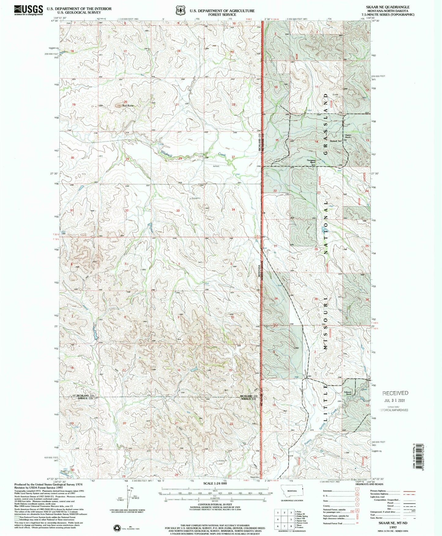
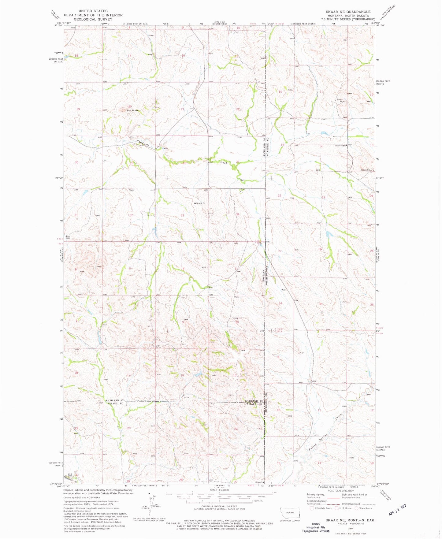
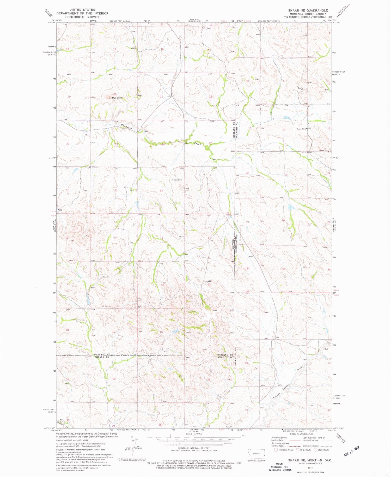
Classic USGS Skaar NE Montana 7.5'x7.5' Topo Map
Regular price
$16.95
Regular price
Sale price
$16.95
Unit price
per
Couldn't load pickup availability
Historical USGS topographic quad map of Skaar NE in the states of Montana, North Dakota. Map scale may vary for some years, but is generally around 1:24,000. Print size is approximately 24" x 27"
This quadrangle is in the following counties: McKenzie, Richland, Wibaux.
The map contains contour lines, roads, rivers, towns, and lakes. Printed on high-quality waterproof paper with UV fade-resistant inks, and shipped rolled.
Contains the following named places: 19N60E17CD__01 Well, 19N60E27AC__01 Well, 19N60E28BA__01 Well, 20N60E17AD__01 Well, Bull Butte, Clark Post Office, Folkvord Ranch, Grace Lutheran Church, Kupper Ranch, Shadwell School, Thompson Headquarter Water Well, Thompson Ranch