
MyTopo
Classic USGS Skagway A-2 NE Alaska 7.5'x7.5' Topo Map
Couldn't load pickup availability
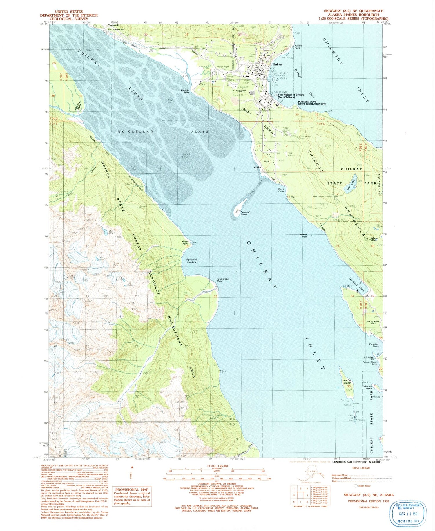
Historical USGS topographic quad map of Skagway A-2 NE in the state of Alaska. Typical map scale is 1:24,000, but may vary for certain years, if available. Print size: 24" x 27"
This quadrangle is in the following counties: Haines.
The map contains contour lines, roads, rivers, towns, and lakes. Printed on high-quality waterproof paper with UV fade-resistant inks, and shipped rolled.
Contains the following named places: Chilkat State Park, Yindastuki, KHNS-FM (Haines), Haines Seaplane Base, Anchorage Point, Chilkat Inlet, Chilkat River, Deshu Isthmus, Green Point, Haines, Haska Creek, Jenkins Rock, Kaskulu Point, Kochu Island, Lehunua Island, Letnikof Cove, Lily Lake, Ludaseska Creek, McClellan Flats, Nukdik Point, Port Chilkoot, Portage Cove, Portage Cove Campground, Pyramid Harbor, Pyramid Island, Haines Airport, Mud Bay, Lehunua Point, Bare Point, Letnikof Cove, Shiyi Bay, Mount Riley Trail, Battery Point Trail, Paradise Cove, Haines Census Designated Place, Chilkoot Alaska Native Village Statistical Area, Haines Volunteer Fire Department, Southeast Alaska Regional Health Consortium Haines Health Center, Haines Public Health Center - Southeast Region, Haines Borough Police Department, Alaska State Troopers Haines, Haines Post Office, Haines Cemetery


