MyTopo
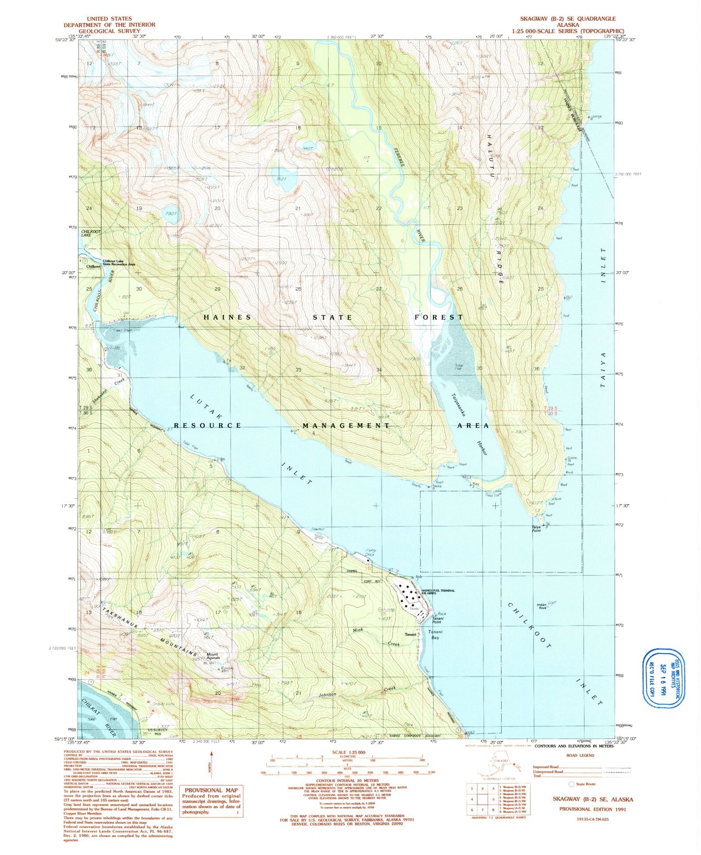
Classic USGS Skagway B-2 SE Alaska 7.5'x7.5' Topo Map
Couldn't load pickup availability
Historical USGS topographic quad map of Skagway B-2 SE in the state of Alaska. Map scale may vary for some years, but is generally around 1:24,000. Print size is approximately 24" x 27"
This quadrangle is in the following counties: Haines, Skagway.
The map contains contour lines, roads, rivers, towns, and lakes. Printed on high-quality waterproof paper with UV fade-resistant inks, and shipped rolled.
Contains the following named places: Chilkoot, Ferebee River, Ferebee Valley, Haines Army Depot Water Supply Dam, Haines Fuel Terminal, Halutu Peninsula, Halutu Ridge, Indian Rock, Johnson Creek, Lutak Inlet, Mink Creek, Mount Ripinski, Shakuseyi Creek, Taiya Point, Taiyasanka Harbor, Tanani, Tanani Bay, Tanani Beach, Tanani Point, Tanani Village, Tlegu Beach, Yindastuki Indian Reservation