
MyTopo
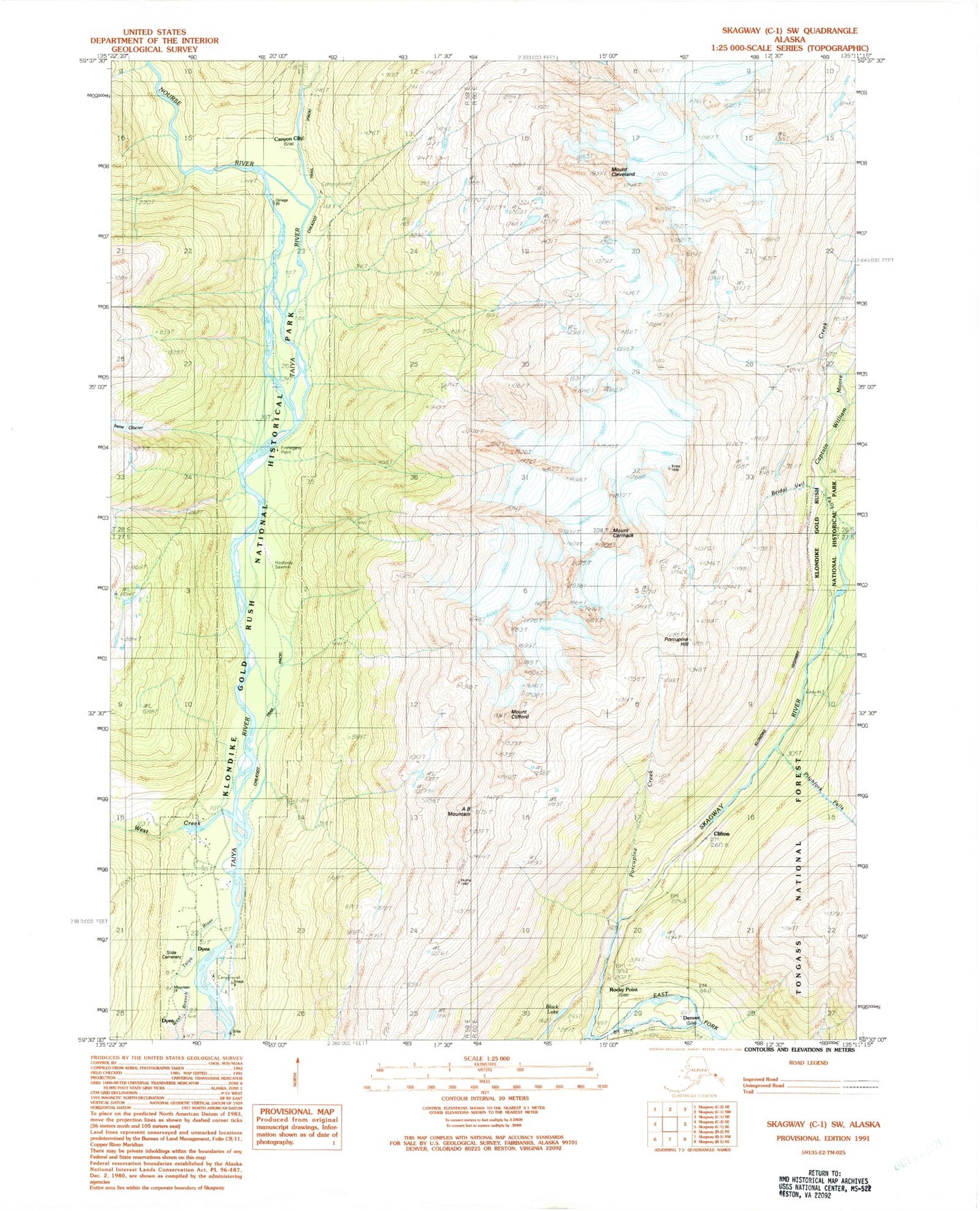
Classic USGS Skagway C-1 SW Alaska 7.5'x7.5' Topo Map
Couldn't load pickup availability
Historical USGS topographic quad map of Skagway C-1 SW in the state of Alaska. Typical map scale is 1:24,000, but may vary for certain years, if available. Print size: 24" x 27"
This quadrangle is in the following counties: Skagway.
The map contains contour lines, roads, rivers, towns, and lakes. Printed on high-quality waterproof paper with UV fade-resistant inks, and shipped rolled.
Contains the following named places: West Creek, Bridal Veil Falls, Captain William Moore Creek, A B Mountain, Mount Carmack, Mount Cleveland, Mount Clifford, Clifton, Dyea, East Fork Skagway River, Eight Mile Canyon Prospect, Finnegans Point, Hasfords Sawmill, Nourse River, Pitchfork Falls, Porcupine Hill, Hosfords Sawmill, Finnegans Point, Skagway Census Subarea, Porcupine Creek, Skyline Trail, Black Lake, Skagway Municipality, Canyon City (historical), Skagway Alaska Native Village Statistical Area, Denver (historical), Rocky Point (historical), United States Customs and Border Protection Port of Entry Skagway


