MyTopo
Classic USGS Skamokawa Pass Washington 7.5'x7.5' Topo Map
Regular price
$16.95
Regular price
Sale price
$16.95
Unit price
per
Couldn't load pickup availability
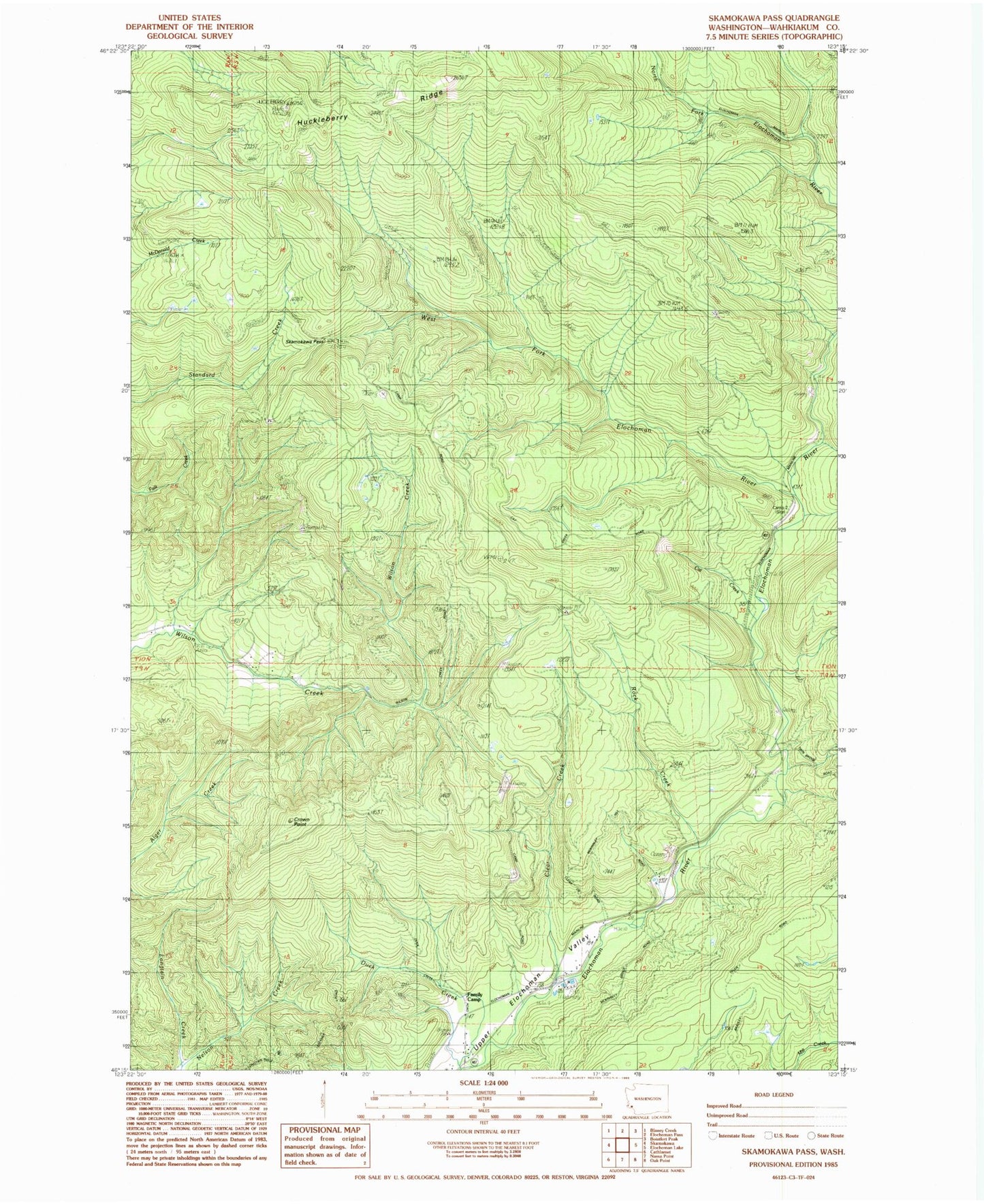
Historical USGS topographic quad map of Skamokawa Pass in the state of Washington. Typical map scale is 1:24,000, but may vary for certain years, if available. Print size: 24" x 27"
This quadrangle is in the following counties: Wahkiakum.
The map contains contour lines, roads, rivers, towns, and lakes. Printed on high-quality waterproof paper with UV fade-resistant inks, and shipped rolled.
Contains the following named places: Bradley Truck Trail, Camp 2, Clear Creek, Crown Point, Duck Creek, Family Camp, Longtain Creek, Rock Creek, Skamokawa Pass, Skamokawa Truck Trail, West Fork Elochoman River, Huckleberry Ridge, Cat Creek, Skamokawa Division, Elochoman Hatchery