MyTopo
Classic USGS Skamokawa Washington 7.5'x7.5' Topo Map
Couldn't load pickup availability
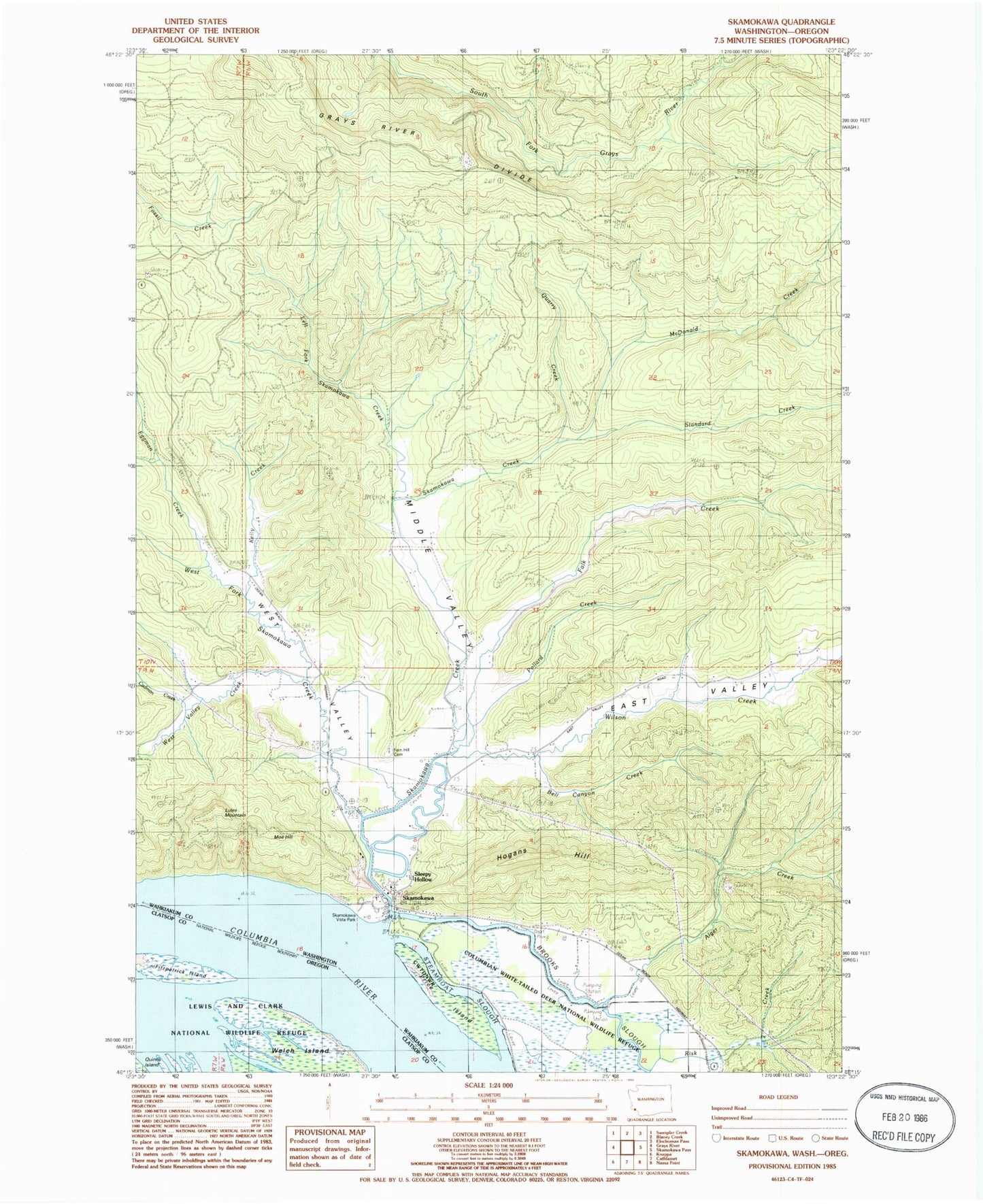
Historical USGS topographic quad map of Skamokawa in the states of Washington, Oregon. Map scale may vary for some years, but is generally around 1:24,000. Print size is approximately 24" x 27"
This quadrangle is in the following counties: Clatsop, Wahkiakum.
The map contains contour lines, roads, rivers, towns, and lakes. Printed on high-quality waterproof paper with UV fade-resistant inks, and shipped rolled.
Contains the following named places: Alger Creek, Alger Truck Trail, Bell Canyon Creek, Brooks Slough, Cadman Creek, East Valley, Eggman Creek, Falk Creek, Fern Hill Cemetery, Fitzpatrick Island, Hogans Hill, Kelly Creek, Left Fork Skamokawa Creek, Lutes Mountain, McDonald Creek, Middle Valley, Moe Hill, Pollard Creek, Price Island, Quarry Creek, Redmen Hall and River Life Interpretive Center, Risk Creek, Skamokawa, Skamokawa Channel, Skamokawa Channel Range, Skamokawa Creek, Skamokawa East Valley Airport, Skamokawa Post Office, Skamokawa United Methodist Church, Skamokawa Valley Census Designated Place, Skamokawa Vista Park, Sleepy Hollow, Standard Creek, Steamboat Slough, Wahkiakum County, Wahkiakum County Fairgrounds, Wahkiakum Fire District 2 Skamokawa Fire Department, West Fork Skamokawa Creek, West Valley, West Valley Creek, Wilson Creek, ZIP Code: 98647