MyTopo
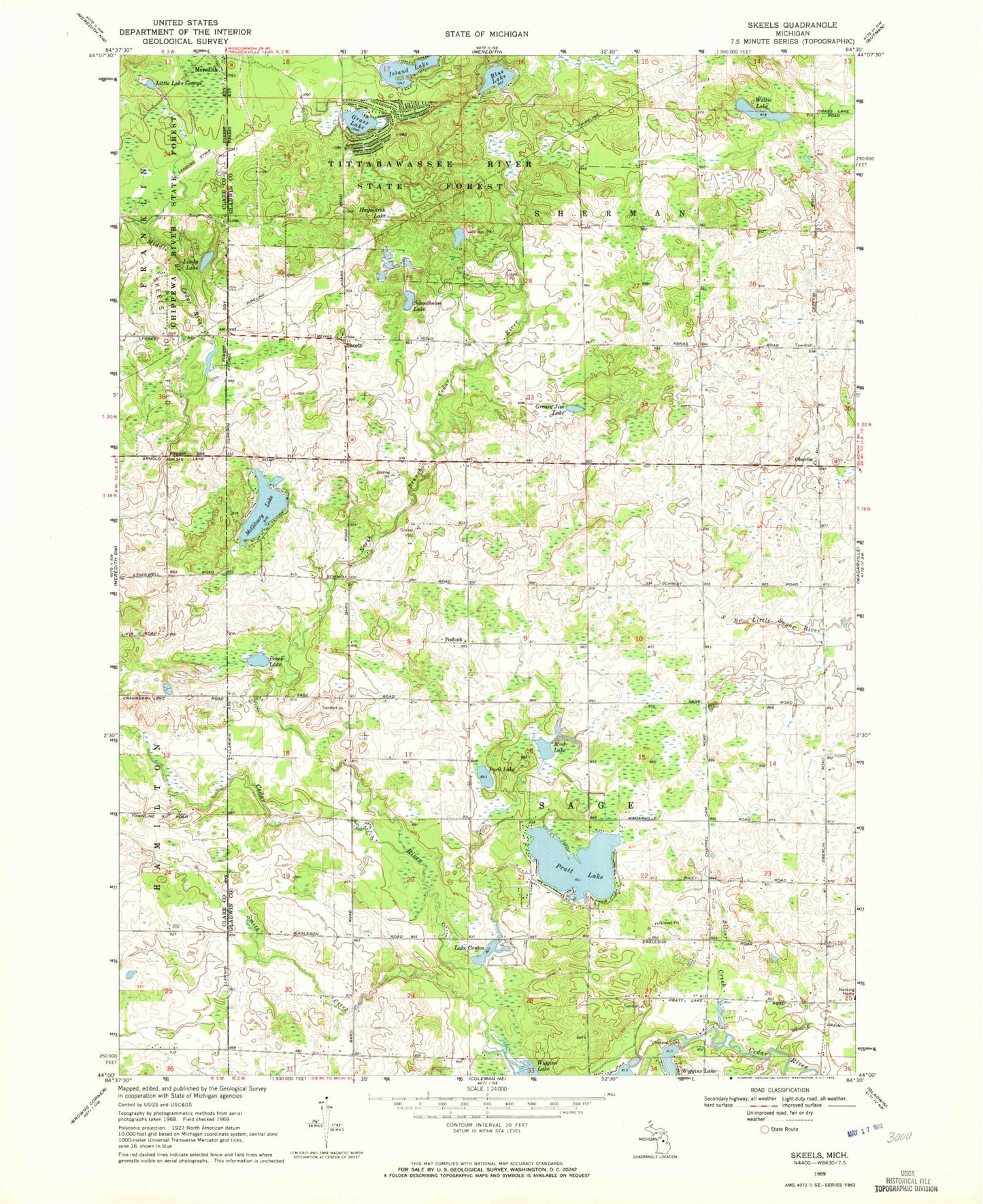
Classic USGS Skeels Michigan 7.5'x7.5' Topo Map
Couldn't load pickup availability
Historical USGS topographic quad map of Skeels in the state of Michigan. Map scale may vary for some years, but is generally around 1:24,000. Print size is approximately 24" x 27"
This quadrangle is in the following counties: Clare, Gladwin.
The map contains contour lines, roads, rivers, towns, and lakes. Printed on high-quality waterproof paper with UV fade-resistant inks, and shipped rolled.
Contains the following named places: Blue Lake, Chappel Dam, Christ Centered Church, Emmanuel Baptist Church, Garrity Cemetery, Gladwin County Recreation Area, Grace Fellowship Church, Grass Lake, Greasy Jim Lake, Haymarsh Lake, Island Lake, Lake Contos, Lake Little George, Lindy Lake, McGilvery Lake, Mud Lake, North Branch Cedar River, Oberlin, Oberlin Post Office, Peach Lake, Podunk, Pratt Lake, Puro Lake, Schoolhouse Lake, Silver Creek, Skeel Cemetery, Skeels, Skeels Northern Christian School, Skeels Oil Field, Skeels Post Office, Smith Creek, Township of Sage, Township of Sherman, Wallic Lake